Call 1-800-550-4997 toll-free in North America for BC Highway Conditions

Beta DriveBC - Provide your feedback on the next DriveBC

Current Travel Advisories

Kamloops to Alberta Improvements

Cone Zone

Welcome to the BC HighwayCams website, where you can view highway conditions, traffic, and weather information at a glance.

To view BC HighwayCams, select one of the tabs below and click on a thumbnail. (NR-Northern Region; SIR-Southern Interior Region; LM-Lower Mainland; VI-Vancouver Island; Brdr-Border; All-All webcams; MyCams-Customize your own page of images.)

Please note all BC HwyCams use Pacific Time Zone (PT).


NR SIR LM VI Brdr All MyCams  

Northern

Highway 2

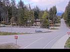
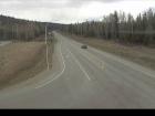
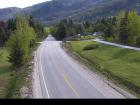
Webcam Image: Tupper - W
Tupper - W
Highway 2 about 2 km west of BC/Alberta border at Highway 2 and Highway 52 junction, looking west.
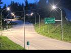
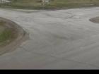
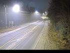
Webcam Image: Tupper - E
Tupper - E
Highway 2 about 2 km west of BC/Alberta border at Highway 2 and Highway 52 junction, looking east.

Highway 5

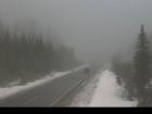
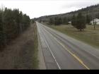
Webcam Image: Lempriere
Lempriere
Highway 5 about 40 km north of Blue River and 26 km south of Albreda, looking south.
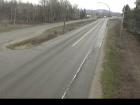
Webcam Image: Blue River
Blue River
Highway 5 at Shell Road in Blue River, looking northeast.
Webcam Image: Messiter Summit
Messiter Summit
Highway 5 about 20 km south of Blue River and 19 km north of Avola, looking north.
Webcam Image: Wire Cache - N
Wire Cache - N
Highway 5 about 15 km south of Avola, looking north.
 
Webcam Image: Wire Cache - S
Wire Cache - S
Highway 5 about 15 km south of Avola, looking south.

Highway 16

Webcam Image: Masset
Masset
Highway 16 at Hodges Road in Masset on Haida Gwaii, looking north.
Webcam Image: Tlell
Tlell
Highway 16 at Wiggins Road on the east coast of Graham Island, looking north.
Webcam Image: Skidegate
Skidegate
Highway 16 at the ferry terminal on Haida Gwaii, looking north.
Webcam Image: Port Edward - W
Port Edward - W
Highway 16 at Port Edward Arterial Road, looking west.
 
Webcam Image: Port Edward - E
Port Edward - E
Highway 16 at Port Edward Arterial Road, looking east.
Webcam Image: Port Edward - S
Port Edward - S
Highway 16 at Port Edward Arterial Road, looking south.
Webcam Image: Rainbow Summit Chain-Up Area
Rainbow Summit Chain-Up Area
Highway 16 about 34 km east of Prince Rupert near McNeil River at the Rainbow Summit chain-up area, looking west.
Webcam Image: Kwinitsa
Kwinitsa
Highway 16 about 70 km east of Prince Rupert, looking east.
 
Webcam Image: Kasiks
Kasiks
Highway 16 at Kasiks resort area about 60 km west of Terrace, looking east.
Webcam Image: Terrace - W
Terrace - W
Highway 16 at Highway 37S near Terrace, looking west.
Webcam Image: Terrace - E
Terrace - E
Highway 16 at Highway 37S near Terrace, looking east on Highway 16.
Webcam Image: Terrace - S
Terrace - S
Highway 16 at Highway 37S near Terrace, looking south.
 
Webcam Image: Chimdemash
Chimdemash
Highway 16 near Chimdemash Creek about 22 km east of Highway 16 and Highway 37 junction in Terrace, looking north.
Webcam Image: Kitwanga - N
Kitwanga - N
Highway 16 at Highway 37 near Kitwanga, looking north on Highway 37.
Webcam Image: Kitwanga - W
Kitwanga - W
Highway 16 at Highway 37 near Kitwanga, looking west on Highway 16.
Webcam Image: Kitwanga - E
Kitwanga - E
Highway 16 at Highway 37 near Kitwanga, looking east on Highway 16.
 
Webcam Image: New Hazelton
New Hazelton
Highway 16 at McLeod Street in New Hazelton, looking east.
Webcam Image: Witset - N
Witset - N
Highway 16 at Beaver Road in Witset, looking north.
Webcam Image: Witset - W
Witset - W
Highway 16 at Beaver Road in Witset, looking west.
Webcam Image: Witset - S
Witset - S
Highway 16 at Beaver Road in Witset, looking south.
 
Webcam Image: Trout Creek
Trout Creek
Highway 16 at the Trout Creek bridge, looking southeast.
Webcam Image: Hwy 16 at Toronto Street - N
Hwy 16 at Toronto Street - N
Highway 16 at Toronto Street in Smithers, looking north.
Webcam Image: Hwy 16 at Toronto Street - W
Hwy 16 at Toronto Street - W
Highway 16 at Toronto Street in Smithers, looking west.
Webcam Image: Hwy 16 at Toronto Street - E
Hwy 16 at Toronto Street - E
Highway 16 at Toronto Street in Smithers, looking east.
 
Webcam Image: Hwy 16 at Toronto Street - S
Hwy 16 at Toronto Street - S
Highway 16 at Toronto Street in Smithers, looking south.
Webcam Image: Smithers - N
Smithers - N
Highway 16 at Main Street in Smithers, looking north.
Webcam Image: Smithers - W
Smithers - W
Highway 16 at Main Street in Smithers, looking west.
Webcam Image: Smithers - E
Smithers - E
Highway 16 at Main Street in Smithers, looking east.
 
Webcam Image: Smithers - S
Smithers - S
Highway 16 at Main Street in Smithers, looking south.
Webcam Image: Telkwa - N
Telkwa - N
Highway 16 at Hankin Road in Telkwa, looking north.
Webcam Image: Telkwa - E
Telkwa - E
Highway 16 at Hankin Road in Telkwa, looking east.
Webcam Image: Telkwa - S
Telkwa - S
Highway 16 at Hankin Road in Telkwa, looking south
 
Webcam Image: Hungry Hill - NW
Hungry Hill - NW
Highway 16 about 14 km northwest of Houston at Anderson Road, looking northwest.
Webcam Image: Hungry Hill - SE
Hungry Hill - SE
Highway 16 about 14 km northwest of Houston at Anderson Road, looking southeast.
Webcam Image: Nadina - N
Nadina - N
Highway 16 at North Nadina Avenue in Houston, looking north.
Webcam Image: Nadina - W
Nadina - W
Highway 16 at North Nadina Avenue in Houston, looking west.
 
Webcam Image: Nadina - E
Nadina - E
Highway 16 at North Nadina Avenue in Houston, looking east.
Webcam Image: Butler - W
Butler - W
Highway 16 at Butler Avenue in Houston, looking west.
Webcam Image: Butler - E
Butler - E
Highway 16 at Butler Avenue in Houston, looking east.
Webcam Image: Six Mile Hill
Six Mile Hill
Highway 16 about 39 km west of Burns Lake, looking west.
 
Webcam Image: Burns Lake - W
Burns Lake - W
Highway 16 at North Francois Highway in Burns Lake, looking west.
Webcam Image: Burns Lake - E
Burns Lake - E
Highway 16 at North Francois Highway in Burns Lake, looking east.
Webcam Image: Burns Lake - S
Burns Lake - S
Highway 16 at North Francois Highway in Burns Lake, looking south.
Webcam Image: Augier Road
Augier Road
Highway 16 about 22 km east of Burns Lake at Augier Road, looking west.
 
Webcam Image: Priestly Hill
Priestly Hill
Highway 16 about 32 km east of Burns Lake, looking east.
Webcam Image: Savory Rest Area - W
Savory Rest Area - W
Highway 16 about 46 km east of Burns Lake, looking west.
Webcam Image: Savory Rest Area - E
Savory Rest Area - E
Highway 16 about 46 km east of Burns Lake, looking east.
Webcam Image: Stella Road - N
Stella Road - N
Highway 16 at Stella Road in Fraser Lake, looking north.
 
Webcam Image: Stella Road - W
Stella Road - W
Highway 16 at Stella Road in Fraser Lake, looking west.
Webcam Image: Stella Road - E
Stella Road - E
Highway 16 at Stella Road in Fraser Lake, looking east.
Webcam Image: Nautley Road - N
Nautley Road - N
Highway 16 at Nautley Road, looking north.
Webcam Image: Nautley Road - W
Nautley Road - W
Highway 16 at Nautley Road, looking west.
 
Webcam Image: Nautley Road - E
Nautley Road - E
Highway 16 at Nautley Road, looking east.
Webcam Image: Fort Fraser Hills
Fort Fraser Hills
Highway 16 about 5 km east of Fort Fraser, looking east.
Webcam Image: Hwy 16 at Hwy 27 - N
Hwy 16 at Hwy 27 - N
Highway 16 at Highway 27 junction, looking north.
Webcam Image: Hwy 16 at Hwy 27 - W
Hwy 16 at Hwy 27 - W
Highway 16 at Highway 27 junction, looking west.
 
Webcam Image: Hwy 16 at Hwy 27 - E
Hwy 16 at Hwy 27 - E
Highway 16 at Highway 27 junction, looking east.
Webcam Image: Sob Lake - W
Sob Lake - W
Highway 16 at Sob Lake Road in Vanderhoof, looking west.
Webcam Image: Sob Lake - E
Sob Lake - E
Highway 16 at Sob Lake Road in Vanderhoof, looking east.
Webcam Image: Bednesti Lake - W
Bednesti Lake - W
Highway 16 at Bobtail Forest Road near Bednesti Lake between Prince George and Vanderhoof, looking west.
 
Webcam Image: Bednesti Lake - E
Bednesti Lake - E
Highway 16 at Bobtail Forest Road near Bednesti Lake between Prince George and Vanderhoof, looking east.
Tamarack
Highway 16 about 33 km west of Prince George, looking west.
Webcam Image: Peden Hill at Davis Road
Peden Hill at Davis Road
Highway 16 at Davis Road in Prince George, looking eastbound.
Webcam Image: Peden Hill at Vance Road
Peden Hill at Vance Road
Highway 16 at Vance Road in Prince George, looking westbound.
 
Webcam Image: Bowron River
Bowron River
Highway 16 about 54 km east of Prince George near Purden Lake, looking west.
Webcam Image: Slim Creek - W
Slim Creek - W
Highway 16 about 0.4 km east of the Slim Creek Rest Area, looking west.
Webcam Image: Slim Creek - E
Slim Creek - E
Highway 16 about 0.4 km east of the Slim Creek Rest Area, looking east.
Webcam Image: Crescent Spur
Crescent Spur
Highway 16 about 50 km west of McBride at Loos Road, looking west.
 
Webcam Image: West Twin - W
West Twin - W
Highway 16 at West Twin Creek, looking west.
Webcam Image: West Twin - E
West Twin - E
Highway 16 at West Twin Creek, looking east.
Webcam Image: Dunster Station Road
Dunster Station Road
Highway 16 at Dunster Station Road, about 30 km east of McBride, looking east.
Webcam Image: Tete Jaune Cache
Tete Jaune Cache
Highway 16 at Highway 5 junction, looking east.
 
Webcam Image: Red Pass
Red Pass
Highway 16 about 27 km east of Tete-Jaune Junction and 40 km west of BC-Alberta border, looking east.
Webcam Image: BC-Alberta Border
BC-Alberta Border
Highway 16 about 0.5 km west of the BC-Alberta border and 1 km to Jasper in Alberta, looking west.

Highway 27

Webcam Image: Fort St. James - N
Fort St. James - N
Highway 27 at Hill Street/Greenview Drive in Fort St. James, looking north.
Webcam Image: Fort St. James - S
Fort St. James - S
Highway 27 at Hill Street/Greenview Drive in Fort St. James, looking south.
Webcam Image: Spencer Pit - N
Spencer Pit - N
Highway 27 about 12 km south of Fort St. James at Spencer Pit, looking north.
Webcam Image: Spencer Pit - S
Spencer Pit - S
Highway 27 about 12 km south of Fort St. James at Spencer Pit, looking south.
 
Webcam Image: Stuart Lake Highway - N
Stuart Lake Highway - N
Highway 27 about 32 km south of Fort St. James, looking north.
Webcam Image: Stuart Lake Highway - S
Stuart Lake Highway - S
Highway 27 about 32 km south of Fort St. James, looking south.

Highway 29

Webcam Image: Hudson's Hope - NE
Hudson's Hope - NE
Highway 29 about 1.5 km north of Hudson's Hope at Powell Road, looking northeast.
Webcam Image: Hudson's Hope - SW
Hudson's Hope - SW
Highway 29 about 1.5 km north of Hudson's Hope at Powell Road, looking southwest.
Webcam Image: Tumbler Ridge
Tumbler Ridge
Highway 29 at Highway 52 junction, looking westbound on Highway 29.
Webcam Image: Peace View Rest Area - NE
Peace View Rest Area - NE
Highway 29 about 29 km west of Fort St. John, looking northeast.
 
Webcam Image: Peace View Rest Area - SW
Peace View Rest Area - SW
Highway 29 about 29 km west of Fort St. John, looking southwest.

Highway 35

Webcam Image: Martin Road - N
Martin Road - N
Highway 35 near Martin Road between Burns Lake and Francois Lake Northbank Ferry Landing, looking north.
Webcam Image: Martin Road - S
Martin Road - S
Highway 35 near Martin Road between Burns Lake and Francois Lake Northbank Ferry Landing, looking south.
Webcam Image: Francois Lake Northbank Ferry Landing
Francois Lake Northbank Ferry Landing
Highway 35 at Francois Lake Northbank Ferry Landing, looking at lineup.
Webcam Image: Francois Lake Southbank Ferry Landing
Francois Lake Southbank Ferry Landing
Highway 35 at Francois Lake Southbank Ferry Landing, looking north at ferry ramp.

Highway 37

BC-Yukon Border
Highway 37 at BC-Yukon Border, looking north.
Good Hope Lake
Highway 37 near Good Hope Lake, looking north.
Dease Lake
Highway 37 at Commercial Drive in Dease Lake, looking north on Highway 37.
Webcam Image: Meziadin Junction
Meziadin Junction
Highway 37 and Highway 37A at Meziadin Junction, looking north.
 
Webcam Image: Gitanyow - N
Gitanyow - N
Highway 37N about 2.5 km south of Gitanyow at Kitwancool Access Road, looking north.
Webcam Image: Gitanyow - S
Gitanyow - S
Highway 37N about 2.5 km south of Gitanyow at Kitwancool Access Road, looking south.
Webcam Image: Onion Lake
Onion Lake
Highway 37S at Onion Lake Cross Country Ski trails, looking north.
Webcam Image: Kitimat
Kitimat
Highway 37 about 5 km north of Kitimat at Oolichan Avenue, looking north.

Highway 37A

Webcam Image: Stewart
Stewart
Highway 37a between Stewart, BC and Hyder, USA, looking north.

Highway 0 (Cecil Lake Rd)

Webcam Image: Cecil Lake Road
Cecil Lake Road
Cecil Lake Road at 243 Road, looking east.

Highway 97 (Northern Region)

Webcam Image: Steamboat Hill
Steamboat Hill
Highway 97 about 80 km northwest of Fort Nelson, looking west.
Webcam Image: Liard Highway Junction
Liard Highway Junction
Highway 97 at Highway 77 junction about 28 km north of Fort Nelson, looking east.
Webcam Image: Fort Nelson
Fort Nelson
Highway 97 at Fort Nelson weigh scale, looking north.
Trutch
Highway 97 near Trutch and the Mile 202 Rest Area, looking north.
 
Webcam Image: Sikanni Chief
Sikanni Chief
Highway 97 about 6 km south of the Sikanni River Bridge and about 175 km north of Fort St. John, looking north.
Webcam Image: Mile 73 - N
Mile 73 - N
Highway 97 at Beaton Highway about 44 km north of Fort St. John, looking north.
Webcam Image: Mile 73 - S
Mile 73 - S
Highway 97 at Beaton Highway about 44 km north of Fort St. John, looking south.
Webcam Image: Fort St. John - N
Fort St. John - N
Highway 97 at 100 Avenue in Fort St. John, looking north.
 
Webcam Image: Fort St. John - NW
Fort St. John - NW
Highway 97 at 100 Avenue in Fort St. John, looking northwest.
Webcam Image: Fort St. John - SE
Fort St. John - SE
Highway 97 at 100 Avenue in Fort St. John, looking southeast.
Webcam Image: Fort St. John - S
Fort St. John - S
Highway 97 at 100 Avenue in Fort St. John, looking south.
Webcam Image: Taylor - N
Taylor - N
Highway 97 at Pine Avenue in Taylor, looking north.
 
Webcam Image: Taylor - W
Taylor - W
Highway 97 at Pine Avenue in Taylor, looking west.
Webcam Image: Taylor - E
Taylor - E
Highway 97 at Pine Avenue in Taylor, looking east.
Webcam Image: Taylor - S
Taylor - S
Highway 97 at Pine Avenue in Taylor, looking south.
Webcam Image: Big Bam Road
Big Bam Road
Highway 97 at Big Bam Road in South Taylor, looking south.
 
Webcam Image: South Taylor Hill - N
South Taylor Hill - N
Highway 97 about 20 km south of Fort St. John at South Taylor Hill, looking north.
Webcam Image: South Taylor Hill - S
South Taylor Hill - S
Highway 97 about 20 km south of Fort St. John at South Taylor Hill, looking south.
Webcam Image: Dawson Creek - N
Dawson Creek - N
Highway 97 at Dangerous Goods Route, west of Dawson Creek, looking north.
Webcam Image: Dawson Creek - W
Dawson Creek - W
Highway 97 at Dangerous Goods Route, west of Dawson Creek, looking west.
 
Webcam Image: Dawson Creek - E
Dawson Creek - E
Highway 97 at Dangerous Goods Route, west of Dawson Creek, looking east.
Webcam Image: Dawson Creek - S
Dawson Creek - S
Highway 97 at Dangerous Goods Route, west of Dawson Creek, looking south.
Webcam Image: John Hart Highway
John Hart Highway
Highway 97 (John Hart Highway) at Mason Road/237 Road, looking east.
Webcam Image: East Pine Hill
East Pine Hill
Highway 97 about 27 km east of Chetwynd on East Pine Hill, looking east.
 
Braden Road - W
Highway 97 near Braden Road, looking west.
Braden Road - E
Highway 97 near Braden Road, looking east.
Webcam Image: Chetwynd - W
Chetwynd - W
Highway 97 about 9 km east of Chetwynd at Wabi Estates Road, looking west.
Webcam Image: Chetwynd - E
Chetwynd - E
Highway 97 about 9 km east of Chetwynd at Wabi Estates Road, looking east.
 
Webcam Image: Link Creek
Link Creek
Highway 97 about 90 km west of Chetwynd near Link Creek Bridge, looking east.
Pine Pass
Highway 97 north of Mackenzie Junction at Powder King access road, looking north.
Webcam Image: Mackenzie Junction
Mackenzie Junction
Highway 97 at Highway 39 about 29 km south of Mackenzie, looking east.
Whiskers Point - N
Highway 97 near Whiskers Point Provincial Park entrance on the east side of McLeod Lake, looking north.
 
Whiskers Point - S
Highway 97 near Whiskers Point Provincial Park entrance on the east side of McLeod Lake, looking south.
Webcam Image: Summit Lake Road - N
Summit Lake Road - N
Highway 97 about 49 km north of Prince George at Summit Lake Road, looking north.
Webcam Image: Summit Lake Road - W
Summit Lake Road - W
Highway 97 about 49 km north of Prince George at Summit Lake Road, looking west.
Webcam Image: Summit Lake Road - S
Summit Lake Road - S
Highway 97 about 49 km north of Prince George at Summit Lake Road, looking south.
 
Webcam Image: Salmon Valley Road - N
Salmon Valley Road - N
Highway 97 at Salmon Valley Road north of Prince George, looking north.
Webcam Image: Salmon Valley Road - E
Salmon Valley Road - E
Highway 97 at Salmon Valley Road north of Prince George, looking east.
Webcam Image: Salmon Valley Road - S
Salmon Valley Road - S
Highway 97 at Salmon Valley Road north of Prince George, looking south.
Webcam Image: Prince George northbound
Prince George northbound
Highway 97 at Highway 16 junction in Prince George, looking northbound on Highway 97.
 
Webcam Image: Prince George westbound
Prince George westbound
Highway 97 at Highway 16 junction in Prince George, looking westbound on Highway 16.
Webcam Image: Prince George eastbound
Prince George eastbound
Highway 97 at Highway 16 junction in Prince George, looking eastbound on Highway 16.
Webcam Image: Prince George southbound
Prince George southbound
Highway 97 at Highway 16 junction in Prince George, looking southbound on Highway 97.
Chamulak Road
Highway 97 about 36 km south of Prince George at Chamulak Road in Stoner, looking north.

Highway 113

Webcam Image: Grizzly Hill
Grizzly Hill
Highway 113 (Nass Road) about 3 km southwest of Village of Laxgalts'ap (Greenville), looking west.
Webcam Image: Laxgalts'ap
Laxgalts'ap
Highway 113 near the Village of Laxgalts'ap in the Nass Valley, looking eastbound.
Webcam Image: Gitwinksihlkw
Gitwinksihlkw
Highway 113 at Anlaw Road near Gitwinksihlkw, within Nisga'a Memorial Lava Bed Provincial Park, looking east.
Webcam Image: Rosswood
Rosswood
Highway 113 near Rosswood about 44 km north of Terrace, looking north.

Highway 118

Webcam Image: Granisle Highway
Granisle Highway
Granisle Highway (Highway 118), near summit. Approximately 14.5 km north of Topley, looking north.

Southern Interior

Highway 1 (Trans Canada Highway)

Webcam Image: Yale - N
Yale - N
Highway 1 at Victoria Street in Yale, looking northbound.
Webcam Image: Yale - S
Yale - S
Highway 1 at Victoria Street in Yale, looking southbound.
Webcam Image: Alexandra Bridge - N
Alexandra Bridge - N
Highway 1 at Alexandra Bridge, looking north.
Webcam Image: Alexandra Bridge - S
Alexandra Bridge - S
Highway 1 at Alexandra Bridge, looking south.
 
Webcam Image: Hells Gate - N
Hells Gate - N
Highway 1 about 3.5 km south of Hells Gate at Bradley Hill, looking north.
Webcam Image: Hells Gate - S
Hells Gate - S
Highway 1 about 3.5 km south of Hells Gate at Bradley Hill, looking south.
Boston Bar - N
Highway 1 about 12 km north of Boston Bar at Kahmoose Road in Boothroyd, looking north.
Boston Bar - S
Highway 1 about 12 km north of Boston Bar at Kahmoose Road in Boothroyd, looking south.
 
Webcam Image: Gladwin - W
Gladwin - W
Highway 1 about 6 km east of Lytton Airport, looking west.
Webcam Image: Gladwin - E
Gladwin - E
Highway 1 about 6 km east of Lytton Airport, looking east.
Webcam Image: Spences Bridge
Spences Bridge
Highway 1 at the north end of Spences Bridge on the west side of the Thompson River, looking north.
Webcam Image: Cache Creek
Cache Creek
Highway 1 at Collins Road, looking east on Highway 1/97.
 
Webcam Image: Savona
Savona
Highway 1 at Holloway Drive near Savona, looking west.
Webcam Image: Dufferin - W
Dufferin - W
Highway 1 about 9 km west of Kamloops, looking west.
Webcam Image: Dufferin - E
Dufferin - E
Highway 1 about 9 km west of Kamloops, looking west.
Webcam Image: Kamloops - W
Kamloops - W
Highway 1 at Peterson Creek bridge in Kamloops, looking west.
 
Webcam Image: Kamloops - E
Kamloops - E
Highway 1 at Peterson Creek bridge in Kamloops, looking east.
Webcam Image: Miners Bluff - W
Miners Bluff - W
Highway 1 between Monte Creek and Pritchard, looking west.
Webcam Image: Miners Bluff - E
Miners Bluff - E
Highway 1 between Monte Creek and Pritchard, looking east.
Squilax - W
Highway 1 east of Squilax Bridge, looking west.
 
Squilax - E
Highway 1 east of Squilax Bridge, looking east.
Webcam Image: Sorrento - Blind Bay
Sorrento - Blind Bay
Highway 1 at Highland Drive east of Sorrento at the Blind Bay turn off, looking southeast.
Webcam Image: Salmon Arm - N
Salmon Arm - N
Highway 1 at 30 Street SW in Salmon Arm, looking north.
Webcam Image: Salmon Arm - W
Salmon Arm - W
Highway 1 at 30 Street SW in Salmon Arm, looking west.
 
Webcam Image: Salmon Arm - E
Salmon Arm - E
Highway 1 at 30 Street SW in Salmon Arm, looking east.
Webcam Image: Salmon Arm - S
Salmon Arm - S
Highway 1 at 30 Street SW in Salmon Arm, looking south.
Webcam Image: Annis Pit - W
Annis Pit - W
Highway 1 about 8 km southwest of Sicamous at Annis Pit, looking west.
Webcam Image: Annis Pit - E
Annis Pit - E
Highway 1 about 8 km southwest of Sicamous at Annis Pit, looking east.
 
Webcam Image: Sicamous - W
Sicamous - W
Highway 1 east of Sicamous at Cambie Road/Solsqua Road, looking west.
Webcam Image: Sicamous - E
Sicamous - E
Highway 1 east of Sicamous at Cambie Road/Solsqua Road, looking east.
Webcam Image: Perry River - W
Perry River - W
Highway 1 about 30 km east of Sicamous near Perry River Bridge, looking west.
Webcam Image: Perry River - E
Perry River - E
Highway 1 about 30 km east of Sicamous near Perry River Bridge, looking east.
 
Webcam Image: Eagle River - W
Eagle River - W
Highway 1 about 33 km west of Revelstoke, looking west.
Webcam Image: Eagle River - E
Eagle River - E
Highway 1 about 33 km west of Revelstoke, looking east.
Webcam Image: Griffin Lake - W
Griffin Lake - W
Highway 1 about 27 km west of Revelstoke by Griffin Lake, looking west.
Webcam Image: Griffin Lake - E
Griffin Lake - E
Highway 1 about 27 km west of Revelstoke by Griffin Lake, looking east.
 
Webcam Image: Three Valley Gap - W
Three Valley Gap - W
Highway 1 about 20 km west of Revelstoke near Three Valley Gap, looking west.
Webcam Image: Three Valley Gap - E
Three Valley Gap - E
Highway 1 about 20 km west of Revelstoke near Three Valley Gap, looking east.
Webcam Image: Clanwilliam Railway Overpass - W
Clanwilliam Railway Overpass - W
Highway 1 about 33 km west of Revelstoke, looking west.
Webcam Image: Clanwilliam Railway Overpass - E
Clanwilliam Railway Overpass - E
Highway 1 about 33 km west of Revelstoke, looking east.
 
Webcam Image: Boulder Hill - W
Boulder Hill - W
Highway 1 about 7 km west of Revelstoke, looking west.
Webcam Image: Boulder Hill - E
Boulder Hill - E
Highway 1 about 7 km west of Revelstoke, looking east.
Webcam Image: One-Mile Hill - W
One-Mile Hill - W
Highway 1 about 4 km west of Revelstoke, looking west.
Webcam Image: One-Mile Hill - E
One-Mile Hill - E
Highway 1 about 4 km west of Revelstoke, looking east.
 
Webcam Image: Hwy 1 at Hwy 23 - N
Hwy 1 at Hwy 23 - N
Highway 1 at Highway 23 in Revelstoke, looking north to Westside Road.
Webcam Image: Hwy 1 at Hwy 23 - W
Hwy 1 at Hwy 23 - W
Highway 1 at Highway 23 in Revelstoke, looking west.
Webcam Image: Hwy 1 at Hwy 23 - E
Hwy 1 at Hwy 23 - E
Highway 1 at Highway 23 in Revelstoke, looking east.
Webcam Image: Hwy 1 at Hwy 23 - S
Hwy 1 at Hwy 23 - S
Highway 1 at Highway 23 in Revelstoke, looking south to Highway 23.
 
Webcam Image: Revelstoke
Revelstoke
Highway 1 at east end of Columbia River Bridge in Revelstoke, looking eastbound.
Webcam Image: Albert Canyon
Albert Canyon
Highway 1 about 30 km east of Revelstoke, looking east.
Webcam Image: Jack McDonald Snowshed
Jack McDonald Snowshed
Highway 1 about 46 km east of Revelstoke, looking east.
Webcam Image: Rogers Pass
Rogers Pass
Highway 1 about 72 km east of Revelstoke at Rogers Pass in Glacier National Park, looking east.
 
Webcam Image: Quartz Creek
Quartz Creek
Highway 1 about 40 km west of Golden near the Quartz Creek bridge, looking east.
Donald Bridge - W
Highway 1 about 28 km north of Golden at Donald Bridge, looking west.
Donald Bridge - E
Highway 1 about 28 km north of Golden at Donald Bridge, looking east.
Webcam Image: Blaeberry - NW
Blaeberry - NW
Highway 1 near Blaeberry River Bridge, looking northwest.
 
Webcam Image: Blaeberry - SE
Blaeberry - SE
Highway 1 near Blaeberry River Bridge, looking southeast.
Webcam Image: Golden northbound
Golden northbound
Highway 1 at Highway 95 interchange, looking northbound along Highway 1.
Webcam Image: Golden eastbound
Golden eastbound
Highway 1 at Highway 95 interchange, looking eastbound along Highway 1.
Webcam Image: Golden southbound
Golden southbound
Highway 1 at Highway 95 interchange, looking southbound along Highway 95.
 
Webcam Image: Kicking Horse Canyon
Kicking Horse Canyon
Highway 1 at 10 Mile Brake Check in Kicking Horse Canyon, looking east.
Webcam Image: Field - SW
Field - SW
Highway 1 about 16 km west of BC/Alberta border at Field Access Road, looking southwest.
Webcam Image: Field - NE
Field - NE
Highway 1 about 16 km west of BC/Alberta border at Field Access Road, looking northeast
Webcam Image: Field - SE
Field - SE
Highway 1 about 16 km west of BC/Alberta border at Field Access Road, looking southeast.
 
Webcam Image: Lake Louise - W
Lake Louise - W
Highway 1 west of Lake Louise Overpass in Alberta, looking west.
Webcam Image: Lake Louise - E
Lake Louise - E
Highway 1 west of Lake Louise Overpass in Alberta, looking east.
Webcam Image: Castle Mountain - W
Castle Mountain - W
Highway 1 at Highway 93S junction, looking west.
Webcam Image: Castle Mountain - E
Castle Mountain - E
Highway 1 at Highway 93S junction, looking east.
 
Webcam Image: Castle Mountain - S
Castle Mountain - S
Highway 1 at Highway 93S junction, looking south.
Banff - W
Highway 1 east of Sunshine Ski Hill overpass in Alberta, looking west.
Banff - E
Highway 1 east of Sunshine Ski Hill, looking east.

Highway 0 (Adams Lake)

Webcam Image: Adams Lake West Ferry Landing
Adams Lake West Ferry Landing
Adams Lake Ferry west shore landing, looking at ferry landing on west side of lake.
Webcam Image: Adams Lake West Ferry Lineup
Adams Lake West Ferry Lineup
Adams Lake Ferry west shore landing, looking at ferry line up toward Rawson Road.
Webcam Image: Adams Lake East Ferry Landing
Adams Lake East Ferry Landing
Adams Lake Ferry east shore landing, looking at ferry landing on east side.

Highway 3

Webcam Image: Hwy 3 at Hwy3/5 Jct
Hwy 3 at Hwy3/5 Jct
Highway 3 at Highway 3/5 junction, looking east.
Webcam Image: Hope Slide
Hope Slide
Highway 3 at the Hope Slide pullout, looking east.
Webcam Image: Allison Pass - W
Allison Pass - W
Highway 3 about 10 km west of Manning Park resort area at Allison Pass, looking west.
Webcam Image: Allison Pass - E
Allison Pass - E
Hwy 3 at Allison Pass, 10 km west of Manning Park resort area, looking east.
 
Webcam Image: Similkameen Falls - W
Similkameen Falls - W
Highway 3 about 6 kms east of Eastgate near Similkameen Falls, looking west.
Webcam Image: Similkameen Falls - E
Similkameen Falls - E
Highway 3 about 6 kms east of Eastgate near Similkameen Falls, looking east.
Webcam Image: Sunday Summit
Sunday Summit
Highway 3 about 32 km south of Princeton, looking north.
Webcam Image: Princeton
Princeton
Highway 3 at Frontage Road on the west side of Princeton, looking south.
 
Webcam Image: Bromley Rock - W
Bromley Rock - W
Highway 3 about 1.4 km east of Bromley Rock Provincial Park, looking west.
Webcam Image: Bromley Rock - E
Bromley Rock - E
Highway 3 about 1.4 km east of Bromley Rock Provincial Park, looking east.
Webcam Image: Keremeos - W
Keremeos - W
Highway 3 at Keremeos Bypass Road, looking west.
Webcam Image: Keremeos - E
Keremeos - E
Highway 3 at Keremeos Bypass Road, looking east.
 
Webcam Image: Mount Kobau - W
Mount Kobau - W
Highway 3 next to Conifryd Lake, looking west.
Webcam Image: Mount Kobau - E
Mount Kobau - E
Highway 3 next to Conifryd Lake, looking east.
Webcam Image: Anarchist
Anarchist
Highway 3 about 9 km west of the Anarchist Summit, looking east.
Webcam Image: Rock Creek
Rock Creek
Highway 3 at Highway 33 junction in Rock Creek, looking northwest.
 
Webcam Image: Midway - W
Midway - W
Highway 3 at Florence Street in Midway, looking west.
Webcam Image: Midway - E
Midway - E
Highway 3 at Florence Street in Midway, looking east.
Webcam Image: Midway - S
Midway - S
Highway 3 at Florence Street in Midway, looking south.
Webcam Image: Eholt Summit
Eholt Summit
Highway 3 about 16 km northeast of Greenwood at Wilgress Rest Area near Eholt Summit, looking westbound.
 
Webcam Image: Christina Lake
Christina Lake
Highway 3 at East Lake Drive on east side of Christina Lake, looking northwest.
Paulson Summit
Highway 3 near the Paulson Summit, looking west.
Webcam Image: Castlegar
Castlegar
Highway 3 at 14 Avenue in Castlegar, looking east.
Webcam Image: Bombi Pass
Bombi Pass
Highway 3 about 22 km south-east of Castlegar at the Bombi Summit, looking west.
 
Webcam Image: Meadows Junction
Meadows Junction
Highway 3 at Highway 3B junction looking westbound.
Webcam Image: Salmo
Salmo
Highway 3 at Highway 6 junction, looking west on Highway 3.
Webcam Image: Kootenay Pass
Kootenay Pass
Highway 3 at Salmo Creston Highway Summit, looking east.
Webcam Image: Creston
Creston
Highway 3 and Highway 3A junction in Creston, looking southeast.
 
Webcam Image: Leadville Road
Leadville Road
Highway 3 about 18 km east of Creston in Kitchener, looking east.
Webcam Image: Goatfell - W
Goatfell - W
Highway 3 about 9 km northwest of Yahk near Goatfell, looking west.
Webcam Image: Goatfell - E
Goatfell - E
Highway 3 about 9 km northwest of Yahk near Goatfell, looking east.
Webcam Image: Yahk
Yahk
Highway 3 at Highway 95 junction by the Yahk Weigh Scale, looking northeast.
 
Webcam Image: Irishman - N
Irishman - N
Highway 3 about 21 km southwest of Moyie, looking north.
Webcam Image: Irishman - S
Irishman - S
Highway 3 about 21 km southwest of Moyie, looking south.
Webcam Image: Moyie Lake
Moyie Lake
Highway 3 near the south end of Moyie Lake, looking north.
Webcam Image: Cranbrook
Cranbrook
Highway 3/95 at 9 Avenue in Cranbrook, looking northeast.
 
Webcam Image: Steamboat- NW
Steamboat- NW
Highway 3/93 near Ha Ha Creek Road, looking northwest.
Webcam Image: Steamboat - SE
Steamboat - SE
Highway 3/93 near Ha Ha Creek Road, looking southeast.
Webcam Image: Elko - W
Elko - W
Highway 3 about 1 km west of Elko at Highway 93 junction, looking west.
Webcam Image: Elko - E
Elko - E
Highway 3 about 1 km west of Elko at Highway 93 junction, looking east.
 
Webcam Image: Elko - S
Elko - S
Highway 3 about 1 km west of Elko at Highway 93 junction, looking south.
Webcam Image: Morrissey
Morrissey
Highway 3 about 10 km south of Fernie at Morrissey Junction, looking north.
Webcam Image: Hosmer
Hosmer
Highway 3 about 12 km north of Fernie in Hosmer, looking north.
Webcam Image: Sparwood
Sparwood
Highway 3 about 2 km west of the Alberta border at Sparwood Weigh Scale, looking southeast.

Highway 3A

Webcam Image: Glade Ferry Terminal - N
Glade Ferry Terminal - N
Highway 3A at Glade Ferry Road, looking north at west side ferry line up.
Webcam Image: Glade Ferry Terminal - W
Glade Ferry Terminal - W
Highway 3A at Glade Ferry Road, looking at ferry landing on west side of river.
Webcam Image: Glade Ferry Terminal - E
Glade Ferry Terminal - E
Highway 3A at Glade Ferry Road, looking at ferry landing on east side of river.
Webcam Image: Harrop Ferry Landing
Harrop Ferry Landing
Harrop Ferry Landing on the south side of Kootenay Lake, looking north.
 
Webcam Image: Harrop Ferry Landing North View
Harrop Ferry Landing North View
Harrop Ferry Landing on south side of Kootenay Lake, looking at the north side landing.
Webcam Image: Harrop Ferry Landing South View
Harrop Ferry Landing South View
Harrop Ferry Landing northbound line-up, looking south.
Webcam Image: Balfour Ferry Approach - NE
Balfour Ferry Approach - NE
Highway 3A and Highway 31 at Balfour ferry terminal entrance near Ferry Landing Road, looking northeast.
Webcam Image: Balfour Ferry Busk Road Parking
Balfour Ferry Busk Road Parking
Highway 3A and Highway 31 at Busk Road near the Balfour ferry terminal, looking at ferry parking lot.
 
Webcam Image: Balfour Ferry Approach - SW
Balfour Ferry Approach - SW
Highway 3A and Highway 31 at Balfour ferry terminal entrance of Ferry Landing Road, looking southwest.
Webcam Image: Balfour Ferry Terminal
Balfour Ferry Terminal
Balfour ferry terminal, looking north towards Highway 3A.
Webcam Image: Balfour Ferry Ramp
Balfour Ferry Ramp
Balfour ferry terminal, looking south at ferry loading ramp.
Webcam Image: Kootenay Bay Ferry Landing
Kootenay Bay Ferry Landing
Highway 3A at Kootenay Bay Ferry Landing, looking northeast.
 
Webcam Image: Kootenay Bay Ferry Ramp
Kootenay Bay Ferry Ramp
Highway 3A at Kootenay Bay Ferry Landing, looking southwest.
Webcam Image: Sanca Creek
Sanca Creek
Highway 3A about 1.6 km south of Sanca Creek Bridge, looking south.

Highway 3A (Kaleden to Keremeos)

Webcam Image: Yellow Lake - W
Yellow Lake - W
Highway 3A (Kaleden to Keremeos) near Sheep Creek Road, looking west.
Webcam Image: Yellow Lake - E
Yellow Lake - E
Highway 3A (Kaleden to Keremeos) near Sheep Creek Road, looking east.

Highway 3B

Webcam Image: Strawberry Pass
Strawberry Pass
Highway 3B about 15 km north of Rossland and 4 km south of summit, looking north.
Webcam Image: Rossland - W
Rossland - W
Highway 3B at Highway 22 near the Rossland Weigh Scale, looking west on Highway 22.
Webcam Image: Rossland - E
Rossland - E
Highway 3B at Highway 22 near the Rossland Weigh Scale, looking east on Highway 22.
Webcam Image: Rossland - S
Rossland - S
Highway 3B at Highway 22 near the Rossland Weigh Scale, looking south on Highway 3B.
 
Webcam Image: Trail
Trail
Highway 3B at Devito Drive, looking east.

Highway 5 (Coquihalla)

Webcam Image: Walloper
Walloper
Highway 5 about 30 km south of Kamloops, looking south.
Webcam Image: Hwy 5 at Hwy 97D northbound
Hwy 5 at Hwy 97D northbound
Highway 5 at Exit 366 Logan Lake/Lac le Jeune Road, looking northbound along Highway 5.
Webcam Image: Hwy 97D at Hwy 5 - NE
Hwy 97D at Hwy 5 - NE
Highway 97D (Logan Lake/Lac le Jeune Road) at Highway 5, looking northeast.
Webcam Image: Hwy 97D at Hwy 5 - SW
Hwy 97D at Hwy 5 - SW
Highway 97D (Logan Lake/Lac le Jeune Road) at Highway 5, looking southwest.
 
Webcam Image: Hwy 5 at Hwy 97D southbound
Hwy 5 at Hwy 97D southbound
Highway 5 at Exit 366 Logan Lake/Lac le Jeune Road, looking southbound along Highway 5.
Webcam Image: Helmer Lake
Helmer Lake
Highway 5 about 24 km north of Merritt at Helmer Interchange, looking north.
Webcam Image: Comstock
Comstock
Highway 5 about 15 km south of Merritt at Comstock Road, looking north.
Webcam Image: Larson Hill - N
Larson Hill - N
Highway 5 about 36 km south of Merritt at Larson Hill, looking north.
 
Webcam Image: Larson Hill - S
Larson Hill - S
Highway 5 about 36 km south of Merritt at Larson Hill, looking south.
Webcam Image: Mine Creek
Mine Creek
Highway 5 southbound at Mine Creek Road, looking south.
Webcam Image: Britton Creek - N
Britton Creek - N
Highway 5 at Britton Creek Rest Area northbound turnoff, looking north.
Webcam Image: Britton Creek - S
Britton Creek - S
Highway 5 at Britton Creek Rest Area northbound turnoff, looking south.
 
Webcam Image: Coquihalla Lakes - N
Coquihalla Lakes - N
Highway 5 about 61 km south of Merritt, looking north.
Webcam Image: Coquihalla Lakes - S
Coquihalla Lakes - S
Highway 5 about 61 km south of Merritt, looking south.
Webcam Image: Coquihalla Summit - N
Coquihalla Summit - N
Highway 5 about 7 km north of Zopkios Brake Check, looking north.
Webcam Image: Coquihalla Summit - S
Coquihalla Summit - S
Highway 5 about 7 km north of Zopkios Brake Check, looking south.
 
Webcam Image: Zopkios Southbound - N
Zopkios Southbound - N
Highway 5 southbound at Zopkios Rest Area near the Coquihalla Summit, looking north.
Webcam Image: Zopkios Southbound - S
Zopkios Southbound - S
Highway 5 southbound at Zopkios Rest Area near the Coquihalla Summit, looking south.
Webcam Image: Zopkios Northbound - N
Zopkios Northbound - N
Highway 5 northbound at Zopkios Rest Area near the Coquihalla Summit looking north.
Webcam Image: Zopkios Northbound - S
Zopkios Northbound - S
Highway 5 northbound at Zopkios Rest Area near the Coquihalla Summit looking south.
 
Webcam Image: Coquihalla Great Bear Snowshed - N
Coquihalla Great Bear Snowshed - N
Highway 5 at the Great Bear Snowshed, looking north.
Webcam Image: Coquihalla Great Bear Snowshed - S
Coquihalla Great Bear Snowshed - S
Highway 5 at the Great Bear Snowshed, looking south.
Webcam Image: Box Canyon - N
Box Canyon - N
Highway 5 near Box Canyon Chain Up, looking north.
Webcam Image: Box Canyon - S
Box Canyon - S
Highway 5 near Box Canyon Chain Up, looking south.
 
Webcam Image: Portia - N
Portia - N
Highway 5 at the northbound Portia Chain Up, looking north.
Webcam Image: Portia - S
Portia - S
Highway 5 at the northbound Portia Chain Up, looking south.
Webcam Image: Othello - N
Othello - N
Highway 5 about 11 km east of Hope at Othello, looking north.
Webcam Image: Othello - S
Othello - S
Highway 5 about 11 km east of Hope at Othello, looking south.

Highway 5

Webcam Image: Mad River - N
Mad River - N
Highway 5 about 18 km northeast of Vavenby, looking northbound.
Webcam Image: Mad River - S
Mad River - S
Highway 5 about 18 km southwest of Vavenby, looking southbound.
Webcam Image: Clearwater - N
Clearwater - N
Highway 5 at Clearwater Valley Road, looking north.
Webcam Image: Clearwater - S
Clearwater - S
Highway 5 at Clearwater Valley Road, looking south.
 
Webcam Image: Little Fort north - N
Little Fort north - N
Highway 5 about 2 km north of Highway 24, looking north.
Webcam Image: Little Fort north - S
Little Fort north - S
Highway 5 about 2 km north of Highway 24, looking south.
Webcam Image: Little Fort
Little Fort
Highway 5 in Little Fort at Highway 5 / Highway 24 junction, looking north.
Webcam Image: Barriere
Barriere
Highway 5 at Agate Bay Road, south of Barriere, looking south.
 
Webcam Image: Halston Avenue / Paul Lake Road - N
Halston Avenue / Paul Lake Road - N
Highway 5 at Halston Avenue / Paul Lake Road in Kamloops, looking north.
Webcam Image: Halston Avenue / Paul Lake Road - W
Halston Avenue / Paul Lake Road - W
Highway 5 at Halston Avenue / Paul Lake Road in Kamloops, looking west.
Webcam Image: Halston Avenue / Paul Lake Road - E
Halston Avenue / Paul Lake Road - E
Highway 5 at Halston Avenue / Paul Lake Road in Kamloops, looking east to Paul Lake Road.
Webcam Image: Halston Avenue / Paul Lake Road - S
Halston Avenue / Paul Lake Road - S
Highway 5 at Halston Avenue / Paul Lake Road in Kamloops, looking south.

Highway 6

Webcam Image: Shuswap Hill - W
Shuswap Hill - W
Highway 6 at Shuswap Hill west of Cherryville, looking west.
Webcam Image: Shuswap Hill - E
Shuswap Hill - E
Highway 6 at Shuswap Hill west of Cherryville, looking east.
Webcam Image: Monashee Pass
Monashee Pass
Highway 6 about 83 km east of Vernon, looking westbound.
Webcam Image: Needles Ferry Bend End
Needles Ferry Bend End
Highway 6 at Needles Ferry Landing, looking west away from ferry landing towards Needles Road N.
 
Webcam Image: Needles Ferry Bend Middle
Needles Ferry Bend Middle
Highway 6 at Needles Ferry Landing, looking east to ferry landing.
Webcam Image: Needles Ferry Rest Area
Needles Ferry Rest Area
Highway 6 at Needles Ferry Landing, looking east towards front of line up near the rest area.
Webcam Image: Needles Ferry Front - W
Needles Ferry Front - W
Highway 6 at front of Needles Ferry Landing line up, looking west.
Webcam Image: Needles Ferry Front - E
Needles Ferry Front - E
Highway 6 at front Needles Ferry Landing line up, looking east.
 
Webcam Image: Fauquier Ferry - W
Fauquier Ferry - W
Highway 6 at Fauquier Ferry Landing, looking west.
Webcam Image: Fauquier Ferry - E
Fauquier Ferry - E
Highway 6 at Fauquier Ferry Landing, looking east.
Webcam Image: Fauquier at Starlite Road - W
Fauquier at Starlite Road - W
Highway 6 at Starlite Road, looking west towards Fauquier.
Webcam Image: Fauquier at Starlite Road - E
Fauquier at Starlite Road - E
Highway 6 at Starlite Road, looking east towards Burton.
 
Webcam Image: Burton Main Road
Burton Main Road
Highway 6 in Burton at Burton Main Road, about 22 km north of Fauquier, looking south.
Webcam Image: Arrow Park Ferry North Terminal
Arrow Park Ferry North Terminal
Highway 6 at South Arrow Park Ferry Terminal, 22 km south of Nakusp at junction of Upper and Lower Arrow Lakes, looking at north landing.
Webcam Image: Arrow Park Ferry South Terminal - N
Arrow Park Ferry South Terminal - N
Highway 6 at South Arrow Park Ferry Terminal, 22 km south of Nakusp at junction of Upper and Lower Arrow Lakes, looking north.
Webcam Image: Arrow Park Ferry South Terminal - S
Arrow Park Ferry South Terminal - S
Highway 6 at South Arrow Park Ferry Terminal, 22 km south of Nakusp at junction of Upper and Lower Arrow Lakes, looking south on Arrow Park Road.
 
Webcam Image: Nakusp
Nakusp
Highway 6 and Highway 23 Junction in Nakusp, looking south along Highway 6.
Webcam Image: New Denver
New Denver
Highway 6 at Highway 31A in New Denver, looking north.
Webcam Image: Lemon Creek
Lemon Creek
Highway 6 at Kennedy Road/Lemon Creek Road about 8 km south of Slocan, looking south.
Webcam Image: Playmor Junction - N
Playmor Junction - N
Highway 6 and Highway 3A at Playmor Junction, looking north.
 
Webcam Image: Playmor Junction - W
Playmor Junction - W
Highway 6 and Highway 3A at Playmor Junction, looking west.
Webcam Image: Playmor Junction - S
Playmor Junction - S
Highway 6 and Highway 3A at Playmor Junction, looking south.
Webcam Image: Nelson - N
Nelson - N
Highway 6 near Highway 3A and Rosemont/Uphill interchange, looking north.
Webcam Image: Nelson - S
Nelson - S
Highway 6 near Highway 3A and Rosemont/Uphill interchange, looking south.
 
Webcam Image: Whitewater
Whitewater
Highway 6 at Whitewater Ski Hill Road about 12.5 km south of Nelson, looking north.
Webcam Image: Ymir
Ymir
Highway 6 in Ymir at First Avenue, looking south.

Highway 20

Webcam Image: Hagensborg
Hagensborg
Highway 20 between Bella Coola and Hagensborg, looking west.
Heckman Summit
Highway 20 about 88 km from Bella Coola and 41 km from Anahim Lake, near gate at top of Bella Coola hill, looking west.
Webcam Image: Anahim Lake
Anahim Lake
Highway 20 near Anahim Lake, about 140 km east of Bella Coola, looking west.
Webcam Image: Alexis Creek
Alexis Creek
Highway 20 at Stum Lake Road in Alexis Creek, looking west.

Highway 23

Webcam Image: Mica Dam
Mica Dam
Highway 23 at Mica Dam about 152 km north of Revelstoke, looking south.
Webcam Image: 50-Mile
50-Mile
Highway 23 about 90 km north of Revelstoke, looking north.
Webcam Image: Blanket Creek - N
Blanket Creek - N
Highway 23 about 30 km south of Revelstoke and 22 km north of Shelter Bay Ferry, looking north.
Webcam Image: Blanket Creek - S
Blanket Creek - S
Highway 23 about 30 km south of Revelstoke and 22 km north of Shelter Bay Ferry, looking south.
 
Webcam Image: Shelter Bay - Middle
Shelter Bay - Middle
Highway 23 near the Upper Arrow Lake ferry landing at Shelter Bay, middle of queue, looking north.
Webcam Image: Shelter Bay - Front
Shelter Bay - Front
Highway 23 near the Upper Arrow Lake ferry landing at Shelter Bay, front of queue, looking north.
Webcam Image: Galena Bay Landing - Front
Galena Bay Landing - Front
Highway 23, near the Upper Arrow Lake ferry landing at Galena Bay, looking at front of lineup.
Webcam Image: Galena Bay Landing - Middle
Galena Bay Landing - Middle
Highway 23 near the Upper Arrow Lake ferry landing at Galena Bay, looking at middle of lineup.
 
Webcam Image: Galena Bay Landing - End
Galena Bay Landing - End
Highway 23 near the Upper Arrow Lake ferry landing at Galena Bay, looking at end of lineup.

Highway 24

Webcam Image: Sheridan Lake - W
Sheridan Lake - W
Highway 24 about 63 km west of Little Fort, looking west.
Webcam Image: Sheridan Lake - E
Sheridan Lake - E
Highway 24 about 63 km west of Little Fort, looking east.
Webcam Image: McDonald Summit
McDonald Summit
Highway 24 about 15 km west of Little Fort, looking west.

Highway 26

Webcam Image: Wells
Wells
Highway 26 near Wells about 78 km east of Quesnel, looking west.

Highway 31

Webcam Image: Kaslo - N
Kaslo - N
Highway 31 at Highway 31A Junction in Kaslo, looking northbound.
Webcam Image: Kaslo - W
Kaslo - W
Highway 31 at Highway 31A Junction in Kaslo, looking westbound.
Webcam Image: Kaslo - S
Kaslo - S
Highway 31 at Highway 31A Junction in Kaslo, looking southbound.
Webcam Image: Coffee Creek
Coffee Creek
Highway 31 about 45 km north of Nelson and 25 km south of Kaslo, looking north.
 
Webcam Image: Cooper Creek
Cooper Creek
Highway 31 at Duncan Lake Road about 35 km north of Kaslo, looking south.

Highway 31A

Webcam Image: Retallack
Retallack
Highway 31A at Retallack between New Denver and Kaslo, looking west.

Highway 33

Webcam Image: McCulloch
McCulloch
Highway 33 about 41 km southeast of Kelowna, just south of Big White Road, looking north.
Webcam Image: Highbridge
Highbridge
Highway 33 about 14 km north of Westbridge and 20 km south of Beaverdell, looking north.

Highway 43

Webcam Image: Elkford - N
Elkford - N
Highway 43 at Fording River Road in Elkford, looking north.
Webcam Image: Elkford - W
Elkford - W
Highway 43 at Fording River Road in Elkford, looking west.
Webcam Image: Elkford - E
Elkford - E
Highway 43 at Fording River Road in Elkford, looking east.
Webcam Image: Elkford - S
Elkford - S
Highway 43 at Fording River Road in Elkford, looking south.
 
Webcam Image: Line Creek Mine Road
Line Creek Mine Road
Highway 43 between Sparwood and Elkford at Line Creek Mine Road, looking north.

Highway 93

Webcam Image: Radium Hot Springs northbound
Radium Hot Springs northbound
Highway 93/95 roundabout at Radium Hot Springs, looking northbound on Highway 95.
Webcam Image: Radium Hot Springs eastbound
Radium Hot Springs eastbound
Highway 93/95 roundabout at Radium Hot Springs, looking eastbound on Highway 93.
Webcam Image: Radium Hot Springs southbound
Radium Hot Springs southbound
Highway 93/95 roundabout at Radium Hot Springs, looking southbound on Highway 93/95.
Webcam Image: Canal Flats
Canal Flats
Highway 93 at Burns Avenue, looking southbound.
 
Webcam Image: Wasa
Wasa
Highway 93/95 at junction of Highway 95A, looking north.

Highway 0 (Toby Creek Road)

Webcam Image: Panorama - W
Panorama - W
Toby Creek Road at Panorama Fire Hall, near Springs Creek Road, looking west.
Webcam Image: Panorama - E
Panorama - E
Toby Creek Road at Panorama Fire Hall, near Springs Hill Road, looking east.

Highway 95

Webcam Image: Quinn Creek - N
Quinn Creek - N
Highway 95 about 31 km north of Brisco near Quinn Creek, looking north.
Webcam Image: Quinn Creek - S
Quinn Creek - S
Highway 95 about 31 km north of Brisco near Quinn Creek, looking south.
Webcam Image: Brisco
Brisco
Highway 95 at Brisco Road in Brisco, looking north.

Highway 95A

Webcam Image: Kimberley
Kimberley
Highway 95A at Black Bear Crescent about 3 km south of Kimberley, looking southwest.

Highway 97 (Southern Interior Region)

Webcam Image: Hixon
Hixon
Highway 97 at Swanson Road near Hixon, looking north.
Webcam Image: Hush Lake Road - N
Hush Lake Road - N
Highway 97 about 25 km north of Quesnel near Hush Lake Road, looking north.
Webcam Image: Hush Lake Road - S
Hush Lake Road - S
Highway 97 about 25 km north of Quesnel near Hush Lake Road, looking south.
Webcam Image: Dragon Lake - N
Dragon Lake - N
Highway 97 at Sales Road, about 10km south of Quesnel, looking north.
 
Webcam Image: Dragon Lake - W
Dragon Lake - W
Highway 97 at Sales Road about 10 km south of Quesnel, looking west.
Webcam Image: Dragon Lake - E
Dragon Lake - E
Highway 97 at Sales Road about 10 km south of Quesnel, looking east.
Webcam Image: Dragon Lake - S
Dragon Lake - S
Highway 97 at Sales Road about 10 km south of Quesnel, looking south.
Webcam Image: McLeese Lake - W
McLeese Lake - W
Highway 97 and Beaver Lake Road junction north of McLeese Lake, looking west.
 
Webcam Image: McLeese Lake - SE
McLeese Lake - SE
Highway 97 and Beaver Lake Road junction north of McLeese Lake, looking southeast.
Webcam Image: McLeese Lake - S
McLeese Lake - S
Highway 97 and Beaver Lake Road junction north of McLeese Lake, looking south.
Webcam Image: Bull Mountain - N
Bull Mountain - N
Highway 97 north of Williams Lake near the turn off to the Bull Mountain ski area, looking north.
Webcam Image: Bull Mountain - S
Bull Mountain - S
Highway 97 north of Williams Lake near the turn off to the Bull Mountain ski area, looking south,
 
Webcam Image: Enterprise - N
Enterprise - N
Highway 97 about 37 km south of Williams Lake, looking north.
Webcam Image: Enterprise - S
Enterprise - S
Highway 97 37 km south of Williams Lake, looking south.
Webcam Image: Begbie Summit
Begbie Summit
Highway 97 at Lookout Road near Begbie Summit about 21 km south of 100 Mile House, looking north.
Webcam Image: Big Bar
Big Bar
Highway 97 about 8 km north of Clinton just before Big Bar rest area, looking north.
 
Webcam Image: Monte Creek Brake Check - N
Monte Creek Brake Check - N
Highway 97 at the Monte Creek brake check, looking north.
Webcam Image: Monte Creek Brake Check - S
Monte Creek Brake Check - S
Highway 97 at the Monte Creek brake check, looking south.
Webcam Image: Falkland
Falkland
Highway 97 at Silvernails Road near Falkland, looking southeast.
Webcam Image: Kalamalka Lookout
Kalamalka Lookout
Highway 97 at Vista Road turnoff south of Vernon, looking north.
 
Webcam Image: Lake Country - N
Lake Country - N
Highway 97 in Lake Country by Wood Lake, looking north.
Webcam Image: Lake Country - S
Lake Country - S
Highway 97 in Lake Country by Wood Lake, looking south.
Webcam Image: Kelowna
Kelowna
Highway 97 at Highway 33 in Kelowna, looking north on Highway 97.
Webcam Image: WR Bennett Bridge 02
WR Bennett Bridge 02
WR Bennett Bridge west end, connecting Kelowna and West Kelowna, looking west.
 
Webcam Image: WR Bennett Bridge 04
WR Bennett Bridge 04
WR Bennett Bridge mid-span, connecting Kelowna and West Kelowna, looking west.
Webcam Image: WR Bennett Bridge 07
WR Bennett Bridge 07
WR Bennett Bridge east end, connecting Kelowna and West Kelowna, looking west.
Webcam Image: WR Bennett Bridge 11
WR Bennett Bridge 11
WR Bennett Bridge east approach at Abbott Street, looking west along Highway 97.
Webcam Image: Hwy 97 at Hwy 97C - N
Hwy 97 at Hwy 97C - N
Highway 97 at Highway 97C junction about 5 km south of Westbank, looking north.
 
Webcam Image: Hwy 97 at Hwy 97C - W
Hwy 97 at Hwy 97C - W
Highway 97 at Highway 97C junction about 5 km south of Westbank, looking west.
Webcam Image: Hwy 97 at Hwy 97C - E
Hwy 97 at Hwy 97C - E
Highway 97 at Highway 97C junction about 5 km south of Westbank, looking east.
Webcam Image: Hwy 97 at Hwy 97C - S
Hwy 97 at Hwy 97C - S
Highway 97 at Highway 97C junction about 5 km south of Westbank, looking south.
Webcam Image: Callan Road
Callan Road
Highway 97 at Callan Road, about 6 km north of Summerland and 15 km south of Peachland, looking south.
 
Webcam Image: Kaleden - N
Kaleden - N
Highway 97 at Highway 3A junction just south of Kaleden Weigh Scale, looking north.
Webcam Image: Kaleden - W
Kaleden - W
Highway 97 at Highway 3A junction just south of Kaleden Weigh Scale, looking west.
Webcam Image: Kaleden - S
Kaleden - S
Highway 97 at Highway 3A junction just south of Kaleden Weigh Scale, looking south.

Highway 97A

Webcam Image: Spallumcheen
Spallumcheen
Highway 97A at Larkin Cross Road about 14 km north of Vernon, looking north.

Highway 97C

Webcam Image: Highland Valley Road
Highland Valley Road
Highway 97C at Highland Valley Road between Merritt and Ashcroft, looking north.
Webcam Image: Aspen Grove - N
Aspen Grove - N
Highway 97C (Okanagan Connector) at Highway 5A junction near Aspen Grove, looking north.
Webcam Image: Aspen Grove - S
Aspen Grove - S
Highway 97C (Okanagan Connector) at Highway 5A junction near Aspen Grove, looking south.
Webcam Image: Pothole Lake - W
Pothole Lake - W
Highway 97C (Okanagan Connector) about 7 km east of Aspen Grove near Pothole Lake, looking west.
 
Webcam Image: Pothole Lake - E
Pothole Lake - E
Highway 97C (Okanagan Connector) about 7 km east of Aspen Grove near Pothole Lake, looking east.
Webcam Image: Elkhart - W
Elkhart - W
Highway 97C (Okanagan Connector) about 25 km east of Highway 5A and Highway 97C junction, looking west.
Webcam Image: Elkhart - E
Elkhart - E
Highway 97C (Okanagan Connector) about 25 km east of Highway 5A and Highway 97C junction, looking east.
Webcam Image: Pennask Summit
Pennask Summit
Highway 97C (Okanagan Connector) about 74 km west of Kelowna, looking east.
 
Webcam Image: Brenda Mine - W
Brenda Mine - W
Highway 97C (Okanagan Connector), about 22 km west of Highway 97 and Highway 97C junction, looking west.
Webcam Image: Brenda Mine - E
Brenda Mine - E
Highway 97C (Okanagan Connector) about 22 km west of Highway 97 and Highway 97C Junction, looking east.

Lower Mainland

Highway 1 (Horseshoe Bay to Lynn Valley)

Webcam Image: Horseshoe Bay - W
Horseshoe Bay - W
Highway 99 at Highway 1 ramp to Horseshoe Bay, looking west.
Webcam Image: Horseshoe Bay - E
Horseshoe Bay - E
Highway 99 at Highway 1 ramp to Horseshoe Bay, looking east.
Webcam Image: Cross Creek
Cross Creek
Highway 1 at Cross Creek / 15 Street exit in West Vancouver, looking east.
Webcam Image: Hwy 1 at Hadden Drive Ramp - W
Hwy 1 at Hadden Drive Ramp - W
Highway 1 at Hadden Drive off-ramp for Taylor Way, looking west.
 
Webcam Image: Hwy 1 at Hadden Drive Ramp - E
Hwy 1 at Hadden Drive Ramp - E
Highway 1 at Hadden Drive off-ramp for Taylor Way, looking east.
Webcam Image: Capilano - N
Capilano - N
Highway 1 (Upper Levels Highway) at Capilano Road, looking north.
Webcam Image: Capilano - W
Capilano - W
Highway 1 (Upper Levels Highway) at Capilano Road, looking west.
Webcam Image: Capilano - E
Capilano - E
Highway 1 (Upper Levels Highway) at Capilano Road, looking east.
 
Webcam Image: Capilano - S
Capilano - S
Highway 1 (Upper Levels Highway) at Capilano Road, looking south.
Webcam Image: Westview - N
Westview - N
Highway 1 (Upper Levels Highway) at Westview Drive, looking north.
Webcam Image: Westview - W
Westview - W
Highway 1 (Upper Levels Highway) at Westview Drive, looking west.
Webcam Image: Westview - E
Westview - E
Highway 1 (Upper Levels Highway) at Westview Drive, looking east.
 
Webcam Image: Westview - S
Westview - S
Highway 1 (Upper Levels Highway) at Westview Drive, looking south.
Webcam Image: Lonsdale - N
Lonsdale - N
Highway 1 (Upper Levels Highway) at Lonsdale Avenue, looking north.
Webcam Image: Lonsdale - W
Lonsdale - W
Highway 1 (Upper Levels Highway) at Lonsdale Avenue, looking west.
Webcam Image: Lonsdale - E
Lonsdale - E
Highway 1 (Upper Levels Highway) at Lonsdale Avenue, looking east.
 
Webcam Image: Lonsdale - S
Lonsdale - S
Highway 1 (Upper Levels Highway) at Lonsdale Avenue, looking south.
Webcam Image: Lynn Valley Road - W
Lynn Valley Road - W
Highway 1 near the Lynn Valley Road on-ramp, looking west.
Webcam Image: Lynn Valley Road - E
Lynn Valley Road - E
Highway 1 near the Lynn Valley Road on-ramp, looking east.

Highway 1 (Ironworkers Memorial Bridge to Port Mann)

Webcam Image: Mountain Highway - N
Mountain Highway - N
Highway 1 at the Mountain Highway exit, looking north.
Webcam Image: Mountain Highway - W
Mountain Highway - W
Highway 1 on the Mountain Highway overpass, looking west on Mountain Highway.
Webcam Image: Mountain Highway - E
Mountain Highway - E
Highway 1 on the Mountain Highway overpass, looking east on Mountain Highway.
Webcam Image: Mountain Highway - S
Mountain Highway - S
Highway 1 at the Mountain Highway exit, looking south.
 
Webcam Image: Ironworkers North approach - N
Ironworkers North approach - N
Highway 1 at the northend of Ironworkers Memorial Bridge by Fern Street, looking northbound.
Webcam Image: Ironworkers North approach - S
Ironworkers North approach - S
Highway 1 at the northend of Ironworkers Memorial Bridge by Fern Street, looking southbound.
Webcam Image: Ironworkers North - N
Ironworkers North - N
Highway 1 at the north end of Ironworkers Memorial Bridge, looking north.
Webcam Image: Ironworkers North - S
Ironworkers North - S
Highway 1 at the north end of Ironworkers Memorial Bridge, looking south.
 
Webcam Image: Ironworkers midspan
Ironworkers midspan
Highway 1 at mid-span on the Ironworkers Memorial Bridge, looking south.
Webcam Image: Ironworkers South westbound
Ironworkers South westbound
Highway 1 at the south end of Ironworkers Memorial Bridge, looking westbound towards the North Shore.
Webcam Image: Ironworkers South eastbound
Ironworkers South eastbound
Highway 1 at the south end of Ironworkers Memorial Bridge, looking eastbound toward the Cassiar Tunnel.
Webcam Image: Cassiar Tunnel
Cassiar Tunnel
Highway 1 at the Cassiar Tunnel south end, looking south.
 
Webcam Image: Douglas Road - W
Douglas Road - W
Highway 1 at Douglas Road overpass, looking west.
Webcam Image: Douglas Road - E
Douglas Road - E
Highway 1 at Douglas Road overpass, looking east.
Webcam Image: Kensington Avenue - W
Kensington Avenue - W
Highway 1 at Kensington Avenue, looking west.
Webcam Image: Kensington Avenue - E
Kensington Avenue - E
Highway 1 at Kensington Avenue, looking east.
 
Webcam Image: Brunette
Brunette
Highway 1 west of the Brunette Avenue overpass in Coquitlam, looking west.
Webcam Image: Coquitlam
Coquitlam
Highway 1 east of the Brunette Avenue overpass in Coquitlam, looking east.
Webcam Image: Port Mann Bridge - W
Port Mann Bridge - W
Highway 1 at Port Mann Bridge, looking westbound.
Webcam Image: Port Mann Bridge - E
Port Mann Bridge - E
Highway 1 at Port Mann Bridge, looking eastbound.

Highway 1 (Fraser Valley)

Webcam Image: Hwy 1 at 176 Street - N
Hwy 1 at 176 Street - N
Highway 1 at 176 Street overpass, looking north.
Webcam Image: Hwy 1 at 176 Street - W
Hwy 1 at 176 Street - W
Highway 1 at 176 Street overpass, looking west.
Webcam Image: Hwy 1 at 176 Street - E
Hwy 1 at 176 Street - E
Highway 1 at 176 Street overpass, looking east.
Webcam Image: Hwy 1 at 176 Street - S
Hwy 1 at 176 Street - S
Highway 1 at 176 Street overpass, looking south.
 
Webcam Image: Hwy 1 at 216 Street - W
Hwy 1 at 216 Street - W
Highway 1 at 216 Street overpass, looking west.
Webcam Image: Hwy 1 at 216 Street - E
Hwy 1 at 216 Street - E
Highway 1 at 216 Street overpass, looking east.
Webcam Image: Hwy 1 at 232 Street - N
Hwy 1 at 232 Street - N
Highway 1 westbound on-ramp from 232 Street, looking north.
Webcam Image: Hwy 1 at 232 Street - W
Hwy 1 at 232 Street - W
Highway 1 at 232 Street overpass, looking west.
 
Webcam Image: Hwy 1 at 232 Street - E
Hwy 1 at 232 Street - E
Highway 1 at 232 Street Overpass, looking east.
Webcam Image: Hwy 1 at 232 Street - S
Hwy 1 at 232 Street - S
Highway 1 eastbound on-ramp from 232 Street, looking south.
Webcam Image: Hwy 1 at 264 Street - N
Hwy 1 at 264 Street - N
Highway 1 off-ramp to 264 Street, looking north.
Webcam Image: Hwy 1 at 264 Street - W
Hwy 1 at 264 Street - W
Highway 1 at 264 Street, looking west.
 
Webcam Image: Hwy 1 at 264 Street - E
Hwy 1 at 264 Street - E
Highway 1 at 264 Street, looking east.
Webcam Image: Hwy 1 at 264 Street - S
Hwy 1 at 264 Street - S
Highway 1 on-ramp from 264 Street, looking south.
Bradner Road
Highway 1 near Bradner Road, looking east.
Bradner Road - W
Highway 1 near Bradner Road, looking west.
 
Bradner Road - E
Highway 1 eastbound near Bradner Road, looking east.
Webcam Image: Mount Lehman - N
Mount Lehman - N
Highway 1 at Mount Lehman Road, looking north.
Webcam Image: Mount Lehman - W
Mount Lehman - W
Highway 1 at Mount Lehman Road, looking west.
Webcam Image: Mount Lehman - E
Mount Lehman - E
Highway 1 at Mount Lehman Road, looking east.
 
Webcam Image: Mount Lehman - S
Mount Lehman - S
Highway 1 at Mount Lehman Road, looking south.
Webcam Image: Clearbrook - N
Clearbrook - N
Highway 1 at Clearbrook Road, looking north.
Webcam Image: Clearbrook - W
Clearbrook - W
Highway 1 at Clearbrook Road, looking west.
Webcam Image: Clearbrook - E
Clearbrook - E
Highway 1 at Clearbrook Road, looking east.
 
Webcam Image: Clearbrook - S
Clearbrook - S
Highway 1 at Clearbrook Road, looking south.
Webcam Image: McCallum Road - W
McCallum Road - W
Highway 1 at McCallum Road overpass, looking west.
Webcam Image: McCallum Road - E
McCallum Road - E
Highway 1 at McCallum Road overpass, looking east.
Webcam Image: McCallum Road Roundabout Northbound
McCallum Road Roundabout Northbound
Highway 1 at McCallum Road roundabout, looking north.
 
Webcam Image: McCallum Road Roundabout Southbound
McCallum Road Roundabout Southbound
Highway 1 at McCallum Road roundabout, looking south.
Webcam Image: Sumas Way - N
Sumas Way - N
Highway 1 at Highway 11 (Sumas Way) interchange in Abbotsford, looking north.
Webcam Image: Sumas Way - W
Sumas Way - W
Highway 1 at Highway 11 (Sumas Way) interchange in Abbotsford, looking west.
Webcam Image: Sumas Way - E
Sumas Way - E
Highway 1 at Highway 11 (Sumas Way) interchange in Abbotsford, looking east.
 
Webcam Image: Sumas Way - S
Sumas Way - S
Highway 1 at Highway 11 (Sumas Way) interchange in Abbotsford, looking south.
Webcam Image: Cole Road - W
Cole Road - W
Highway 1 at Cole Road Rest Area, looking west.
Webcam Image: Cole Road - E
Cole Road - E
Highway 1 at Cole Road Rest Area, looking east.
Webcam Image: Vedder Canal Bridge - W
Vedder Canal Bridge - W
Highway 1 at the Vedder Canal Bridge, looking westbound.
 
Webcam Image: Vedder Canal Bridge - E
Vedder Canal Bridge - E
Highway 1 at Vedder Canal Bridge, looking eastbound.
Webcam Image: Evans Road - N
Evans Road - N
Highway 1 at Evans Road overpass near Chilliwack, looking north.
Webcam Image: Evans Road - W
Evans Road - W
Highway 1 at Evans Road overpass near Chilliwack, looking west.
Webcam Image: Evans Road - E
Evans Road - E
Highway 1 at Evans Road overpass near Chilliwack, looking east.
 
Webcam Image: Evans Road - S
Evans Road - S
Highway 1 at Evans Road overpass near Chilliwack, looking south.
Webcam Image: Prest Road - N
Prest Road - N
Highway 1 at Prest Road in Chilliwack, looking north.
Webcam Image: Prest Road - W
Prest Road - W
Highway 1 at Prest Road in Chilliwack, looking west.
Webcam Image: Prest Road - E
Prest Road - E
Highway 1 at Prest Road in Chilliwack, looking east.
 
Webcam Image: Prest Road - S
Prest Road - S
Highway 1 at Prest Road in Chilliwack, looking south.
Webcam Image: Annis Road - N
Annis Road - N
Highway 1 at Annis Road overpass, looking north.
Webcam Image: Annis Road - W
Annis Road - W
Highway 1 at Annis Road overpass, looking west.
Webcam Image: Annis Road - E
Annis Road - E
Highway 1 at Annis Road overpass, looking east.
 
Webcam Image: Annis Road - S
Annis Road - S
Highway 1 at Annis Road overpass, looking south.
Webcam Image: Bridal Falls - W
Bridal Falls - W
Highway 1 near Bridal Falls, looking west.
Webcam Image: Bridal Falls - E
Bridal Falls - E
Highway 1 near Bridal Falls, looking east.
Webcam Image: Herrling Island - W
Herrling Island - W
Highway 1 near Herrling Island, looking west.
 
Webcam Image: Herrling Island - E
Herrling Island - E
Highway 1 near Herrling Island, looking east.
Webcam Image: Herrling Island Overpass - N
Herrling Island Overpass - N
Highway 1 at Herrling Island overpass, looking north.
Webcam Image: Herrling Island Overpass - W
Herrling Island Overpass - W
Highway 1 westbound at Herrling Island overpass, looking west.
Webcam Image: Herrling Island Overpass - E
Herrling Island Overpass - E
Highway 1 westbound at Herrling Island overpass, looking east.
 
Webcam Image: Herrling Island Overpass - S
Herrling Island Overpass - S
Highway 1 at Herrling Island overpass, looking south.
Webcam Image: Hunter Creek
Hunter Creek
Highway 1 at Hunter Creek, looking east.

Highway 0 (Chilliwack Lake Road)

Webcam Image: Chilliwack Lake
Chilliwack Lake
Chilliwack Lake Road, at Paulsen Road. About 42 km east of Chilliwack, looking east.

Highway 7 (Lougheed Highway)

Webcam Image: Lougheed at Kennedy Road
Lougheed at Kennedy Road
Highway 7 (Lougheed Highway) at Kennedy Road, looking northwest towards Pitt River Bridge.
Webcam Image: Pitt Meadows
Pitt Meadows
Highway 7 (Lougheed Highway) at Kennedy Road, looking southeast, towards Pitt Meadows.
Webcam Image: Lougheed Highway
Lougheed Highway
Highway 7 (Lougheed Highway) at Kennedy Road, looking southeast.
Webcam Image: Lougheed at Harris Road - N
Lougheed at Harris Road - N
Highway 7 (Lougheed Highway) at Harris Road, looking north.
 
Webcam Image: Lougheed at Harris Road - W
Lougheed at Harris Road - W
Highway 7 (Lougheed Highway) at Harris Road, looking west.
Webcam Image: Lougheed at Harris Road - E
Lougheed at Harris Road - E
Highway 7 (Lougheed Highway) at Harris Road, looking east.
Webcam Image: Lougheed at Harris Road - S
Lougheed at Harris Road - S
Highway 7 (Lougheed Highway) at Harris Road, looking south.
Webcam Image: Lougheed at Dewdney Trunk Road - N
Lougheed at Dewdney Trunk Road - N
Highway 7 (Lougheed Highway) at Dewdney Trunk Road, looking north.
 
Webcam Image: Lougheed at Dewdney Trunk Rd - W
Lougheed at Dewdney Trunk Rd - W
Hwy 7 (Lougheed Hwy) at Dewdney Trunk Rd, looking west.
Webcam Image: Lougheed at Dewdney Trunk Road - E
Lougheed at Dewdney Trunk Road - E
Highway 7 (Lougheed Highway) at Dewdney Trunk Road, looking east.
Webcam Image: Lougheed at Maple Meadows Way - S
Lougheed at Maple Meadows Way - S
Highway 7 (Lougheed Highway) at Maple Meadows Way/Dewdney Trunk Road, looking south.
Webcam Image: Lougheed at Haney Bypass - N
Lougheed at Haney Bypass - N
Highway 7 (Lougheed Highway) at Haney Bypass/222 Street, looking north.
 
Webcam Image: Lougheed at Haney Bypass - W
Lougheed at Haney Bypass - W
Highway 7 (Lougheed Highway) at Haney Bypass/222 Street, looking west.
Webcam Image: Lougheed at Haney Bypass - E
Lougheed at Haney Bypass - E
Highway 7 (Lougheed Highway) at Haney Bypass/222 Street, looking east.
Webcam Image: Lougheed at Haney Bypass - S
Lougheed at Haney Bypass - S
Highway 7 (Lougheed Highway) at Haney Bypass/222 Street, looking south.
Webcam Image: Haney Bypass - NW
Haney Bypass - NW
Highway 7 (Lougheed Highway) near River Road on-ramp, looking northwest.
 
Webcam Image: Haney Bypass - SE
Haney Bypass - SE
Highway 7 (Lougheed Highway) near River Road on-ramp, looking southeast.
Webcam Image: Kanaka Way at Lougheed - northbound
Kanaka Way at Lougheed - northbound
Northbound on Kanaka Way at Highway 7 (Lougheed Highway).
Webcam Image: Kanaka Way at Lougheed - westbound
Kanaka Way at Lougheed - westbound
Westbound on Highway 7 (Lougheed Highway) at Kanaka Way/Haney Bypass.
Webcam Image: Kanaka Way at Lougheed - eastbound
Kanaka Way at Lougheed - eastbound
Eastbound on Highway 7 (Lougheed Highway) at Kanaka Way/Haney Bypass.
 
Webcam Image: Haney Bypass at Lougheed
Haney Bypass at Lougheed
Southbound on Haney Bypass at Highway 7 (Lougheed Highway).
Webcam Image: Albion - N
Albion - N
Highway 7 (Lougheed Highway) at 240 Street, looking north along 240 Street.
Webcam Image: Albion - W
Albion - W
Highway 7 (Lougheed Highway) at 240 Street, looking west along Hwy 7.
Webcam Image: Albion - E
Albion - E
Highway 7 (Lougheed Highway) at 240 Street, looking east along Highway 7.
 
Webcam Image: Albion - S
Albion - S
Highway 7 (Lougheed Highway) at 240 Street, looking south along 240 Street.
Webcam Image: Silverdale - N
Silverdale - N
Highway 7 (Lougheed Highway) at Hayward Street in Mission, looking north along Hayward Street.
Webcam Image: Silverdale - W
Silverdale - W
Highway 7 (Lougheed Highway) at Hayward Street in Mission, looking westbound along Highway 7.
Webcam Image: Silverdale - E
Silverdale - E
Highway 7 (Lougheed Highway) at Hayward Street in Mission, looking eastbound along Highway 7.
 
Webcam Image: Silverdale - S
Silverdale - S
Highway 7 (Lougheed Highway) at Hayward Street in Mission, looking south to Hayward Street.
Webcam Image: Nelson Street - W
Nelson Street - W
Highway 7 (Lougheed Highway) at Nelson Street in Mission, looking west.
Webcam Image: Nelson Street - E
Nelson Street - E
Highway 7 (Lougheed Highway) at Nelson Street in Mission, looking east.
Webcam Image: Mission - N
Mission - N
Highway 7 at Highway 11 approaching Mission, looking north.
 
Webcam Image: Mission - W
Mission - W
Highway 7 at Highway 11 approaching Mission, looking west.
Webcam Image: Mission - E
Mission - E
Highway 7 at Highway 11 approaching Mission, looking east.
Webcam Image: Mission - S
Mission - S
Highway 7 at Highway 11 approaching Mission, looking south.
Webcam Image: Deroche - W
Deroche - W
Highway 7 at Deroche Road and Nicomen Road railway crossing, looking west.
 
Webcam Image: Deroche - E
Deroche - E
Highway 7 at Deroche Road and Nicomen Road railway crossing, looking east.
Webcam Image: Highlands Boulevard
Highlands Boulevard
Highway 7 (Lougheed Highway) about 3 km east of Harrison Mills at Highlands Boulevard, looking east.
Webcam Image: Agassiz
Agassiz
Highway 7 at Highway 9 (Evergreen Drive) in Agassiz, looking east.
Webcam Image: Hope
Hope
Highway 7 at Highway 1 junction near Hope, looking west.
 
Webcam Image: Devil Lake - SW
Devil Lake - SW
Highway 7 about 2 km west of Hope, looking westbound.
Webcam Image: Devil Lake - NE
Devil Lake - NE
Highway 7 about 2 km west of Hope, looking eastbound.

Highway 0 (Golden Ears Way)

Webcam Image: Golden Ears Way at Lougheed
Golden Ears Way at Lougheed
Golden Ears Way at Highway 7 (Lougheed Highway), looking south.
Webcam Image: Golden Ears Way at Wharf Street
Golden Ears Way at Wharf Street
North end of Golden Ears Bridge at Wharf Street, looking southbound.
Webcam Image: Golden Ears Way at 199A Avenue and 200 Street
Golden Ears Way at 199A Avenue and 200 Street
Golden Ears Way, at 199A Avenue off-ramp and 200 Street on-ramp, looking northbound.
Webcam Image: Golden Ears Way at 96 Avenue
Golden Ears Way at 96 Avenue
Golden Ears Way at 96 Avenue Connector, looking southwest.

Highway 7B (Mary Hill Bypass)

Webcam Image: Mary Hill Bypass at Shaughnessy - W
Mary Hill Bypass at Shaughnessy - W
Hwy 7B/Mary Hill Bypass at Shaughnessy St looking west.
Webcam Image: Mary Hill Bypass at Shaughnessy - E
Mary Hill Bypass at Shaughnessy - E
Hwy 7B/Mary Hill Bypass at Shaughnessy St looking east.
Webcam Image: Pitt River Road - N
Pitt River Road - N
Highway 7B (Mary Hill Bypass), at Pitt River Road, looking north.
Webcam Image: Pitt River Road - W
Pitt River Road - W
Highway 7B (Mary Hill Bypass), at Pitt River Road, looking west.
 
Webcam Image: Pitt River Road - E
Pitt River Road - E
Highway 7B (Mary Hill Bypass), at Pitt River Road, looking east.
Webcam Image: Pitt River Road - S
Pitt River Road - S
Highway 7B (Mary Hill Bypass), at Pitt River Road, looking south.
Webcam Image: Mary Hill Bypass at Broadway - N
Mary Hill Bypass at Broadway - N
Hwy 7B (Mary Hill Bypass), at Broadway St in Port Coquitlam, looking north.
Webcam Image: Mary Hill Bypass at Broadway - W
Mary Hill Bypass at Broadway - W
Hwy 7B (Mary Hill Bypass), at Broadway St in Port Coquitlam, looking west.
 
Webcam Image: Mary Hill Bypass at Broadway - E
Mary Hill Bypass at Broadway - E
Hwy 7B (Mary Hill Bypass), at Broadway St in Port Coquitlam, looking east.
Webcam Image: Mary Hill Bypass - W
Mary Hill Bypass - W
Hwy 7B, on Mary Hill at Kingsway Ave, looking west.
Webcam Image: Mary Hill Bypass - E
Mary Hill Bypass - E
Hwy 7B, on Mary Hill, looking east.

Highway 9

Webcam Image: Agassiz-Rosedale Bridge - N
Agassiz-Rosedale Bridge - N
Hwy 9, north end of Agassiz-Rosedale Bridge, looking north.
Webcam Image: Agassiz-Rosedale Bridge - S
Agassiz-Rosedale Bridge - S
Hwy 9, north end of Agassiz-Rosedale Bridge, looking south.
Webcam Image: Rosedale Overhead - N
Rosedale Overhead - N
Hwy 9, at the north end of Rosedale Overhead, looking north.
Webcam Image: Rosedale Overhead - S
Rosedale Overhead - S
Hwy 9, at the north end of Rosedale Overhead, looking south.

Highway 10

Webcam Image: Hwy 10 at King George Boulevard - W
Hwy 10 at King George Boulevard - W
Highway 10 at King George Boulevard, looking west on Highway 10.
Webcam Image: Hwy 10 at King George Boulevard - E
Hwy 10 at King George Boulevard - E
Highway 10 at King George Boulevard, looking east on Highway 10.
Webcam Image: Hwy 10 at 152 Street - N
Hwy 10 at 152 Street - N
Highway 10 at 152 Street, looking north.
Webcam Image: Hwy 10 at 152 Street - W
Hwy 10 at 152 Street - W
Highway 10 at 152 Street, looking west.
 
Webcam Image: Hwy 10 at 152 Street - E
Hwy 10 at 152 Street - E
Highway 10 at 152 Street, looking east.
Webcam Image: Hwy 10 at 152 Street - S
Hwy 10 at 152 Street - S
Highway 10 at 152 Street, looking south.
Webcam Image: Hwy 10 at 192 Street - N
Hwy 10 at 192 Street - N
Highway 10 at 192 Street, looking north
Webcam Image: Hwy 10 at 192 Street - W
Hwy 10 at 192 Street - W
Highway 10 at 192 Street, looking west.
 
Webcam Image: Hwy 10 at 192 Street - E
Hwy 10 at 192 Street - E
Highway 10 at 192 Street, looking east.
Webcam Image: Hwy 10 at 192 Street - S
Hwy 10 at 192 Street - S
Highway 10 at 192 Street, looking south.
Webcam Image: Hwy 10 at Fraser Highway - NW
Hwy 10 at Fraser Highway - NW
Highway 10 at Fraser Highway in Langley, looking northwest.
Webcam Image: Hwy 10 at Fraser Highway - NE
Hwy 10 at Fraser Highway - NE
Highway 10 at Fraser Highway in Langley, looking northeast.
 
Webcam Image: Hwy 10 at Fraser Highway - SW
Hwy 10 at Fraser Highway - SW
Highway 10 at Fraser Highway in Langley, looking southwest.
Webcam Image: Hwy 10 at Fraser Highway - SE
Hwy 10 at Fraser Highway - SE
Highway 10 at Fraser Highway in Langley, looking southeast.
Webcam Image: Hwy 10 at 200 Street - N
Hwy 10 at 200 Street - N
Highway 10 at 200 Street in Langley, looking north.
Webcam Image: Hwy 10 at 200 Street - W
Hwy 10 at 200 Street - W
Highway 10 at 200 Street in Langley, looking west.
 
Webcam Image: Hwy 10 at 200 Street - E
Hwy 10 at 200 Street - E
Highway 10 at 200 Street in Langley, looking east.
Webcam Image: Hwy 10 at 200 Street - S
Hwy 10 at 200 Street - S
Highway 10 at 200 Street in Langley, looking south.

Highway 11 (Abbotsford Mission Hwy)

Webcam Image: Hwy 11 at Harris Road - N
Hwy 11 at Harris Road - N
Highway 11 at Harris Road, looking north.
Webcam Image: Hwy 11 at Harris Road - W
Hwy 11 at Harris Road - W
Highway 11 at Harris Road, looking west.
Webcam Image: Hwy 11 at Harris Road - E
Hwy 11 at Harris Road - E
Highway 11 at Harris Road, looking east
Webcam Image: Hwy 11 at Harris Road - S
Hwy 11 at Harris Road - S
Highway 11 at Harris Road, looking south.
 
Webcam Image: Hwy 11 at Clayburn Road - N
Hwy 11 at Clayburn Road - N
Highway 11 at Clayburn Road, looking north.
Webcam Image: Hwy 11 at Clayburn Road - W
Hwy 11 at Clayburn Road - W
Highway 11 at Clayburn Road, looking west.
Webcam Image: Hwy 11 at Clayburn Road - E
Hwy 11 at Clayburn Road - E
Highway 11 at Clayburn Road, looking east.
Webcam Image: Hwy 11 at Clayburn Road - S
Hwy 11 at Clayburn Road - S
Highway 11 at Clayburn Road, looking south.

Highway 0 (Barnston)

Webcam Image: Barnston Island - N
Barnston Island - N
Barnston Island, at Barnston Island Ferry Landing, looking north.
Webcam Image: Barnston Island - W
Barnston Island - W
Barnston Island, at Barnston Island Ferry Landing, looking west.
Webcam Image: Port Kells - W
Port Kells - W
Port Kells, at Barnston Ferry Landing, looking west.
Webcam Image: Port Kells - E
Port Kells - E
Port Kells, at Barnston Ferry Landing, looking east.

Highway 15 (South Surrey - Whiterock)

Webcam Image: Hwy 15 at 88 Avenue - N
Hwy 15 at 88 Avenue - N
Highway 15 at 88 Avenue, looking north.
Webcam Image: Hwy 15 at 88 Avenue - W
Hwy 15 at 88 Avenue - W
Highway 15 at 88 Avenue, looking west.
Webcam Image: Hwy 15 at 88 Avenue - E
Hwy 15 at 88 Avenue - E
Highway 15 at 88 Avenue, looking east.
Webcam Image: Hwy 15 at 88 Avenue - S
Hwy 15 at 88 Avenue - S
Highway 15 at 88 Avenue, looking south.
 
Webcam Image: Hwy 15 at Fraser Highway - N
Hwy 15 at Fraser Highway - N
Highway 15 at Fraser Highway (1A) looking north.
Webcam Image: Hwy 15 at Fraser Highway - NW
Hwy 15 at Fraser Highway - NW
Highway 15 at Fraser Highway (1A) looking northwest.
Webcam Image: Hwy 15 at Fraser Highway - SE
Hwy 15 at Fraser Highway - SE
Highway 15 at Fraser Highway (1A) looking southeast.
Webcam Image: Hwy 15 at Fraser Highway - S
Hwy 15 at Fraser Highway - S
Highway 15 at Fraser Highway (1A) looking south.
 
Webcam Image: Hwy 15 at Hwy 10 - N
Hwy 15 at Hwy 10 - N
Highway 15 at Highway 10, looking north onto Highway 15.
Webcam Image: Hwy 15 at Hwy 10 - W
Hwy 15 at Hwy 10 - W
Highway 15 at Highway 10, looking west onto Highway 15.
Webcam Image: Hwy 15 at Hwy 10 - E
Hwy 15 at Hwy 10 - E
Highway 15 at Highway 10, looking east onto Highway 10.
Webcam Image: Hwy 15 at Hwy 10 - S
Hwy 15 at Hwy 10 - S
Highway 15 at Highway 10, looking south onto Highway 15.
 
Webcam Image: Hwy 15 at 24 Avenue - N
Hwy 15 at 24 Avenue - N
Highway 15 at 24 Avenue, looking north.
Webcam Image: Hwy 15 at 24 Avenue - W
Hwy 15 at 24 Avenue - W
Highway 15 at 24 Avenue, looking west.
Webcam Image: Hwy 15 at 24 Avenue - E
Hwy 15 at 24 Avenue - E
Highway 15 at 24 Avenue, looking east.
Webcam Image: Hwy 15 at 24 Avenue - S
Hwy 15 at 24 Avenue - S
Highway 15 at 24 Avenue, looking south.
 
Webcam Image: Hwy 15 at 16 Avenue - N
Hwy 15 at 16 Avenue - N
Highway 15 at 16 Avenue, looking north.
Webcam Image: Hwy 15 at 16 Avenue - W
Hwy 15 at 16 Avenue - W
Highway 15 at 16 Avenue, looking west.
Webcam Image: Hwy 15 at 16 Avenue - E
Hwy 15 at 16 Avenue - E
Highway 15 at 16 Avenue, looking east.
Webcam Image: Hwy 15 at 16 Avenue - S
Hwy 15 at 16 Avenue - S
Highway 15 at 16 Avenue, looking south.

Highway 17

Webcam Image: Deltaport Way - N
Deltaport Way - N
Hwy 17 (South Fraser Perimeter Rd) at Deltaport Way in South Delta, looking north.
Webcam Image: Deltaport Way - E
Deltaport Way - E
Hwy 17 (South Fraser Perimeter Rd) at Deltaport Way in South Delta, looking east.
Webcam Image: Deltaport Way - S
Deltaport Way - S
Hwy 17 (South Fraser Perimeter Rd) at Deltaport Way in South Delta, looking south.
Webcam Image: Salish Sea Drive - N
Salish Sea Drive - N
Highway 17 at Salish Sea Drive (48th Street), looking north.
 
Webcam Image: Salish Sea Drive - W
Salish Sea Drive - W
Highway 17 at Salish Sea Drive (48th Street), looking west.
Webcam Image: Salish Sea Drive - E
Salish Sea Drive - E
Highway 17 at Salish Sea Drive (48th Street), looking east.
Webcam Image: Hwy 17 at 52 Street - N
Hwy 17 at 52 Street - N
Highway 17 at 52 Street, looking north.
Webcam Image: Hwy 17 at 52 Street - W
Hwy 17 at 52 Street - W
Highway 17 at 52 Street, looking west.
 
Webcam Image: Hwy 17 at 52 Street - E
Hwy 17 at 52 Street - E
Highway 17 at 52 Street, looking east.
Webcam Image: Hwy 17 at 52 Street - S
Hwy 17 at 52 Street - S
Highway 17 at 52 Street, looking south.
Webcam Image: Hwy 17 at 56 Street - N
Hwy 17 at 56 Street - N
Highway 17 at 56 Street, looking north.
Webcam Image: Hwy 17 at 56 Street - W
Hwy 17 at 56 Street - W
Hwy 17 at 56 Street, looking west.
 
Webcam Image: Hwy 17 at 56 Street - E
Hwy 17 at 56 Street - E
Hwy 17 at 56 Street, looking east.
Webcam Image: Hwy 17 at 56 Street - S
Hwy 17 at 56 Street - S
Hwy 17 at 56 Street, looking south.
Webcam Image: Hwy 17 at 80 Street - N
Hwy 17 at 80 Street - N
Highway 17 (South Fraser Perimeter Road) at 80 Street, looking north.
Webcam Image: Hwy 17 at 80 Street - W
Hwy 17 at 80 Street - W
Highway 17 (South Fraser Perimeter Road) at 80 Street, looking west.
 
Webcam Image: Hwy 17 at 80 Street - E
Hwy 17 at 80 Street - E
Highway 17 (South Fraser Perimeter Road) at 80 Street, looking east.
Hwy 17 at Hwy 91 Connector - N
Hwy 17 (South Fraser Perimeter Rd), at Hwy 91 Connector, looking north.
Hwy 17 at Hwy 91 Connector - W
Hwy 17 (South Fraser Perimeter Rd), at Hwy 91 Connector, looking west.
Hwy 17 at Hwy 91 Connector - E
Hwy 17 (South Fraser Perimeter Rd), at Hwy 91 Connector, looking east.
 
Webcam Image: Tannery Road - N
Tannery Road - N
Highway 17 (South Fraser Perimeter Road) at Tannery Road Overpass in Surrey, looking north.
Webcam Image: Tannery Road - W
Tannery Road - W
Highway 17 (South Fraser Perimeter Road) at Tannery Road Overpass in Surrey, looking west.
Webcam Image: Tannery Road - E
Tannery Road - E
Highway 17 (South Fraser Perimeter Road) at Tannery Road Overpass in Surrey, looking east.
Webcam Image: Tannery Road - S
Tannery Road - S
Highway 17 (South Fraser Perimeter Road) at Tannery Road Overpass in Surrey, looking south.
 
Webcam Image: Bridgeview Drive - W
Bridgeview Drive - W
Highway 17 (South Fraser Perimeter Road) at Bridgeview Drive, looking west.
Webcam Image: Bridgeview Drive - E
Bridgeview Drive - E
Highway 17 (South Fraser Perimeter Road) at Bridgeview Drive, looking east.
Webcam Image: Bridgeview Drive - S
Bridgeview Drive - S
Highway 17 (South Fraser Perimeter Road) at Bridgeview Drive, looking south.
104 Avenue at Hwy 17 westbound
104 Avenue at Highway 17, looking westbound.
 
Hwy 17 at 104 Avenue eastbound
Highway 17 at 104 Avenue eastbound along Highway 17.
104 Avenue at Hwy 17 eastbound
104 Avenue at Highway 17, looking east.
Hwy 17 at 104 Avenue southbound
Highway 17 at 104 Avenue, looking southbound.

Highway 17A

Webcam Image: Ladner - N
Ladner - N
Highway 17A at Highway 10 (Ladner Trunk Road), looking north.
Webcam Image: Ladner - W
Ladner - W
Highway 17A at Highway 10 (Ladner Trunk Road), looking west.
Webcam Image: Ladner - E
Ladner - E
Highway 17A at Highway 10 (Ladner Trunk Road), looking east.
Webcam Image: Ladner - S
Ladner - S
Highway 17A at Highway 10 (Ladner Trunk Road), looking south.
 
Webcam Image: Delta - N
Delta - N
Highway 17A, about 0.5 km south of Highway 10 intersection in Delta, looking north.
Webcam Image: Delta - S
Delta - S
Highway 17A, about 0.5 km south of Highway 10 intersection in Delta, looking south.

Highway 91A (New Westminster / Queensborough)

Webcam Image: Hwy 91A at Boundary Road - W
Hwy 91A at Boundary Road - W
Highway 91A at Boundary Road, looking west.
Webcam Image: Hwy 91A at Boundary Road - E
Hwy 91A at Boundary Road - E
Highway 91A at Boundary Road, looking east.
Webcam Image: Hwy 91A at Queensborough Bridge - E
Hwy 91A at Queensborough Bridge - E
Highway 91A at the north end of Queensborough Bridge, looking east.
Webcam Image: Hwy 91A at Queensborough Bridge - S
Hwy 91A at Queensborough Bridge - S
Highway 91A at the north end of Queensborough Bridge, looking south.
 
Webcam Image: Howes Street - W
Howes Street - W
Highway 91A west of Howes Street, looking west.
Webcam Image: Howes Street - E
Howes Street - E
Highway 91A west of Howes Street, looking east.
Webcam Image: Queensborough Connector
Queensborough Connector
Highway 91A at Highway 91 interchange to Queensborough Connector, looking north.

Highway 0 (Knight Street)

Webcam Image: Knight Street Bridge northend - N
Knight Street Bridge northend - N
North end of Knight Street Bridge, looking north.
Webcam Image: Knight Street Bridge northend - S
Knight Street Bridge northend - S
North end of Knight Street Bridge, looking south.
Webcam Image: Knight Street Bridge southend - N
Knight Street Bridge southend - N
South end of Knight Street Bridge, looking north.
Webcam Image: Knight Street Bridge southend - S
Knight Street Bridge southend - S
South end of Knight Street Bridge, looking south.

Highway 91 (Alex Fraser Bridge)

Webcam Image: Alex Fraser Bridge Southbound
Alex Fraser Bridge Southbound
Hwy 91, southbound approach to Alex Fraser Bridge, looking south.
Webcam Image: Annacis Channel Bridge Approach
Annacis Channel Bridge Approach
Hwy 91 at Hwy 91A interchange, looking northeast to Annacis Channel Bridge approach.
Webcam Image: Annacis Island - N
Annacis Island - N
Hwy 91 on Annacis Island at the Cliveden Ave Overpass, looking north.
Webcam Image: Annacis Island - W
Annacis Island - W
Hwy 91 on Annacis Island at the Cliveden Ave Overpass, looking west.
 
Webcam Image: Annacis Island - E
Annacis Island - E
Hwy 91 on Annacis Island at the Cliveden Ave Overpass, looking east.
Webcam Image: Annacis Island - S
Annacis Island - S
Hwy 91 on Annacis Island at the Cliveden Ave Overpass, looking south.
Webcam Image: Alex Fraser Bridge - N
Alex Fraser Bridge - N
Alex Fraser Bridge, mid-span, looking north.
Webcam Image: Alex Fraser Bridge - S
Alex Fraser Bridge - S
Alex Fraser Bridge, mid-span, looking south.
 
Webcam Image: Hwy 91 Connector at Nordel Way - N
Hwy 91 Connector at Nordel Way - N
Hwy 91 Connector at Nordel Way, looking north.
Webcam Image: Hwy 91 Connector at Nordel Way - W
Hwy 91 Connector at Nordel Way - W
Hwy 91 Connector at Nordel Way, looking west.
Webcam Image: Hwy 91 Connector at Nordel Way - E
Hwy 91 Connector at Nordel Way - E
Hwy 91 Connector at Nordel Way, looking east.

Highway 91 (East-West Connector)

Webcam Image: Hwy 91 East-West Connector - W
Hwy 91 East-West Connector - W
Hwy 91 at Hwy 91A Interchange, looking west on the East-West Connector.
Webcam Image: Hwy 91 at No.6 Road - W
Hwy 91 at No.6 Road - W
Hwy 91 (East-West Connector) at No.6 Road, looking west.
Webcam Image: Hwy 91 at No.6 Road - E
Hwy 91 at No.6 Road - E
Hwy 91 (East-West Connector) at No.6 Road, looking east.
Webcam Image: Hwy 91 at No.8 Road - W
Hwy 91 at No.8 Road - W
Hwy 91 at No.8 Road on East-West Connector, looking west.
 
Webcam Image: Hwy 91 at No.8 Road - E
Hwy 91 at No.8 Road - E
Hwy 91 at No.8 Road on East-West Connector, looking east.
Webcam Image: Hwy 91 at Fraserwood Way - W
Hwy 91 at Fraserwood Way - W
Hwy 91 at Fraserwood Way, on the East-West Connector, looking west.
Webcam Image: Hwy 91 at Fraserwood Way - E
Hwy 91 at Fraserwood Way - E
Hwy 91 at Fraserwood Way, on the East-West Connector, looking east.

Highway 91 (Delta)

Webcam Image: Hwy 91 at 72 Avenue - N
Hwy 91 at 72 Avenue - N
Hwy 91 at 72 Avenue in Delta, looking north.
Webcam Image: Hwy 91 at 72 Avenue - E
Hwy 91 at 72 Avenue - E
Hwy 91 at 72 Avenue in Delta, looking east on 72nd.
Webcam Image: Hwy 91 at 72 Avenue - S
Hwy 91 at 72 Avenue - S
Hwy 91 at 72 Avenue in Delta, looking south.

Highway 99 (Whistler to Lillooet)

Webcam Image: Lillooet-Fountain Valley
Lillooet-Fountain Valley
Highway 99 about 15 km north of Lillooet near Fountain Slide, looking southwest.
Webcam Image: Duffey Lake Road
Duffey Lake Road
Highway 99 (Duffey Lake Road) at Cayoosh summit, looking east.
Webcam Image: Pemberton - N
Pemberton - N
Highway 99 at Portage Road in Pemberton, looking north.
Webcam Image: Pemberton - W
Pemberton - W
Highway 99 at Portage Road in Pemberton, looking west.
 
Webcam Image: Pemberton - E
Pemberton - E
Highway 99 at Portage Road in Pemberton, looking east.
Webcam Image: Pemberton - S
Pemberton - S
Highway 99 at Portage Road in Pemberton, looking south.
Webcam Image: Wedge
Wedge
Highway 99 about 13 km north of Whistler at Riverside Drive, looking north.
Webcam Image: Alpine Way - N
Alpine Way - N
Highway 99 at Alpine Way, looking north.
 
Webcam Image: Alpine Way - W
Alpine Way - W
Highway 99 at Alpine Way, looking west.
Webcam Image: Alpine Way - E
Alpine Way - E
Highway 99 at Alpine Way, looking east.
Webcam Image: Alpine Way - S
Alpine Way - S
Highway 99 at Alpine Way, looking south.
Webcam Image: Lorimer Road - N
Lorimer Road - N
Highway 99 at Lorimer Road in Whistler, looking north.
 
Webcam Image: Lorimer Road - W
Lorimer Road - W
Highway 99 at Lorimer Road in Whistler, looking west.
Webcam Image: Lorimer Road - E
Lorimer Road - E
Highway 99 at Lorimer Road in Whistler, looking east.
Webcam Image: Lorimer Road - S
Lorimer Road - S
Highway 99 at Lorimer Road in Whistler, looking south
Webcam Image: Whistler Village Gate - N
Whistler Village Gate - N
Highway 99 at Village Gate Boulevard in Whistler, looking north.
 
Webcam Image: Whistler Village Gate - E
Whistler Village Gate - E
Highway 99 at Village Gate Boulevard in Whistler, looking east.
Webcam Image: Whistler Village Gate - S
Whistler Village Gate - S
Highway 99 at Village Gate Boulevard in Whistler, looking south.
Webcam Image: Lake Placid - N
Lake Placid - N
Highway 99 at Lake Placid Road in Whistler, looking north.
Webcam Image: Lake Placid - W
Lake Placid - W
Highway 99 at Lake Placid Road in Whistler, looking west.
 
Webcam Image: Lake Placid - E
Lake Placid - E
Highway 99 at Lake Placid Road in Whistler, looking east.
Webcam Image: Lake Placid - S
Lake Placid - S
Highway 99 at Lake Placid Road in Whistler, looking south.
Webcam Image: Bayshore Drive northbound
Bayshore Drive northbound
Highway 99 at Bayshore Drive, looking northbound.
Webcam Image: Bayshore Drive
Bayshore Drive
Highway 99 at Bayshore Drive, looking towards Bayshore Drive.
 
Webcam Image: Bayshore Drive southbound
Bayshore Drive southbound
Highway 99 at Bayshore Drive, looking southbound.

Highway 99 (Sea-to-Sky Highway)

Webcam Image: Function Junction - N
Function Junction - N
Highway 99 at Cheakamus Lake Road and Alpha Lake Road, looking north.
Webcam Image: Function Junction - W
Function Junction - W
Highway 99 at Cheakamus Lake Road and Alpha Lake Road, looking west.
Webcam Image: Function Junction - E
Function Junction - E
Highway 99 at Cheakamus Lake Road and Alpha Lake Road, looking east.
Webcam Image: Function Junction - S
Function Junction - S
Highway 99 at Cheakamus Lake Road and Alpha Lake Road, looking south.
 
Webcam Image: Brew Creek - N
Brew Creek - N
Highway 99 near Brew Creek Forest Service Road, looking north.
Webcam Image: Brew Creek - S
Brew Creek - S
Highway 99 near Brew Creek Forest Service Road, looking south.
Webcam Image: Daisy Lake - N
Daisy Lake - N
Highway 99 at Daisy Lake Road, looking north.
Webcam Image: Daisy Lake - S
Daisy Lake - S
Highway 99 at Daisy Lake Road, looking south.
 
Webcam Image: Culliton - N
Culliton - N
Highway 99 about 24 km north of Squamish, looking north.
Webcam Image: Culliton - S
Culliton - S
Highway 99 about 24 km north of Squamish, looking south.
Webcam Image: Alice Lake - N
Alice Lake - N
Highway 99 at Squamish Valley Road, looking north.
Webcam Image: Alice Lake - S
Alice Lake - S
Highway 99 at Squamish Valley Road, looking south.
 
Webcam Image: Valley Drive - N
Valley Drive - N
Highway 99 at Valley Drive in Squamish, looking north.
Webcam Image: Valley Drive - S
Valley Drive - S
Highway 99 at Valley Drive, looking south.
Webcam Image: Britannia - N
Britannia - N
Highway 99 at Copper Drive in Britannia Beach, looking north.
Webcam Image: Britannia - S
Britannia - S
Highway 99 at Copper Drive in Britannia Beach, looking south.
 
Webcam Image: Furry Creek
Furry Creek
Highway 99 about 12 km south of Squamish, looking south.
Webcam Image: Lions Bay - N
Lions Bay - N
Highway 99 in Lions Bay, looking north.
Webcam Image: Lions Bay - S
Lions Bay - S
Hwy 99, in Lions Bay looking south.

Highway 99 (Lions Gate Bridge/Marine Drive)

Webcam Image: Marine Drive
Marine Drive
Marine Drive at Taylor Way, looking east toward Lions Gate Bridge.
Webcam Image: Taylor Way
Taylor Way
Taylor Way at Marine Drive, looking north on Taylor Way.
Webcam Image: LGB North End 2
LGB North End 2
Lions Gate Bridge north end, looking north.
Webcam Image: LGB North End 1
LGB North End 1
Lions Gate Bridge north end, looking south.
 
Webcam Image: Causeway
Causeway
Stanley Park Causeway at Stanley Park entrance, looking north.
Webcam Image: Georgia Street
Georgia Street
Georgia Street at Chilco, looking south.

Highway 99 (Oak Street Bridge - Richmond)

Webcam Image: Oak St at 70 Avenue - N
Oak St at 70 Avenue - N
Oak Street at 70 Avenue, north approach to Oak Street Bridge, looking north on Oak Street.
Webcam Image: Oak St at 70 Avenue - S
Oak St at 70 Avenue - S
Oak Street at 70 Avenue, north approach to Oak Street Bridge, looking south to the bridge.
Webcam Image: Hwy 99 at Cambie - N
Hwy 99 at Cambie - N
Highway 99 at Cambie Road in Richmond, looking north.
Webcam Image: Hwy 99 at Cambie - S
Hwy 99 at Cambie - S
Highway 99 at Cambie Road in Richmond, looking south.
 
Webcam Image: Hwy 99 at Shell Road
Hwy 99 at Shell Road
Highway 99 at Shell Road, approaching Oak Street Bridge, looking north.
Webcam Image: Hwy 99 at Westminster Highway - N
Hwy 99 at Westminster Highway - N
Highway 99 at Westminster Highway in Richmond, looking north.
Webcam Image: Hwy 99 at Westminster Highway - S
Hwy 99 at Westminster Highway - S
Highway 99 at Westminster Highway in Richmond, looking south.

Highway 99 (George Massey Tunnel)

Webcam Image: Works Yard
Works Yard
Highway 99 at Delta Works Yard, looking north*.
Webcam Image: Hwy 17A Overpass
Hwy 17A Overpass
Highway 99 from Highway 17A overpass, looking northbound.
Webcam Image: Hwy 99 at Hwy 17A - NE
Hwy 99 at Hwy 17A - NE
Highway 99 at Highway 17A overpass, looking northeast to 62B/River Road.
Webcam Image: Hwy 99 at Hwy 17A - W
Hwy 99 at Hwy 17A - W
Highway 99 at Highway 17A overpass, looking west on Highway 99 at northbound lanes.
 
Webcam Image: Hwy 99 at Hwy 17A - E
Hwy 99 at Hwy 17A - E
Highway 99 at Highway 17A overpass, looking east at southbound lanes on Highway 99.
Webcam Image: Hwy 99 at Hwy 17A - S
Hwy 99 at Hwy 17A - S
Highway 99 at Highway 17A overpass, looking south to Highway 17A.
Webcam Image: South Approach
South Approach
Highway 99 north of Highway 17A overpass, looking north.
Webcam Image: Deas
Deas
Highway 99 north of Highway 17A overpass, looking north*.
 
Webcam Image: Steveston
Steveston
Highway 99 at Steveston interchange, looking north.*
Webcam Image: Blundell - N
Blundell - N
Highway 99 between Blundell Road overpass and Steveston off-ramp, looking north.
Webcam Image: Blundell - S
Blundell - S
Highway 99 between Blundell Road overpass and Steveston off-ramp, looking south.

Highway 99 (Delta to Surrey)

Webcam Image: Hwy 99 at Hwy 17 - W
Hwy 99 at Hwy 17 - W
Highway 99 at Highway 17 in Delta, looking west.
Webcam Image: Hwy 99 at Hwy 17 - E
Hwy 99 at Hwy 17 - E
Highway 99 at Highway 17 in Delta, looking east.
Webcam Image: Hwy 99 at 80 Street - W
Hwy 99 at 80 Street - W
Highway 99 at 80 Street ramp, looking west.
Webcam Image: Hwy 99 at 80 Street - E
Hwy 99 at 80 Street - E
Highway 99 at 80 Street ramp, looking east.
 
Webcam Image: 80 Street at Ladner Trunk Road
80 Street at Ladner Trunk Road
80 Street at Ladner Trunk Road, looking south.
Webcam Image: Hwy 99 at Mud Bay - W
Hwy 99 at Mud Bay - W
Highway 99, near Highway 91 around Mud Bay in Surrey, looking west on Highway 99 northbound.
Webcam Image: Hwy 99 at Mud Bay - E
Hwy 99 at Mud Bay - E
Highway 99, near Highway 91 around Mud Bay in Surrey, looking east on Highway 99 southbound.

Highway 99 (Surrey to White Rock)

Webcam Image: Hwy 99 at King George Boulevard - N
Hwy 99 at King George Boulevard - N
Hwy 99 at King George Boulevard, looking north.
Webcam Image: Hwy 99 at King George Boulevard - W
Hwy 99 at King George Boulevard - W
Highway 99 at King George Boulevard, looking west.
Webcam Image: Hwy 99 at King George Boulevard - E
Hwy 99 at King George Boulevard - E
Highway 99 at King George Boulevard, looking east.
Webcam Image: Hwy 99 at King George Boulevard - S
Hwy 99 at King George Boulevard - S
Highway 99 at King George Boulevard, looking south.
 
Webcam Image: Hwy 99 - 32 Avenue Diversion - N
Hwy 99 - 32 Avenue Diversion - N
Highway 99, north of 32 Avenue Diversion, looking north.
Webcam Image: Hwy 99 - 32 Avenue Diversion - S
Hwy 99 - 32 Avenue Diversion - S
Highway 99, north of 32 Avenue Diversion, looking south.
Webcam Image: Hwy 99 at 16 Avenue - N
Hwy 99 at 16 Avenue - N
Highway 99 at 16 Avenue, looking north.
Webcam Image: Hwy 99 at 16 Avenue - W
Hwy 99 at 16 Avenue - W
Highway 99 at 16 Avenue, looking west.
 
Webcam Image: Hwy 99 at 16 Avenue - E
Hwy 99 at 16 Avenue - E
Highway 99 at 16 Avenue, looking east.
Webcam Image: Hwy 99 at 16 Avenue - S
Hwy 99 at 16 Avenue - S
Highway 99 at 16 Avenue, looking south.

Highway 99A (King George Blvd)

Webcam Image: Pattullo Bridge Northend - North
Pattullo Bridge Northend - North
Pattullo Bridge in New Westminster at north end, looking north.
Webcam Image: Pattullo Bridge Northend - South
Pattullo Bridge Northend - South
Pattullo Bridge in New Westminster at north end, looking south.
Webcam Image: Pattullo Bridge Southend - West
Pattullo Bridge Southend - West
Pattullo Bridge in Surrey at the south end, looking west.
Webcam Image: Pattullo Bridge Southend - East
Pattullo Bridge Southend - East
Pattullo Bridge in Surrey at the south end, looking east
 
Webcam Image: Pattullo Bridge Approach
Pattullo Bridge Approach
Highway 99A (King George Boulevard) near 132 Street, looking west.

Highway 101 (Sunshine Coast)

Webcam Image: Lund - N
Lund - N
Highway 101 about 8.5 km south of Lund, looking north.
Webcam Image: Lund - S
Lund - S
Highway 101 about 8.5 km south of Lund, looking south.
Webcam Image: Powell River
Powell River
Highway 101 near Loubert Road in the qathet Regional District, looking south.
Webcam Image: Earls Cove
Earls Cove
Highway 101 at Egmont Road, south of Earls Cove on the Sunshine Coast, looking South.
 
Webcam Image: Secret Cove
Secret Cove
Highway 101 at Brooks Road on the Sunshine Coast, looking south.
Webcam Image: Trout Lake - W
Trout Lake - W
Highway 101 about 10 km north of Sechelt, looking west.
Webcam Image: Trout Lake - E
Trout Lake - E
Highway 101 about 10 km north of Sechelt, looking east.
Webcam Image: Gibsons Bypass - N
Gibsons Bypass - N
Highway 101 at top of Gibsons Bypass at Stewart Road, looking north.
 
Webcam Image: Gibsons Bypass - NE
Gibsons Bypass - NE
Highway 101 at top of Gibsons Bypass at Stewart Road, looking northeast.
Webcam Image: Gibsons Bypass - S
Gibsons Bypass - S
Highway 101 at top of Gibsons Bypass at Stewart Road, looking south.

Vancouver Island

Highway 1 (Vancouver Island)

Webcam Image: Departure Bay northbound
Departure Bay northbound
Highway 1 at Zorkin Road/Brechin Road, looking northbound to Brechin Road.
Webcam Image: Departure Bay southbound
Departure Bay southbound
Highway 1 at Zorkin Road/Brechin Road, looking to Stewart Avenue.
Webcam Image: Departure Bay Ferry
Departure Bay Ferry
Highway 1 at Zorkin Road/Brechin Road, looking at Departure Bay Ferry Terminal.
Webcam Image: Departure Bay - Zorkin Road
Departure Bay - Zorkin Road
Highway 1 at Zorkin Road/Brechin Road, looking onto Zorkin Road.
 
Webcam Image: Comox Road - N
Comox Road - N
Highway 1, at Comox Road and Terminal Avenue in Nanaimo, looking north.
Webcam Image: Comox Road - W
Comox Road - W
Highway 1, at Comox Road and Terminal Avenue in Nanaimo, looking west.
Webcam Image: Comox Road - E
Comox Road - E
Highway 1, at Comox Road and Terminal Avenue in Nanaimo, looking east.
Webcam Image: Comox Road - S
Comox Road - S
Highway 1, at Comox Road and Terminal Avenue in Nanaimo, looking south.
 
Webcam Image: Nanaimo Airport - N
Nanaimo Airport - N
Highway 1 at Vowels Road next to Nanaimo Airport, looking north.
Webcam Image: Nanaimo Airport - S
Nanaimo Airport - S
Highway 1 at Vowels Road next to Nanaimo Airport, looking south.
Webcam Image: Ladysmith
Ladysmith
Highway 1 at South Davis Road, south of Ladysmith, looking south.
Webcam Image: Chemainus
Chemainus
Highway 1 at Henry Road near Chemainus, looking south.
 
Webcam Image: Herd Road - N
Herd Road - N
Highway 1 about 5 km north of Duncan at Herd Road/Cowichan Valley Highway, looking north.
Webcam Image: Herd Road - W
Herd Road - W
Highway 1 about 5 km north of Duncan at Herd Road/Cowichan Valley Highway, looking west.
Webcam Image: Herd Road - E
Herd Road - E
Highway 1 about 5 km north of Duncan at Herd Road/Cowichan Valley Highway, looking east.
Webcam Image: Herd Road - S
Herd Road - S
Highway 1 about 5 km north of Duncan at Herd Road/Cowichan Valley Highway, looking south.
 
Webcam Image: Duncan - N
Duncan - N
Highway 1 in Duncan at Trunk Road, looking north.
Webcam Image: Duncan - E
Duncan - E
Highway 1 at Trunk Road in Duncan, looking east.
Webcam Image: Duncan - S
Duncan - S
Highway 1 at Trunk Road in Duncan, looking south.
Webcam Image: Cobble Hill Road
Cobble Hill Road
Highway 1 at Cowichan Bay Road/Cobble Hill Road, looking south.
 
Webcam Image: Mill Bay - N
Mill Bay - N
Highway 1 at Shawnigan Mill Bay Road, looking north.
Webcam Image: Mill Bay - W
Mill Bay - W
Highway 1 at Shawnigan Mill Bay Road, looking west.
Webcam Image: Mill Bay - S
Mill Bay - S
Highway 1 at Shawnigan Mill Bay Road, looking south.
Webcam Image: Butterfield Road - N
Butterfield Road - N
Highway 1 at Butterfield Road, approximately 3 km south of Mill Bay, looking north.
 
Webcam Image: Butterfield Road - S
Butterfield Road - S
Highway 1 at Butterfield Road, approximately 3 km south of Mill Bay, looking south.
Webcam Image: Bamberton - N
Bamberton - N
Highway 1 south of Mill Bay Rd Overpass at the Bamberton Park Entrance, looking north.
Webcam Image: Bamberton - S
Bamberton - S
Highway 1 south of Mill Bay Road Overpass at the Bamberton Park Entrance, looking south.
Webcam Image: Malahat Summit - N
Malahat Summit - N
Highway 1, about 3.7 km south of Bamberton, looking northbound.
 
Webcam Image: Malahat Summit - S
Malahat Summit - S
Highway 1, about 3.7 km south of Bamberton, looking southbound.
Webcam Image: Malahat Drive - N
Malahat Drive - N
Highway 1 at South Shawnigan Lake Road, looking north.
Webcam Image: South Shawnigan Lake Road - W
South Shawnigan Lake Road - W
Highway 1 at South Shawnigan Lake Road, looking west.
Webcam Image: Malahat Drive - S
Malahat Drive - S
Highway 1 at South Shawnigan Lake Road, looking south.
 
Webcam Image: Okotoks - N
Okotoks - N
Highway 1 at Okotoks Road, looking north.
Webcam Image: Okotoks - S
Okotoks - S
Highway 1 at Okotoks Road, looking south.
Webcam Image: Tunnel Hill - N
Tunnel Hill - N
Highway 1 at Tunnel Hill on the Malahat, looking north.
Webcam Image: Tunnel Hill - S
Tunnel Hill - S
Highway 1 at Tunnel Hill on the Malahat, looking south.
 
Webcam Image: Goldstream - N
Goldstream - N
Highway 1 at Finlayson Arm Road in Goldstream Park, looking north.
Webcam Image: Goldstream - S
Goldstream - S
Highway 1 at Finlayson Arm Road in Goldstream Park, looking south.
Webcam Image: Hwy 1 at West Shore Parkway northbound
Hwy 1 at West Shore Parkway northbound
Highway 1 at West Shore Parkway, looking northbound toward Goldstream Park.
Webcam Image: West Shore Parkway
West Shore Parkway
Highway 1 at West Shore Parkway, looking west along West Shore Parkway.
 
Webcam Image: Hwy 1 at West Shore Parkway southbound
Hwy 1 at West Shore Parkway southbound
Highway 1 at West Shore Parkway, looking southbound towards Victoria.
Webcam Image: Spencer Road - W
Spencer Road - W
Highway 1 at Spencer Road, northbound looking west.
Webcam Image: Spencer Road - E
Spencer Road - E
Hwy 1 at Spencer Road, southbound looking east.
Webcam Image: Millstream Road - N
Millstream Road - N
Highway 1 at the Millstream Road, looking north.
 
Webcam Image: Millstream Road - W
Millstream Road - W
Highway 1 at Millstream Road, looking west.
Webcam Image: Millstream Road - E
Millstream Road - E
Highway 1 at Millstream Road, looking east.
Webcam Image: Colwood - W
Colwood - W
Highway 1 northbound, near the View Royal / Colwood exit, looking west.
Webcam Image: Colwood - E
Colwood - E
Highway 1 southbound, near the View Royal / Colwood exit, looking east.
 
Webcam Image: Helmcken - N
Helmcken - N
Highway 1 at Helmcken Overpass, looking north
Webcam Image: Helmcken - W
Helmcken - W
Highway 1 at Helmcken Overpass, looking west.
Webcam Image: Helmcken - E
Helmcken - E
Highway 1 at Helmcken overpass, looking east.
Webcam Image: Helmcken - S
Helmcken - S
Highway 1 at Helmcken overpass, looking south.
 
Webcam Image: Admirals-McKenzie - N
Admirals-McKenzie - N
Highway 1, at Admirals Road / McKenzie Avenue, looking north.
Webcam Image: Admirals-McKenzie - W
Admirals-McKenzie - W
Highway 1, at Admirals Road / McKenzie Avenue, looking west.
Webcam Image: Admirals-McKenzie - E
Admirals-McKenzie - E
Highway 1, at Admirals Road / McKenzie Avenue, looking east.
Webcam Image: Admirals-McKenzie - S
Admirals-McKenzie - S
Highway 1, at Admirals Road / McKenzie Avenue, looking south.
 
Webcam Image: Tillicum - N
Tillicum - N
Highway 1 at Tillicum Road, looking north.
Webcam Image: Tillicum - W
Tillicum - W
Highway 1 at Tillicum Road, looking west.
Webcam Image: Tillicum - E
Tillicum - E
Highway 1 at Tillicum Road, looking east.
Webcam Image: Tillicum - S
Tillicum - S
Highway 1 at Tillicum Road, looking south.
 
Webcam Image: Carey Road - NW
Carey Road - NW
Highway 1 at Carey Road, looking northwest.
Webcam Image: Carey Road - SE
Carey Road - SE
Highway 1 at Carey Road, looking southeast.

Highway 4

Webcam Image: Ucluelet-Tofino Highway - N
Ucluelet-Tofino Highway - N
Highway 4 at Ucluelet-Tofino Highway junction, looking north.
Webcam Image: Ucluelet-Tofino Highway - E
Ucluelet-Tofino Highway - E
Highway 4 at Ucluelet-Tofino Highway junction, looking east to Highway 4.
Webcam Image: Ucluelet-Tofino Highway - S
Ucluelet-Tofino Highway - S
Highway 4 at Ucluelet-Tofino Highway junction, looking south towards Ucluelet.
Webcam Image: Kennedy Lake
Kennedy Lake
Highway 4 by Kennedy Lake, looking west.
 
Webcam Image: Taylor River - W
Taylor River - W
Highway 4 about 37 km west of Port Alberni at turn off for Taylor River Rest Area, looking west.
Webcam Image: Taylor River - E
Taylor River - E
Highway 4 about 37 km west of Port Alberni at turn off for Taylor River Rest Area, looking east.
Webcam Image: Port Alberni Summit
Port Alberni Summit
Highway 4 about 9 km east of Port Alberni, looking west.
Webcam Image: Highway 4 at Alberni Highway - N
Highway 4 at Alberni Highway - N
Highway 4 at Alberni Highway (Highway 4A) junction, about 2 km west of Coombs, looking north.
 
Webcam Image: Hwy 4 at Alberni Highway - W
Hwy 4 at Alberni Highway - W
Highway 4 at Alberni Highway (Highway 4A) junction, about 2 km west of Coombs, looking west.
Webcam Image: Hwy 4 at Alberni Highway - E
Hwy 4 at Alberni Highway - E
Highway 4 at Alberni Highway (Highway 4A) junction, about 2 km west of Coombs, looking east.

Highway 14

Hwy 14 at Trailhead Drive
Highway 14 near Cormorant Way / Trailhead Drive, looking east.
Webcam Image: Sooke - W
Sooke - W
Highway 14 at Lazzar Road near Sooke, looking west.
Webcam Image: Sooke - E
Sooke - E
Highway 14 at Lazzar Road near Sooke, looking east.
Webcam Image: Glinz Lake Road - N
Glinz Lake Road - N
Highway 14 at Glinz Lake Road, looking north.
 
Webcam Image: Glinz Lake Road - W
Glinz Lake Road - W
Highway 14 at Glinz Lake Road, looking west.
Webcam Image: Glinz Lake Road - E
Glinz Lake Road - E
Highway 14 at Glinz Lake Road, looking east.
Webcam Image: Gillespie Road - W
Gillespie Road - W
Highway 14 at Gillespie Road, looking west.
Webcam Image: Gillespie Road - E
Gillespie Road - E
Highway 14 at Gillespie Road, looking east.
 
Webcam Image: Hwy 14 at Kangaroo Road - W
Hwy 14 at Kangaroo Road - W
Highway 14 at Kangaroo Road, looking west.
Webcam Image: Hwy 14 at Kangaroo Road - E
Hwy 14 at Kangaroo Road - E
Highway 14 at Kangaroo Road, looking east.
Webcam Image: Hwy 14 at Kangaroo Road - S
Hwy 14 at Kangaroo Road - S
Highway 14 at Kangaroo Road, looking south
Webcam Image: Suyer Road
Suyer Road
Highway 14, between Langford and Sooke near Suyer Road, looking west.
 
Webcam Image: Hwy 14 at West Shore Parkway - N
Hwy 14 at West Shore Parkway - N
Highway 14 at West Shore Parkway, looking north to West Shore Parkway.
Webcam Image: Hwy 14 at West Shore Parkway - W
Hwy 14 at West Shore Parkway - W
Hwy 14 at West Shore Parkway, looking west.
Webcam Image: Hwy 14 at West Shore Parkway - E
Hwy 14 at West Shore Parkway - E
Highway 14 at West Shore Parkway, looking east.
Webcam Image: Veteran's Memorial Parkway - N
Veteran's Memorial Parkway - N
Highway 14 (Veteran's Memorial Parkway) at Goldstream Avenue in Langford, looking north.
 
Webcam Image: Veteran's Memorial Parkway - W
Veteran's Memorial Parkway - W
Highway 14 (Veteran's Memorial Parkway) at Goldstream Avenue in Langford, looking west.
Webcam Image: Veteran's Memorial Parkway - E
Veteran's Memorial Parkway - E
Highway 14 (Veteran's Memorial Parkway) at Goldstream Avenue in Langford, looking east.
Webcam Image: Veteran's Memorial Parkway - S
Veteran's Memorial Parkway - S
Highway 14 (Veteran's Memorial Parkway) at Goldstream Avenue in Langford, looking south.

Highway 17 (Victoria)

Webcam Image: McTavish Road - N
McTavish Road - N
Highway 17 at McTavish Road, looking north.
Webcam Image: McTavish Road - S
McTavish Road - S
Highway 17 at McTavish Road, looking south.
Webcam Image: Mt Newton X Road - N
Mt Newton X Road - N
Highway 17 at Mount Newton Cross Road, looking north.
Webcam Image: Mt Newton X Road - W
Mt Newton X Road - W
Highway 17 at Mount Newton Cross Road, looking west.
 
Webcam Image: Mt Newton X Road - E
Mt Newton X Road - E
Highway 17 at Mount Newton Cross Road, looking east.
Webcam Image: Mt Newton X Road - S
Mt Newton X Road - S
Highway 17 at Mount Newton Cross Road, looking south.
Webcam Image: Sayward Road - N
Sayward Road - N
Highway 17 (Patricia Bay Highway) at Sayward Road in Saanich, looking north.
Webcam Image: Sayward Road - E
Sayward Road - E
Highway 17 (Patricia Bay Highway) at Sayward Road in Saanich, looking east.
 
Webcam Image: Sayward Road - S
Sayward Road - S
Patricia Bay Highway (Hwy 17) at Sayward Road in Saanich, looking south.
Webcam Image: Royal Oak - N
Royal Oak - N
Highway 17 at Royal Oak Drive, looking north.
Webcam Image: Royal Oak - W
Royal Oak - W
Highway 17 at Royal Oak Drive, looking west.
Webcam Image: Royal Oak - E
Royal Oak - E
Highway 17 at Royal Oak Drive, looking east.
 
Webcam Image: Royal Oak - S
Royal Oak - S
Highway 17 at Royal Oak Drive, looking south.
Webcam Image: Ravine Way - N
Ravine Way - N
Highway 17 (Patricia Bay Highway) at Ravine Way, looking north.
Webcam Image: Ravine Way - W
Ravine Way - W
Highway 17 (Patricia Bay Highway) at Ravine Way, looking west.
Webcam Image: Ravine Way - E
Ravine Way - E
Highway 17 (Patricia Bay Highway) at Ravine Way, looking east.
 
Webcam Image: Ravine Way - S
Ravine Way - S
Highway 17 (Patricia Bay Highway) at Ravine Way, looking south.
Webcam Image: Hwy 17 at Saanich Road 1 - N
Hwy 17 at Saanich Road 1 - N
Highway 17 (Blanshard Street) southbound at Saanich Road, looking north.
Webcam Image: Hwy 17 at Saanich Road 1 - W
Hwy 17 at Saanich Road 1 - W
Highway 17 (Blanshard Street) at Saanich Road, looking west.
Webcam Image: Hwy 17 at Saanich Road 1 - E
Hwy 17 at Saanich Road 1 - E
Highway 17 (Blanshard Street) southbound at Saanich Road, looking east.
 
Webcam Image: Hwy 17 at Saanich Rd 1 - S
Hwy 17 at Saanich Rd 1 - S
Highway 17 (Blanshard Street) southbound at Saanich Rd, looking south.
Webcam Image: Hwy 17 at Saanich Road 2 - N
Hwy 17 at Saanich Road 2 - N
Highway 17 northbound at Saanich Road, looking north.
Webcam Image: Hwy 17 at Saanich Road 2 - W
Hwy 17 at Saanich Road 2 - W
Highway 17 northbound at Saanich Road, looking west.
Webcam Image: Hwy 17 at Saanich Road 2 - E
Hwy 17 at Saanich Road 2 - E
Highway 17 northbound at Saanich Road, looking east.
 
Webcam Image: Hwy 17 at Saanich Road 2 - S
Hwy 17 at Saanich Road 2 - S
Highway 17 northbound at Saanich Road, looking south.
Webcam Image: Hwy 17 at Cloverdale Avenue - N
Hwy 17 at Cloverdale Avenue - N
Highway 17 at Cloverdale Avenue in Victoria, looking north.
Webcam Image: Hwy 17 at Cloverdale Avenue - S
Hwy 17 at Cloverdale Avenue - S
Highway 17 at Cloverdale Avenue in Victoria, looking south.

Highway 18

Webcam Image: Skutz Falls
Skutz Falls
Highway 18 at Skutz Falls Road, looking west.
Webcam Image: Cowichan
Cowichan
Highway 18 at mid-point between Highway 1 turn-off and Cowichan Lake exit, looking west.

Highway 0 (Cowichan Lake)

Webcam Image: South Cowichan Lake
South Cowichan Lake
South Shore Road at Pacific Marine Road, looking south.

Highway 19

Webcam Image: Hwy 19 at Port Alice Road
Hwy 19 at Port Alice Road
Highway 19 at Highway 30 (Port Alice Road) between Port Hardy and Port McNeill, looking south.
Webcam Image: Port McNeill - W
Port McNeill - W
Highway 19 at Campbell Way in Port McNeill, looking west.
Webcam Image: Port McNeill - E
Port McNeill - E
Highway 19 at Campbell Way in Port McNeill, looking east.
Webcam Image: Hyde Creek Road - W
Hyde Creek Road - W
Highway 19 about 4.5 km south of Port McNeill near Hyde Creek Road, looking west.
 
Webcam Image: Hyde Creek Road - E
Hyde Creek Road - E
Highway 19 about 4.5 km south of Port McNeill near Hyde Creek Road, looking east.
Webcam Image: Woss
Woss
Highway 19 about 75 km southeast of Port McNeill and 128 km north of Campbell River, looking east.
Webcam Image: Tsitika
Tsitika
Highway 19 about 101 km north of Campbell River and about 27 km south of Woss near Tsitika, looking southeast.
Webcam Image: Roberts Lake
Roberts Lake
Highway 19 about 31 km north of Campbell River, looking north.
 
Webcam Image: Menzies Hill - N
Menzies Hill - N
Highway 19 about 7 km southeast of Roberts Lake and 24 km north of Campbell River at Menzies Hill, looking north.
Webcam Image: Menzies Hill - S
Menzies Hill - S
Highway 19 about 7 km southeast of Roberts Lake and 24 km north of Campbell River at Menzies Hill, looking south.
Webcam Image: Duncan Bay - N
Duncan Bay - N
Highway 19 north of Campbell River between Orange Point Road and Duncan Bay Road, looking north.
Webcam Image: Duncan Bay - S
Duncan Bay - S
Highway 19 north of Campbell River between Orange Point Road and Duncan Bay Road, looking south.
 
Webcam Image: Campbell River - N
Campbell River - N
Highway 19 about 2.5 km south of Campbell River at Willis Road, looking north.
Webcam Image: Campbell River - W
Campbell River - W
Highway 19 about 2.5 km south of Campbell River at Willis Road, looking west.
Webcam Image: Campbell River - E
Campbell River - E
Highway 19 about 2.5 km south of Campbell River at Willis Road, looking east.
Webcam Image: Campbell River - S
Campbell River - S
Highway 19 about 2.5 km south of Campbell River at Willis Road, looking south.
 
Webcam Image: Black Creek
Black Creek
Highway 19 about 25 km north of Courtenay at Hamm Road, looking north.
Webcam Image: Piercy Road - N
Piercy Road - N
Hwy 19 at Piercy Road, looking north.
Webcam Image: Piercy Road - S
Piercy Road - S
Highway 19 at Piercy Road, looking south.
Webcam Image: Buckley Bay Road
Buckley Bay Road
Highway 19 near the Buckley Bay Road Interchange, looking north.
 
Webcam Image: Cook Creek Road
Cook Creek Road
Highway 19 about 29 km north of Parksville at Cook Creek Road, looking north.
Webcam Image: Horne Lake Road - N
Horne Lake Road - N
Highway 19 at Horne Lake Road, looking north.
Webcam Image: Horne Lake Road - W
Horne Lake Road - W
Highway 19 at Horne Lake Road, looking west.
Webcam Image: Horne Lake Road - E
Horne Lake Road - E
Highway 19 at Horne Lake Road, looking east.
 
Webcam Image: Horne Lake Road - S
Horne Lake Road - S
Highway 19 at Horne Lake Road, looking south.
Webcam Image: Qualicum Interchange - W
Qualicum Interchange - W
Highway 19 south of Qualicum Interchange at Highway 4, looking west.
Webcam Image: Qualicum Interchange - E
Qualicum Interchange - E
Highway 19 south of Qualicum Interchange at Highway 4, looking east.
Webcam Image: Nanoose Bay - N
Nanoose Bay - N
Highway 19 at Northwest Bay Road near Nanoose Bay, looking north.
 
Webcam Image: Nanoose Bay - E
Nanoose Bay - E
Highway 19 at Northwest Bay Road near Nanoose Bay, looking east.
Webcam Image: Nanoose Bay - S
Nanoose Bay - S
Highway 19 at Northwest Bay Road near Nanoose Bay, looking south.
Webcam Image: Nanoose Rest Area - N
Nanoose Rest Area - N
Highway 19 at the Nanoose Rest Area, looking north.
Webcam Image: Nanoose Rest Area - S
Nanoose Rest Area - S
Highway 19 at the Nanoose Rest Area, looking south.
 
Webcam Image: Lantzville - N
Lantzville - N
Highway 19 near McKercher Road in Lantzville, looking northbound.
Webcam Image: Lantzville - S
Lantzville - S
Highway 19 near McKercher Road in Lantzville, looking southbound.
Webcam Image: Aulds Road - N
Aulds Road - N
Highway 19 at Aulds Road in Nanaimo, looking north.
Webcam Image: Aulds Road - W
Aulds Road - W
Highway 19 at Aulds Road in Nanaimo, looking west.
 
Webcam Image: Aulds Road - E
Aulds Road - E
Highway 19, at Aulds Road in Nanaimo, looking east.
Webcam Image: Aulds Road - S
Aulds Road - S
Highway 19 at Aulds Road in Nanaimo, looking south.
Webcam Image: Northfield Road - N
Northfield Road - N
Highway 19 at Northfield Road in Nanaimo, looking north.
Webcam Image: Northfield Road - W
Northfield Road - W
Highway 19 at Northfield Road in Nanaimo, looking west.
 
Webcam Image: Northfield Road - E
Northfield Road - E
Highway 19 at Northfield Road in Nanaimo, looking east
Webcam Image: Northfield Road - S
Northfield Road - S
Highway 19 at Northfield Road in Nanaimo, looking south.
Webcam Image: Nanaimo Parkway
Nanaimo Parkway
Highway 19 at College Drive, looking north.

Highway 19A

Webcam Image: Hwy 19A at Ryan Road - N
Hwy 19A at Ryan Road - N
Highway 19A at Ryan Road in Courtenay, looking northbound.
Webcam Image: Hwy 19A at Ryan Road - W
Hwy 19A at Ryan Road - W
Highway 19A at Ryan Road in Courtenay, looking westbound.
Webcam Image: Hwy 19A at Ryan Road - E
Hwy 19A at Ryan Road - E
Highway 19A at Ryan Road in Courtenay, looking eastbound.
Webcam Image: Hwy 19A at Ryan Road - S
Hwy 19A at Ryan Road - S
Highway 19A at Ryan Road in Courtenay, looking southbound.
 
Webcam Image: Ryan Road - N
Ryan Road - N
Intersection of Ryan Road and Lerwick Road in Courtenay, looking north.
Webcam Image: Ryan Road - W
Ryan Road - W
Intersection of Ryan Road and Lerwick Road in Courtenay, looking west.
Webcam Image: Ryan Road - E
Ryan Road - E
Intersection of Ryan Road and Lerwick Road in Courtenay, looking east.
Webcam Image: Ryan Road - S
Ryan Road - S
Intersection of Ryan Road and Lerwick Road in Courtenay, looking south.
 
Webcam Image: Hwy 19A at 17 Street Bridge - N
Hwy 19A at 17 Street Bridge - N
Highway 19A at 17 Street Bridge in Courtenay, looking northbound.
Webcam Image: Hwy 19A at 17 Street Bridge - W
Hwy 19A at 17 Street Bridge - W
Highway 19A at 17 Street Bridge in Courtenay, looking west.
Webcam Image: Hwy 19A at 17 Street Bridge - S
Hwy 19A at 17 Street Bridge - S
Highway 19A at 17 Street Bridge in Courtenay, looking southbound on Comox Road.

Highway 28

Webcam Image: Gold River Highway
Gold River Highway
Highway 28 (Gold River Highway) about 24 km west of Campbell River, looking west.
Webcam Image: Crest Lake
Crest Lake
Hwy 28 Gold River Highway at Crest Lake, about 14 km east of Gold River, looking east.

Border Cams

Highway 11 (Canada/US Border Crossing)

Webcam Image: Hwy 11 at Farmer Road - N
Hwy 11 at Farmer Road - N
Highway 11 at Farmer Road, looking north.
Webcam Image: Hwy 11 at Farmer Road - S
Hwy 11 at Farmer Road - S
Highway 11 at Farmer Road, looking south.
Webcam Image: Huntingdon/Sumas - N
Huntingdon/Sumas - N
Canada/USA border crossing at Highway 11 and 2 Avenue, looking north.
Webcam Image: Huntingdon/Sumas - S
Huntingdon/Sumas - S
Canada/USA border crossing at Highway 11 and 2 Avenue, looking south.

Highway 13 (Canada/US Border Crossing)

Webcam Image: Hwy 13 at 264 Street Diversion - N
Hwy 13 at 264 Street Diversion - N
Highway 13 at 264 Street Diversion, south of 8 Avenue, looking north.
Webcam Image: Hwy 13 at 264 Street Diversion - S
Hwy 13 at 264 Street Diversion - S
Highway 13 at 264 Street Diversion, south of 8 Avenue, looking south.
Webcam Image: Aldergrove / Lynden - N
Aldergrove / Lynden - N
Canada/USA border crossing at Highway 13 and 0 Avenue, looking north.
Webcam Image: Aldergrove / Lynden - S
Aldergrove / Lynden - S
Canada/USA border crossing at Highway 13 and 0 Avenue, looking south.

Highway 15 (Canada/US Border Crossing)

Webcam Image: Hwy 15 at 8 Avenue - N
Hwy 15 at 8 Avenue - N
Highway 15 at 8 Avenue in South Surrey, looking north.
Webcam Image: Hwy 15 at 8 Avenue - W
Hwy 15 at 8 Avenue - W
Highway 15 at 8 Avenue in South Surrey, looking west.
Webcam Image: Hwy 15 at 8 Avenue - E
Hwy 15 at 8 Avenue - E
Highway 15 at 8 Avenue in South Surrey, looking east.
Webcam Image: Hwy 15 at 8 Avenue - S
Hwy 15 at 8 Avenue - S
Highway 15 at 8 Avenue in South Surrey, looking south.
 
Webcam Image: Second Avenue - N
Second Avenue - N
Pacific Crossing at 2 Avenue, looking north.
Webcam Image: Second Avenue - S
Second Avenue - S
Pacific Crossing at 2 Avenue, looking south.
Webcam Image: Pacific Border Crossing
Pacific Border Crossing
Pacific Crossing at the Canada/USA border, looking north.

Highway 93 (Canada/USA Border Crossing)

Webcam Image: Roosville
Roosville
Highway 93 at Canada/USA border, looking north.

Highway 99 (Peace Arch Border Crossing)

Webcam Image: Hwy 99 at 8 Avenue - N
Hwy 99 at 8 Avenue - N
Highway 99 at 8 Avenue in White Rock, looking north.
Webcam Image: Hwy 99 at 8 Avenue - W
Hwy 99 at 8 Avenue - W
Highway 99 at 8 Avenue in White Rock, looking west at southbound ramp from 8 Avenue.
Webcam Image: Hwy 99 at 8 Avenue - S
Hwy 99 at 8 Avenue - S
Highway 99 at 8 Avenue in White Rock, looking south.
Webcam Image: Beach Road - N
Beach Road - N
Highway 99 at Canada/USA border, looking north.
 
Webcam Image: Beach Road - S
Beach Road - S
Highway 99 near Canada/USA border, looking south.
Webcam Image: Peace Arch
Peace Arch
Highway 99 at Peace Arch border crossing, looking north.