


BC HighwayCams - Highway 5 (Coquihalla)
Please note all BC HwyCams use Pacific Time Zone (PT).
Attention motorists:
Spring weather can make highway conditions in B.C. unpredictable, particularly through high mountain passes. Please be prepared and be aware that winter tires and chains may still be needed.
We reserve the right to restrict travel at any time of the year depending on road conditions.
Click for more information
 |
|
|||||||
|
||||||||
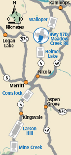
 Walloper Highway 5 about 30 km south of Kamloops, looking south. |  Hwy 5 at Hwy 97D northbound Highway 5 at Exit 366 Logan Lake/Lac le Jeune Road, looking northbound along Highway 5. |  Hwy 97D at Hwy 5 - NE Highway 97D (Logan Lake/Lac le Jeune Road) at Highway 5, looking northeast. |  Hwy 97D at Hwy 5 - SW Highway 97D (Logan Lake/Lac le Jeune Road) at Highway 5, looking southwest. | |||||
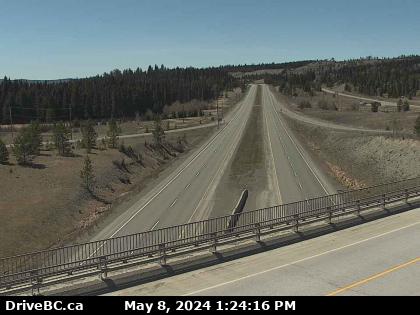
 Hwy 5 at Hwy 97D southbound Highway 5 at Exit 366 Logan Lake/Lac le Jeune Road, looking southbound along Highway 5. |  Helmer Lake Highway 5 about 24 km north of Merritt at Helmer Interchange, looking north. |  Comstock - N Highway 5 about 15 km south of Merritt at Comstock Road, looking north. |  Comstock - S Highway 5 about 15 km south of Merritt at Comstock Road, looking south. | |||||
 Larson Hill - N Highway 5 about 36 km south of Merritt at Larson Hill, looking north. |  Larson Hill - S Highway 5 about 36 km south of Merritt at Larson Hill, looking south. |  Mine Creek Highway 5 southbound at Mine Creek Road, looking south. |  Britton Creek - N Highway 5 at Britton Creek Rest Area northbound turnoff, looking north. | |||||
 Britton Creek - S Highway 5 at Britton Creek Rest Area northbound turnoff, looking south. |  Coquihalla Lakes - N Highway 5 about 61 km south of Merritt, looking north. |  Coquihalla Lakes - S Highway 5 about 61 km south of Merritt, looking south. |  Coquihalla Summit - N Highway 5 about 7 km north of Zopkios Brake Check, looking north. | |||||
 Coquihalla Summit - S Highway 5 about 7 km north of Zopkios Brake Check, looking south. |  Zopkios Southbound - N Highway 5 southbound at Zopkios Rest Area near the Coquihalla Summit, looking north. |  Zopkios Southbound - S Highway 5 southbound at Zopkios Rest Area near the Coquihalla Summit, looking south. |  Zopkios Northbound - N Highway 5 northbound at Zopkios Rest Area near the Coquihalla Summit looking north. | |||||
 Zopkios Northbound - S Highway 5 northbound at Zopkios Rest Area near the Coquihalla Summit looking south. |  Coquihalla Great Bear Snowshed - N Highway 5 at the Great Bear Snowshed, looking north. |  Coquihalla Great Bear Snowshed - S Highway 5 at the Great Bear Snowshed, looking south. |  Box Canyon - N Highway 5 near Box Canyon Chain Up, looking north. | |||||
 Box Canyon - S Highway 5 near Box Canyon Chain Up, looking south. |  Portia - N Highway 5 at the northbound Portia Chain Up, looking north. |  Portia - S Highway 5 at the northbound Portia Chain Up, looking south. | Image Unavailable. Othello - N Highway 5 about 11 km east of Hope at Othello, looking north. | |||||
Image Unavailable. Othello - S Highway 5 about 11 km east of Hope at Othello, looking south. |
||||||||
