


BC HighwayCams - Highway 6
Please note all BC HwyCams use Pacific Time Zone (PT).
Attention motorists:
Spring weather can make highway conditions in B.C. unpredictable, particularly through high mountain passes. Please be prepared and be aware that winter tires and chains may still be needed.
We reserve the right to restrict travel at any time of the year depending on road conditions.
Click for more information
 |
|
|||||||
|
||||||||
 Lumby - W Highway 6 at Mountain View Avenue, looking west. |  Lumby - E Highway 6 at Mountain View Avenue, looking east. |  Shuswap Hill - W Highway 6 at Shuswap Hill west of Cherryville, looking west. |  Shuswap Hill - E Highway 6 at Shuswap Hill west of Cherryville, looking east. | |||||
 Monashee Pass Highway 6 about 83 km east of Vernon, looking westbound. |  Needles Ferry Bend End Highway 6 at Needles Ferry Landing, looking west away from ferry landing towards Needles Road N. |  Needles Ferry Bend Middle Highway 6 at Needles Ferry Landing, looking east to ferry landing. |  Needles Ferry Rest Area Highway 6 at Needles Ferry Landing, looking east towards front of line up near the rest area. | |||||
 Needles Ferry Front - W Highway 6 at front of Needles Ferry Landing line up, looking west. |  Needles Ferry Front - E Highway 6 at front Needles Ferry Landing line up, looking east. |  Fauquier Ferry - W Highway 6 at Fauquier Ferry Landing, looking west. |  Fauquier Ferry - E Highway 6 at Fauquier Ferry Landing, looking east. | |||||
 Fauquier at Starlite Road - W Highway 6 at Starlite Road, looking west towards Fauquier. |  Fauquier at Starlite Road - E Highway 6 at Starlite Road, looking east towards Burton. |  Burton Main Road Highway 6 in Burton at Burton Main Road, about 22 km north of Fauquier, looking south. |  Arrow Park Ferry North Terminal Highway 6 at South Arrow Park Ferry Terminal, 22 km south of Nakusp at junction of Upper and Lower Arrow Lakes, looking at north landing. | |||||
 Arrow Park Ferry South Terminal - N Highway 6 at South Arrow Park Ferry Terminal, 22 km south of Nakusp at junction of Upper and Lower Arrow Lakes, looking north. |  Arrow Park Ferry South Terminal - S Highway 6 at South Arrow Park Ferry Terminal, 22 km south of Nakusp at junction of Upper and Lower Arrow Lakes, looking south on Arrow Park Road. |  Nakusp - N Highway 6 and Highway 23 Junction in Nakusp, looking north on Highway 6. |  Nakusp - S Highway 6 and Highway 23 Junction in Nakusp, looking south on Highway 6. | |||||
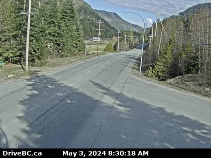
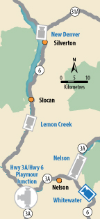
 New Denver Highway 6 at Highway 31A in New Denver, looking north. |  Lemon Creek Highway 6 at Kennedy Road/Lemon Creek Road about 8 km south of Slocan, looking south. |  Playmor Junction - N Highway 6 and Highway 3A at Playmor Junction, looking north. |  Playmor Junction - W Highway 6 and Highway 3A at Playmor Junction, looking west. | |||||
 Playmor Junction - S Highway 6 and Highway 3A at Playmor Junction, looking south. |  Nelson - N Highway 6 near Highway 3A and Rosemont/Uphill interchange, looking north. |  Nelson - S Highway 6 near Highway 3A and Rosemont/Uphill interchange, looking south. |  Whitewater Highway 6 at Whitewater Ski Hill Road about 12.5 km south of Nelson, looking north. | |||||
 Ymir Highway 6 in Ymir at First Avenue, looking south. |
||||||||
