 |
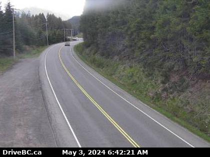
Menzies Hill - N
Highway 19 about 7 km southeast of Roberts Lake and 24 km north of Campbell River at Menzies Hill, looking north. (elevation: 300 metres)  Add to My HighwayCams Add to My HighwayCams
 Add to My HighwayCams Add to My HighwayCams
|
|

|
 |
 |
 Port Hardy - N
Highway 19 at Douglas Street, looking north along Highway 19 (Bear Cove Highway). |  Port Hardy - W
Highway 19 at Douglas Street, looking west along Douglas Street. |  Port Hardy - E
Highway 19 at Douglas Street, looking east along Highway 19. | 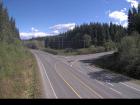 Hwy 19 at Port Alice Road
Highway 19 at Highway 30 (Port Alice Road) between Port Hardy and Port McNeill, looking south. |
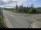 Port McNeill - W
Highway 19 at Campbell Way in Port McNeill, looking west. | 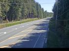 Port McNeill - E
Highway 19 at Campbell Way in Port McNeill, looking east. | 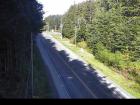 Hyde Creek Road - W
Highway 19 about 4.5 km south of Port McNeill near Hyde Creek Road, looking west. |  Hyde Creek Road - E
Highway 19 about 4.5 km south of Port McNeill near Hyde Creek Road, looking east. |
 Woss
Highway 19 about 75 km southeast of Port McNeill and 128 km north of Campbell River, looking east. |  Tsitika
Highway 19 about 101 km north of Campbell River and about 27 km south of Woss near Tsitika, looking southeast. |  Roberts Lake
Highway 19 about 31 km north of Campbell River, looking north. |  Menzies Hill - N
Highway 19 about 7 km southeast of Roberts Lake and 24 km north of Campbell River at Menzies Hill, looking north. |
 Menzies Hill - S
Highway 19 about 7 km southeast of Roberts Lake and 24 km north of Campbell River at Menzies Hill, looking south. |  Duncan Bay - N
Highway 19 north of Campbell River between Orange Point Road and Duncan Bay Road, looking north. |  Duncan Bay - S
Highway 19 north of Campbell River between Orange Point Road and Duncan Bay Road, looking south. |  Campbell River - N
Highway 19 about 2.5 km south of Campbell River at Willis Road, looking north. |
 Campbell River - W
Highway 19 about 2.5 km south of Campbell River at Willis Road, looking west. |  Campbell River - E
Highway 19 about 2.5 km south of Campbell River at Willis Road, looking east. |  Campbell River - S
Highway 19 about 2.5 km south of Campbell River at Willis Road, looking south. |  Black Creek
Highway 19 about 25 km north of Courtenay at Hamm Road, looking north. |
 Piercy Road - N
Hwy 19 at Piercy Road, looking north. |  Piercy Road - S
Highway 19 at Piercy Road, looking south. |  Buckley Bay Road
Highway 19 near the Buckley Bay Road Interchange, looking north. |  Cook Creek Road
Highway 19 about 29 km north of Parksville at Cook Creek Road, looking north. |
 Horne Lake Road - N
Highway 19 at Horne Lake Road, looking north. | 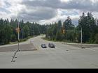 Horne Lake Road - W
Highway 19 at Horne Lake Road, looking west. |  Horne Lake Road - E
Highway 19 at Horne Lake Road, looking east. |  Horne Lake Road - S
Highway 19 at Horne Lake Road, looking south. |
 Qualicum Interchange - W
Highway 19 south of Qualicum Interchange at Highway 4, looking west. | 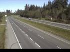 Qualicum Interchange - E
Highway 19 south of Qualicum Interchange at Highway 4, looking east. | 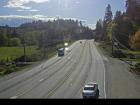 Nanoose Bay - N
Highway 19 at Northwest Bay Road near Nanoose Bay, looking north. | 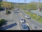 Nanoose Bay - E
Highway 19 at Northwest Bay Road near Nanoose Bay, looking east. |
 Nanoose Bay - S
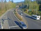
Highway 19 at Northwest Bay Road near Nanoose Bay, looking south. | 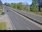 Nanoose Rest Area - N
Highway 19 at the Nanoose Rest Area, looking north. |  Nanoose Rest Area - S
Highway 19 at the Nanoose Rest Area, looking south. |  Lantzville - N
Highway 19 near McKercher Road in Lantzville, looking northbound. |
 Lantzville - S
Highway 19 near McKercher Road in Lantzville, looking southbound. |  Aulds Road - N
Highway 19 at Aulds Road in Nanaimo, looking north. | 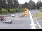 Aulds Road - W
Highway 19 at Aulds Road in Nanaimo, looking west. | 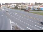 Aulds Road - E
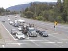
Highway 19, at Aulds Road in Nanaimo, looking east. |
 Aulds Road - S
Highway 19 at Aulds Road in Nanaimo, looking south. | 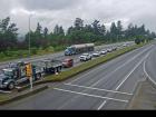 Northfield Road - N
Highway 19 at Northfield Road in Nanaimo, looking north.
|  Northfield Road - W
Highway 19 at Northfield Road in Nanaimo, looking west.
|  Northfield Road - E
Highway 19 at Northfield Road in Nanaimo, looking east
|
 Northfield Road - S
Highway 19 at Northfield Road in Nanaimo, looking south.
|  Nanaimo Parkway
Highway 19 at College Drive, looking north. |


