


BC HighwayCams - Highway 1 (Horseshoe Bay to Lynn Valley)
Please note all BC HwyCams use Pacific Time Zone (PT).
Attention motorists:
Spring weather can make highway conditions in B.C. unpredictable, particularly through high mountain passes. Please be prepared and be aware that winter tires and chains may still be needed.
We reserve the right to restrict travel at any time of the year depending on road conditions.
Click for more information
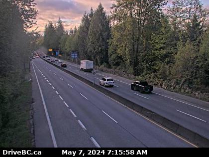 |
Hwy 1 at Hadden Drive Ramp - E
Highway 1 at Hadden Drive off-ramp for Taylor Way, looking east. (elevation: 62 metres) |
||
Weather Forecast (from Environment Canada)All weather stations (current weather) for this region (map) |
|||
|
|||
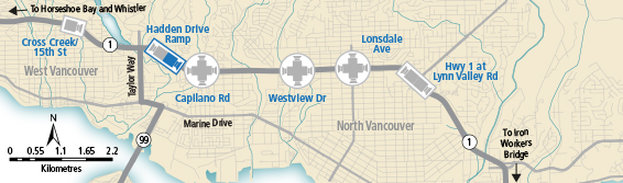
 Horseshoe Bay - W Highway 99 at Highway 1 ramp to Horseshoe Bay, looking west. |  Horseshoe Bay - E Highway 99 at Highway 1 ramp to Horseshoe Bay, looking east. |  Cross Creek Highway 1 at Cross Creek / 15 Street exit in West Vancouver, looking east. |  Hwy 1 at Hadden Drive Ramp - W Highway 1 at Hadden Drive off-ramp for Taylor Way, looking west. |
 Hwy 1 at Hadden Drive Ramp - E Highway 1 at Hadden Drive off-ramp for Taylor Way, looking east. |  Capilano - N Highway 1 (Upper Levels Highway) at Capilano Road, looking north. |  Capilano - W Highway 1 (Upper Levels Highway) at Capilano Road, looking west. |  Capilano - E Highway 1 (Upper Levels Highway) at Capilano Road, looking east. |
 Capilano - S Highway 1 (Upper Levels Highway) at Capilano Road, looking south. |  Westview - N Highway 1 (Upper Levels Highway) at Westview Drive, looking north. |  Westview - W Highway 1 (Upper Levels Highway) at Westview Drive, looking west. |  Westview - E Highway 1 (Upper Levels Highway) at Westview Drive, looking east. |
 Westview - S Highway 1 (Upper Levels Highway) at Westview Drive, looking south. |  Lonsdale - N Highway 1 (Upper Levels Highway) at Lonsdale Avenue, looking north. |  Lonsdale - W Highway 1 (Upper Levels Highway) at Lonsdale Avenue, looking west. |  Lonsdale - E Highway 1 (Upper Levels Highway) at Lonsdale Avenue, looking east. |
 Lonsdale - S Highway 1 (Upper Levels Highway) at Lonsdale Avenue, looking south. |  Lynn Valley Road - W Highway 1 near the Lynn Valley Road on-ramp, looking west. |  Lynn Valley Road - E Highway 1 near the Lynn Valley Road on-ramp, looking east. |
|
