


BC HighwayCams - Highway 1 (Vancouver Island)
Please note all BC HwyCams use Pacific Time Zone (PT).
Attention motorists:
Spring weather can make highway conditions in B.C. unpredictable, particularly through high mountain passes. Please be prepared and be aware that winter tires and chains may still be needed.
We reserve the right to restrict travel at any time of the year depending on road conditions.
Click for more information
 |
|
|||||||
|
||||||||
 Departure Bay northbound Highway 1 at Zorkin Road/Brechin Road, looking northbound to Brechin Road. |  Departure Bay southbound Highway 1 at Zorkin Road/Brechin Road, looking to Stewart Avenue. |  Departure Bay Ferry Highway 1 at Zorkin Road/Brechin Road, looking at Departure Bay Ferry Terminal. |  Departure Bay - Zorkin Road Highway 1 at Zorkin Road/Brechin Road, looking onto Zorkin Road. | |||||
 Comox Road - N Highway 1, at Comox Road and Terminal Avenue in Nanaimo, looking north. |  Comox Road - W Highway 1, at Comox Road and Terminal Avenue in Nanaimo, looking west. |  Comox Road - E Highway 1, at Comox Road and Terminal Avenue in Nanaimo, looking east. |  Comox Road - S Highway 1, at Comox Road and Terminal Avenue in Nanaimo, looking south. | |||||
 Nanaimo Airport - N Highway 1 at Vowels Road next to Nanaimo Airport, looking north. |  Nanaimo Airport - S Highway 1 at Vowels Road next to Nanaimo Airport, looking south. |  Ladysmith Highway 1 at South Davis Road, south of Ladysmith, looking south. |  Chemainus Highway 1 at Henry Road near Chemainus, looking south. | |||||
 Herd Road - N Highway 1 about 5 km north of Duncan at Herd Road/Cowichan Valley Highway, looking north. |  Herd Road - W Highway 1 about 5 km north of Duncan at Herd Road/Cowichan Valley Highway, looking west. |  Herd Road - E Highway 1 about 5 km north of Duncan at Herd Road/Cowichan Valley Highway, looking east. |  Herd Road - S Highway 1 about 5 km north of Duncan at Herd Road/Cowichan Valley Highway, looking south. | |||||
 Duncan - N Highway 1 in Duncan at Trunk Road, looking north. |  Duncan - E Highway 1 at Trunk Road in Duncan, looking east. |  Duncan - S Highway 1 at Trunk Road in Duncan, looking south. |  Cobble Hill Road Highway 1 at Cowichan Bay Road/Cobble Hill Road, looking south. | |||||
 Mill Bay - N Highway 1 at Shawnigan Mill Bay Road, looking north. |  Mill Bay - W Highway 1 at Shawnigan Mill Bay Road, looking west. |  Mill Bay - S Highway 1 at Shawnigan Mill Bay Road, looking south. |  Butterfield Road - N Highway 1 at Butterfield Road, approximately 3 km south of Mill Bay, looking north. | |||||
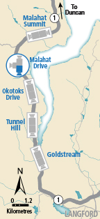
 Butterfield Road - S Highway 1 at Butterfield Road, approximately 3 km south of Mill Bay, looking south. |  Bamberton - N Highway 1 south of Mill Bay Rd Overpass at the Bamberton Park Entrance, looking north. |  Bamberton - S Highway 1 south of Mill Bay Road Overpass at the Bamberton Park Entrance, looking south. |  Malahat Summit - N Highway 1, about 3.7 km south of Bamberton, looking northbound. | |||||
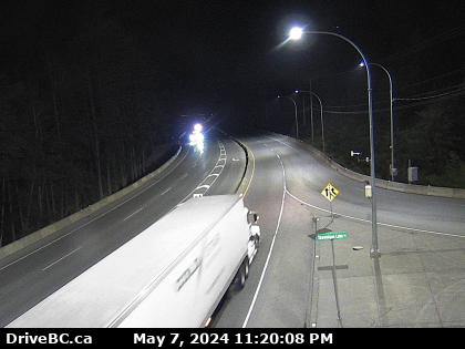
 Malahat Summit - S Highway 1, about 3.7 km south of Bamberton, looking southbound. |  Malahat Drive - N Highway 1 at South Shawnigan Lake Road, looking north. |  South Shawnigan Lake Road - W Highway 1 at South Shawnigan Lake Road, looking west. |  Malahat Drive - S Highway 1 at South Shawnigan Lake Road, looking south. | |||||
 Okotoks - N Highway 1 at Okotoks Road, looking north. |  Okotoks - S Highway 1 at Okotoks Road, looking south. |  Tunnel Hill - N Highway 1 at Tunnel Hill on the Malahat, looking north. |  Tunnel Hill - S Highway 1 at Tunnel Hill on the Malahat, looking south. | |||||
 Goldstream - N Highway 1 at Finlayson Arm Road in Goldstream Park, looking north. |  Goldstream - S Highway 1 at Finlayson Arm Road in Goldstream Park, looking south. |  Hwy 1 at West Shore Parkway northbound Highway 1 at West Shore Parkway, looking northbound toward Goldstream Park. |  West Shore Parkway Highway 1 at West Shore Parkway, looking west along West Shore Parkway. | |||||
 Hwy 1 at West Shore Parkway southbound Highway 1 at West Shore Parkway, looking southbound towards Victoria. |  Spencer Road - W Highway 1 at Spencer Road, northbound looking west. |  Spencer Road - E Hwy 1 at Spencer Road, southbound looking east. |  Millstream Road - N Highway 1 at the Millstream Road, looking north. | |||||
 Millstream Road - W Highway 1 at Millstream Road, looking west. |  Millstream Road - E Highway 1 at Millstream Road, looking east. |  Colwood - W Highway 1 northbound, near the View Royal / Colwood exit, looking west. |  Colwood - E Highway 1 southbound, near the View Royal / Colwood exit, looking east. | |||||
 Helmcken - N Highway 1 at Helmcken Overpass, looking north |  Helmcken - W Highway 1 at Helmcken Overpass, looking west. |  Helmcken - E Highway 1 at Helmcken overpass, looking east. |  Helmcken - S Highway 1 at Helmcken overpass, looking south. | |||||
 Admirals-McKenzie - N Highway 1, at Admirals Road / McKenzie Avenue, looking north. |  Admirals-McKenzie - W Highway 1, at Admirals Road / McKenzie Avenue, looking west. |  Admirals-McKenzie - E Highway 1, at Admirals Road / McKenzie Avenue, looking east. |  Admirals-McKenzie - S Highway 1, at Admirals Road / McKenzie Avenue, looking south. | |||||
 Tillicum - N Highway 1 at Tillicum Road, looking north. |  Tillicum - W Highway 1 at Tillicum Road, looking west. |  Tillicum - E Highway 1 at Tillicum Road, looking east. |  Tillicum - S Highway 1 at Tillicum Road, looking south. | |||||
 Carey Road - NW Highway 1 at Carey Road, looking northwest. |  Carey Road - SE Highway 1 at Carey Road, looking southeast. |
|||||||
