


BC HighwayCams - Highway 5
Please note all BC HwyCams use Pacific Time Zone (PT).
Attention motorists:
Spring weather can make highway conditions in B.C. unpredictable, particularly through high mountain passes. Please be prepared and be aware that winter tires and chains may still be needed.
We reserve the right to restrict travel at any time of the year depending on road conditions.
Click for more information
 |
|
|||||||
|
||||||||
 Mad River - N Highway 5 about 18 km northeast of Vavenby, looking northbound. |  Mad River - S Highway 5 about 18 km southwest of Vavenby, looking southbound. |  Clearwater - N Highway 5 at Clearwater Valley Road, looking north. |  Clearwater - S Highway 5 at Clearwater Valley Road, looking south. | |||||
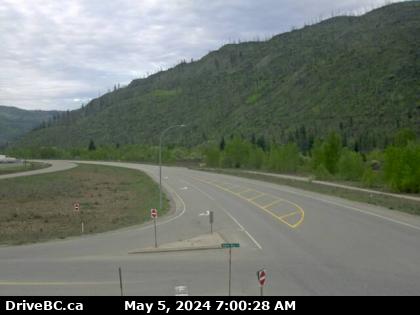
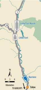
 Little Fort north - N Highway 5 about 2 km north of Highway 24, looking north. |  Little Fort north - S Highway 5 about 2 km north of Highway 24, looking south. |  Little Fort Highway 5 in Little Fort at Highway 5 / Highway 24 junction, looking north. |  Barriere Highway 5 at Agate Bay Road, south of Barriere, looking south. | |||||
 Halston Avenue / Paul Lake Road - N Highway 5 at Halston Avenue / Paul Lake Road in Kamloops, looking north. |  Halston Avenue / Paul Lake Road - W Highway 5 at Halston Avenue / Paul Lake Road in Kamloops, looking west. |  Halston Avenue / Paul Lake Road - E Highway 5 at Halston Avenue / Paul Lake Road in Kamloops, looking east to Paul Lake Road. |  Halston Avenue / Paul Lake Road - S Highway 5 at Halston Avenue / Paul Lake Road in Kamloops, looking south. | |||||
