

BC HighwayCams - Highway 19
Please note all BC HwyCams use Pacific Time Zone (PT).
Attention motorists:
Fall weather can make highway conditions in B.C. unpredictable, particularly through high mountain passes. Winter tires or chains are required on most routes in British Columbia from October 1 to April 30.

Click for more information
 |
|
|||||||
|
||||||||
Weather Forecast (from Environment Canada)All weather stations (current weather) for this region (map) |
||||||||
 Hwy 19 at Port Alice Road Highway 19 at Highway 30 (Port Alice Road) between Port Hardy and Port McNeill, looking south. |  Port McNeill - W Highway 19 at Campbell Way in Port McNeill, looking west. |  Port McNeill - E Highway 19 at Campbell Way in Port McNeill, looking east. |  Hyde Creek Road - W Highway 19 about 4.5 km south of Port McNeill near Hyde Creek Road, looking west. | |||||
 Hyde Creek Road - E Highway 19 about 4.5 km south of Port McNeill near Hyde Creek Road, looking east. |  Woss Highway 19 about 75 km southeast of Port McNeill and 128 km north of Campbell River, looking east. |  Tsitika Highway 19 about 101 km north of Campbell River and about 27 km south of Woss near Tsitika, looking southeast. |  Roberts Lake Highway 19 about 31 km north of Campbell River, looking north. | |||||
 Menzies Hill - N Highway 19 about 7 km southeast of Roberts Lake and 24 km north of Campbell River at Menzies Hill, looking north. |  Menzies Hill - S Highway 19 about 7 km southeast of Roberts Lake and 24 km north of Campbell River at Menzies Hill, looking south. |  Duncan Bay - N Highway 19 north of Campbell River between Orange Point Road and Duncan Bay Road, looking north. |  Duncan Bay - S Highway 19 north of Campbell River between Orange Point Road and Duncan Bay Road, looking south. | |||||
 Campbell River - N Highway 19 about 2.5 km south of Campbell River at Willis Road, looking north. |  Campbell River - W Highway 19 about 2.5 km south of Campbell River at Willis Road, looking west. |  Campbell River - E Highway 19 about 2.5 km south of Campbell River at Willis Road, looking east. |  Campbell River - S Highway 19 about 2.5 km south of Campbell River at Willis Road, looking south. | |||||
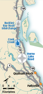
 Black Creek Highway 19 about 25 km north of Courtenay at Hamm Road, looking north. |  Piercy Road - N Hwy 19 at Piercy Road, looking north. |  Piercy Road - S Highway 19 at Piercy Road, looking south. |  Buckley Bay Road Highway 19 near the Buckley Bay Road Interchange, looking north. | |||||
 Cook Creek Road Highway 19 about 29 km north of Parksville at Cook Creek Road, looking north. |  Horne Lake Road - N Highway 19 at Horne Lake Road, looking north. |  Horne Lake Road - W Highway 19 at Horne Lake Road, looking west. |  Horne Lake Road - E Highway 19 at Horne Lake Road, looking east. | |||||
 Horne Lake Road - S Highway 19 at Horne Lake Road, looking south. |  Qualicum Interchange - W Highway 19 south of Qualicum Interchange at Highway 4, looking west. |  Qualicum Interchange - E Highway 19 south of Qualicum Interchange at Highway 4, looking east. |  Nanoose Bay - N Highway 19 at Northwest Bay Road near Nanoose Bay, looking north. | |||||
 Nanoose Bay - E Highway 19 at Northwest Bay Road near Nanoose Bay, looking east. |  Nanoose Bay - S Highway 19 at Northwest Bay Road near Nanoose Bay, looking south. |  Nanoose Rest Area - N Highway 19 at the Nanoose Rest Area, looking north. |  Nanoose Rest Area - S Highway 19 at the Nanoose Rest Area, looking south. | |||||
 Lantzville - N Highway 19 near McKercher Road in Lantzville, looking northbound. |  Lantzville - S Highway 19 near McKercher Road in Lantzville, looking southbound. |  Aulds Road - N Highway 19 at Aulds Road in Nanaimo, looking north. |  Aulds Road - W Highway 19 at Aulds Road in Nanaimo, looking west. | |||||
 Aulds Road - E Highway 19, at Aulds Road in Nanaimo, looking east. |  Aulds Road - S Highway 19 at Aulds Road in Nanaimo, looking south. |  Northfield Road - N Highway 19 at Northfield Road in Nanaimo, looking north. |  Northfield Road - W Highway 19 at Northfield Road in Nanaimo, looking west. | |||||
 Northfield Road - E Highway 19 at Northfield Road in Nanaimo, looking east |  Northfield Road - S Highway 19 at Northfield Road in Nanaimo, looking south. |  Nanaimo Parkway Highway 19 at College Drive, looking north. |
||||||
