


BC HighwayCams - Highway 97C
Please note all BC HwyCams use Pacific Time Zone (PT).
Attention motorists:
Spring weather can make highway conditions in B.C. unpredictable, particularly through high mountain passes. Please be prepared and be aware that winter tires and chains may still be needed.
We reserve the right to restrict travel at any time of the year depending on road conditions.
Click for more information
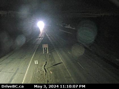 |
Elkhart - E
Highway 97C (Okanagan Connector) about 25 km east of Highway 5A and Highway 97C junction, looking east. (elevation: 1621 metres) |
||
Weather Forecast (from Environment Canada)All weather stations (current weather) for this region (map) |
|||
|
|||
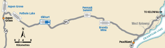
 Highland Valley Road - N Highway 97C at Highland Valley Road between Merritt and Ashcroft, looking north. |  Highland Valley Road - S Highway 97C at Highland Valley Road between Merritt and Ashcroft, looking south. |  Aspen Grove - N Highway 97C (Okanagan Connector) at Highway 5A junction near Aspen Grove, looking north. |  Aspen Grove - S Highway 97C (Okanagan Connector) at Highway 5A junction near Aspen Grove, looking south. |
Image Temporarily Unavailable. Pothole Lake - W Highway 97C (Okanagan Connector) about 7 km east of Aspen Grove near Pothole Lake, looking west. | Image Temporarily Unavailable. Pothole Lake - E Highway 97C (Okanagan Connector) about 7 km east of Aspen Grove near Pothole Lake, looking east. |  Elkhart - W Highway 97C (Okanagan Connector) about 25 km east of Highway 5A and Highway 97C junction, looking west. |  Elkhart - E Highway 97C (Okanagan Connector) about 25 km east of Highway 5A and Highway 97C junction, looking east. |
 Pennask Summit - W Highway 97C (Okanagan Connector) about 74 km west of Kelowna, looking west. |  Pennask Summit - E Highway 97C (Okanagan Connector) about 74 km west of Kelowna, looking east. |  Brenda Mine - W Highway 97C (Okanagan Connector), about 22 km west of Highway 97 and Highway 97C junction, looking west. |  Brenda Mine - E Highway 97C (Okanagan Connector) about 22 km west of Highway 97 and Highway 97C Junction, looking east. |
