Welcome to the BC HighwayCams website, where you can view highway conditions, traffic, and weather information at a glance.
To view BC HighwayCams, select one of the tabs below and click on a thumbnail. (NR-Northern Region; SIR-Southern Interior Region; LM-Lower Mainland; VI-Vancouver Island; Brdr-Border; All-All webcams; MyCams-Customize your
own page of images.)
|
Highway 2 |  Tupper - W
Highway 2 about 2 km west of BC/Alberta border at Highway 2 and Highway 52 junction, looking west. |  Tupper - E
Highway 2 about 2 km west of BC/Alberta border at Highway 2 and Highway 52 junction, looking east. |
Highway 5 |  Lempriere
Highway 5 about 40 km north of Blue River and 26 km south of Albreda, looking south. |  Blue River
Highway 5 at Shell Road in Blue River, looking northeast. |  Messiter Summit
Highway 5 about 20 km south of Blue River and 19 km north of Avola, looking north. | |
| | |
Highway 16 |  Masset
Highway 16 at Hodges Road in Masset on Haida Gwaii, looking north. |  Tlell
Highway 16 at Wiggins Road on the east coast of Graham Island, looking north. |  Skidegate
Highway 16 at the ferry terminal on Haida Gwaii, looking north. | |
| | | |  Rainbow Summit Chain-Up Area
Highway 16 about 34 km east of Prince Rupert near McNeil River at the Rainbow Summit chain-up area, looking west. |  Kwinitsa
Highway 16 about 70 km east of Prince Rupert, looking east. |
| |  Kasiks
Highway 16 at Kasiks resort area about 60 km west of Terrace, looking east. |  Terrace - W
Highway 16 at Highway 37S on the border of Terrace and Thornhill, looking west. |  Terrace - E
Highway 16 at Highway 37S on the border of Terrace and Thornhill, looking east on Highway 16. |  Terrace - S
Highway 16 at Highway 37S on the border of Terrace and Thornhill, looking south. |
| |  Chimdemash
Highway 16 near Chimdemash Creek about 22 km east of Highway 16 and Highway 37 junction in Terrace, looking north. |  Kitwanga - N
Highway 16 at Highway 37 near Kitwanga, looking north on Highway 37. |  Kitwanga - W
Highway 16 at Highway 37 near Kitwanga, looking west on Highway 16. |  Kitwanga - E
Highway 16 at Highway 37 near Kitwanga, looking east on Highway 16. |
| |  New Hazelton
Highway 16 at McLeod Street in New Hazelton, looking east. |  Witset - N
Highway 16 at Beaver Road in Witset, looking north. |  Witset - W
Highway 16 at Beaver Road in Witset, looking west. |  Witset - S
Highway 16 at Beaver Road in Witset, looking south. |
| |  Trout Creek
Highway 16 at the Trout Creek bridge, looking southeast. | | | |
| | |  Smithers - N
Highway 16 at Main Street in Smithers, looking north. |  Smithers - W
Highway 16 at Main Street in Smithers, looking west. |  Smithers - E
Highway 16 at Main Street in Smithers, looking east. |
| |  Smithers - S
Highway 16 at Main Street in Smithers, looking south. |  Telkwa - N
Highway 16 at Hankin Road in Telkwa, looking north. |  Telkwa - E
Highway 16 at Hankin Road in Telkwa, looking east. |  Telkwa - S
Highway 16 at Hankin Road in Telkwa, looking south |
| |  Hungry Hill - NW
Highway 16 about 14 km northwest of Houston at Anderson Road, looking northwest. |  Hungry Hill - SE
Highway 16 about 14 km northwest of Houston at Anderson Road, looking southeast. |  Nadina - N
Highway 16 at North Nadina Avenue in Houston, looking north. | 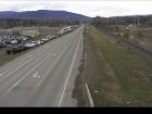 Nadina - W
Highway 16 at North Nadina Avenue in Houston, looking west. |
| |  Nadina - E
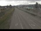
Highway 16 at North Nadina Avenue in Houston, looking east. | 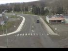 Butler - W
Highway 16 at Butler Avenue in Houston, looking west. | 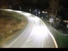 Butler - E
Highway 16 at Butler Avenue in Houston, looking east. |  Six Mile Hill
Highway 16 about 39 km west of Burns Lake, looking west. |
| |  Burns Lake - W
Highway 16 at North Francois Highway in Burns Lake, looking west. |  Burns Lake - E
Highway 16 at North Francois Highway in Burns Lake, looking east. |  Burns Lake - S
Highway 16 at North Francois Highway in Burns Lake, looking south. | 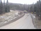 Augier Road - N
Highway 16 about 22 km east of Burns Lake at Augier Road, looking north. |
| |  Augier Road - W
Highway 16 about 22 km east of Burns Lake at Augier Road, looking west. | 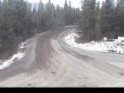 Augier Road - S
Highway 16 about 22 km east of Burns Lake at Augier Road, looking south. | 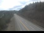 Priestly Hill
Highway 16 about 32 km east of Burns Lake, looking east. | |
| | | | | |
| | | | | |
| | | | |  Sob Lake - W
Highway 16 at Sob Lake Road in Vanderhoof, looking west. |
| |  Sob Lake - E
Highway 16 at Sob Lake Road in Vanderhoof, looking east. |  Bednesti Lake - W
Highway 16 at Bobtail Forest Road near Bednesti Lake between Prince George and Vanderhoof, looking west. |  Bednesti Lake - E
Highway 16 at Bobtail Forest Road near Bednesti Lake between Prince George and Vanderhoof, looking east. |  Tamarack
Highway 16 about 33 km west of Prince George, looking west. |
| | | |  Bowron River
Highway 16 about 54 km east of Prince George near Purden Lake, looking west. |  Slim Creek - W
Highway 16 about 0.4 km east of the Slim Creek Rest Area, looking west. |
| |  Slim Creek - E
Highway 16 about 0.4 km east of the Slim Creek Rest Area, looking east. |  Crescent Spur
Highway 16 about 50 km west of McBride at Loos Road, looking west. | | |
| | | |  Red Pass
Highway 16 about 27 km east of Tete-Jaune Junction and 40 km west of BC-Alberta border, looking east. | BC-Alberta Border
Highway 16 about 0.5 km west of the BC-Alberta border and 1 km to Jasper in Alberta, looking west. |
Highway 27 |  Fort St. James - N
Highway 27 at Hill Street/Greenview Drive in Fort St. James, looking north. |  Fort St. James - S
Highway 27 at Hill Street/Greenview Drive in Fort St. James, looking south. | 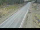 Spencer Pit - N
Highway 27 about 12 km south of Fort St. James at Spencer Pit, looking north. | 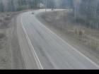 Spencer Pit - S
Highway 27 about 12 km south of Fort St. James at Spencer Pit, looking south. |
| | | |
Highway 29 |  Hudson's Hope - NE
Highway 29 about 1.5 km north of Hudson's Hope at Powell Road, looking northeast. |  Hudson's Hope - SW
Highway 29 about 1.5 km north of Hudson's Hope at Powell Road, looking southwest. |  Tumbler Ridge
Highway 29 at Highway 52 junction, looking westbound on Highway 29. | |
| | |
Highway 35 | 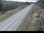 Martin Road - N
Highway 35 near Martin Road between Burns Lake and Francois Lake Northbank Ferry Landing, looking north. | 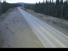 Martin Road - S
Highway 35 near Martin Road between Burns Lake and Francois Lake Northbank Ferry Landing, looking south. | | |
Highway 37 | | |  Dease Lake
Highway 37 at Commercial Drive in Dease Lake, looking north on Highway 37. | |
| | Gitanyow - N
Highway 37N about 2.5 km south of Gitanyow at Kitwancool Access Road, looking north. | Gitanyow - S
Highway 37N about 2.5 km south of Gitanyow at Kitwancool Access Road, looking south. |  Onion Lake
Highway 37S at Onion Lake Cross Country Ski trails, looking north. |  Kitimat
Highway 37 about 5 km north of Kitimat at Oolichan Avenue, looking north. |
Highway 37A |  Stewart
Highway 37a between Stewart, BC and Hyder, USA, looking north. |
Highway 0 (Cecil Lake Rd) | |
Highway 97 (Northern Region) |  Steamboat Hill
Highway 97 about 80 km northwest of Fort Nelson, looking west. | |  Fort Nelson
Highway 97 at Fort Nelson weigh scale, looking north. |  Trutch
Highway 97 near Trutch and the Mile 202 Rest Area, looking north. |
| |  Sikanni Chief
Highway 97 about 6 km south of the Sikanni River Bridge and about 175 km north of Fort St. John, looking north. |  Mile 73 - N
Highway 97 at Beaton Highway about 44 km north of Fort St. John, looking north. |  Mile 73 - S
Highway 97 at Beaton Highway about 44 km north of Fort St. John, looking south. | |
| | | | |  Taylor - N
Highway 97 at Pine Avenue in Taylor, looking north. |
| |  Taylor - W
Highway 97 at Pine Avenue in Taylor, looking west. |  Taylor - E
Highway 97 at Pine Avenue in Taylor, looking east. |  Taylor - S
Highway 97 at Pine Avenue in Taylor, looking south. |  Big Bam Road
Highway 97 at Big Bam Road in South Taylor, looking south. |
| | | |  Dawson Creek - N
Highway 97 at Dangerous Goods Route, west of Dawson Creek, looking north. |  Dawson Creek - W
Highway 97 at Dangerous Goods Route, west of Dawson Creek, looking west. |
| |  Dawson Creek - E
Highway 97 at Dangerous Goods Route, west of Dawson Creek, looking east. |  Dawson Creek - S
Highway 97 at Dangerous Goods Route, west of Dawson Creek, looking south. |  John Hart Highway
Highway 97 (John Hart Highway) at Mason Road/237 Road, looking east. |  East Pine Hill
Highway 97 about 27 km east of Chetwynd on East Pine Hill, looking east. |
| | | |  Chetwynd - W
Highway 97 about 9 km east of Chetwynd at Wabi Estates Road, looking west. |  Chetwynd - E
Highway 97 about 9 km east of Chetwynd at Wabi Estates Road, looking east. |
| |  Link Creek
Highway 97 about 90 km west of Chetwynd near Link Creek Bridge, looking east. |  Pine Pass
Highway 97 north of Mackenzie Junction at Powder King access road, looking north. | |  Whiskers Point - N
Highway 97 near Whiskers Point Provincial Park entrance on the east side of McLeod Lake, looking north. |
| |  Whiskers Point - S
Highway 97 near Whiskers Point Provincial Park entrance on the east side of McLeod Lake, looking south. |  Summit Lake Road - N
Highway 97 about 49 km north of Prince George at Summit Lake Road, looking north. | 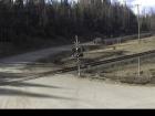 Summit Lake Road - W
Highway 97 about 49 km north of Prince George at Summit Lake Road, looking west. | 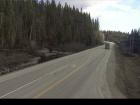 Summit Lake Road - S
Highway 97 about 49 km north of Prince George at Summit Lake Road, looking south. |
| | | | | |
| | | | |  Chamulak Road
Highway 97 about 36 km south of Prince George at Chamulak Road in Stoner, looking north. |
Highway 113 |  Grizzly Hill
Highway 113 (Nass Road) about 3 km southwest of Village of Laxgalts'ap (Greenville), looking west. |  Laxgalts'ap
Highway 113 near the Village of Laxgalts'ap in the Nass Valley, looking eastbound. | 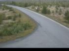 Gitwinksihlkw
Highway 113 at Anlaw Road near Gitwinksihlkw, within Nisga'a Memorial Lava Bed Provincial Park, looking east. |  Rosswood
Highway 113 near Rosswood about 44 km north of Terrace, looking north. |
Highway 118 | 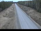 Granisle Highway
 (Highway 118), near summit. Approximately 14.5 km north of Topley, looking north. |


