


BC HighwayCams - Highway 97 (Northern Region)
Please note all BC HwyCams use Pacific Time Zone (PT).
Attention motorists:
Spring weather can make highway conditions in B.C. unpredictable, particularly through high mountain passes. Please be prepared and be aware that winter tires and chains may still be needed.
We reserve the right to restrict travel at any time of the year depending on road conditions.
Click for more information
 |
|
|||||||
|
||||||||
 Steamboat Hill Highway 97 about 80 km northwest of Fort Nelson, looking west. |  Liard Highway Junction Highway 97 at Highway 77 junction about 28 km north of Fort Nelson, looking east. |  Fort Nelson Highway 97 at Fort Nelson weigh scale, looking north. |  Trutch Highway 97 near Trutch and the Mile 202 Rest Area, looking north. | |||||
 Sikanni Chief Highway 97 about 6 km south of the Sikanni River Bridge and about 175 km north of Fort St. John, looking north. |  Mile 73 - N Highway 97 at Beaton Highway about 44 km north of Fort St. John, looking north. |  Mile 73 - S Highway 97 at Beaton Highway about 44 km north of Fort St. John, looking south. |  Fort St. John - N Highway 97 at 100 Avenue in Fort St. John, looking north. | |||||
 Fort St. John - NW Highway 97 at 100 Avenue in Fort St. John, looking northwest. |  Fort St. John - SE Highway 97 at 100 Avenue in Fort St. John, looking southeast. |  Fort St. John - S Highway 97 at 100 Avenue in Fort St. John, looking south. |  Taylor - N Highway 97 at Pine Avenue in Taylor, looking north. | |||||
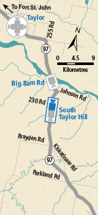
 Taylor - W Highway 97 at Pine Avenue in Taylor, looking west. |  Taylor - E Highway 97 at Pine Avenue in Taylor, looking east. |  Taylor - S Highway 97 at Pine Avenue in Taylor, looking south. |  Big Bam Road Highway 97 at Big Bam Road in South Taylor, looking south. | |||||
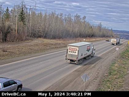
 South Taylor Hill - N Highway 97 about 20 km south of Fort St. John at South Taylor Hill, looking north. |  South Taylor Hill - S Highway 97 about 20 km south of Fort St. John at South Taylor Hill, looking south. |  Dawson Creek - N Highway 97 at Dangerous Goods Route, west of Dawson Creek, looking north. |  Dawson Creek - W Highway 97 at Dangerous Goods Route, west of Dawson Creek, looking west. | |||||
 Dawson Creek - E Highway 97 at Dangerous Goods Route, west of Dawson Creek, looking east. |  Dawson Creek - S Highway 97 at Dangerous Goods Route, west of Dawson Creek, looking south. |  John Hart Highway Highway 97 (John Hart Highway) at Mason Road/237 Road, looking east. |  East Pine Hill Highway 97 about 27 km east of Chetwynd on East Pine Hill, looking east. | |||||
 Braden Road - W Highway 97 near Braden Road, looking west. |  Braden Road - E Highway 97 near Braden Road, looking east. |  Chetwynd - W Highway 97 about 9 km east of Chetwynd at Wabi Estates Road, looking west. |  Chetwynd - E Highway 97 about 9 km east of Chetwynd at Wabi Estates Road, looking east. | |||||
 Link Creek Highway 97 about 90 km west of Chetwynd near Link Creek Bridge, looking east. |  Pine Pass Highway 97 north of Mackenzie Junction at Powder King access road, looking north. |  Mackenzie Junction Highway 97 at Highway 39 about 29 km south of Mackenzie, looking east. |  Whiskers Point - N Highway 97 near Whiskers Point Provincial Park entrance on the east side of McLeod Lake, looking north. | |||||
 Whiskers Point - S Highway 97 near Whiskers Point Provincial Park entrance on the east side of McLeod Lake, looking south. |  Summit Lake Road - N Highway 97 about 49 km north of Prince George at Summit Lake Road, looking north. |  Summit Lake Road - W Highway 97 about 49 km north of Prince George at Summit Lake Road, looking west. |  Summit Lake Road - S Highway 97 about 49 km north of Prince George at Summit Lake Road, looking south. | |||||
 Salmon Valley Road - N Highway 97 at Salmon Valley Road north of Prince George, looking north. |  Salmon Valley Road - E Highway 97 at Salmon Valley Road north of Prince George, looking east. |  Salmon Valley Road - S Highway 97 at Salmon Valley Road north of Prince George, looking south. |  Prince George northbound Highway 97 at Highway 16 junction in Prince George, looking northbound on Highway 97. | |||||
 Prince George westbound Highway 97 at Highway 16 junction in Prince George, looking westbound on Highway 16. |  Prince George eastbound Highway 97 at Highway 16 junction in Prince George, looking eastbound on Highway 16. |  Prince George southbound Highway 97 at Highway 16 junction in Prince George, looking southbound on Highway 97. |  Chamulak Road Highway 97 about 36 km south of Prince George at Chamulak Road in Stoner, looking north. | |||||
