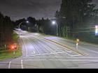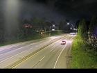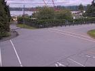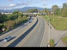
Welcome to the BC HighwayCams website, where you can view highway conditions, traffic, and weather information at a glance.
To view BC HighwayCams, select one of the tabs below and click on a thumbnail. (NR-Northern Region; SIR-Southern Interior Region; LM-Lower Mainland; VI-Vancouver Island; Brdr-Border; All-All webcams; MyCams-Customize your own page of images.)
Please note all BC HwyCams use Pacific Time Zone (PT).
Attention motorists:
Spring weather can make highway conditions in B.C. unpredictable, particularly through high mountain passes. Please be prepared and be aware that winter tires and chains may still be needed.
We reserve the right to restrict travel at any time of the year depending on road conditions.
Click for more information
 | NR |  |  | SIR |  |  | LM |  |  | VI |  |  | Brdr |  |  | All |  |  | MyCams |  |
| |||||||
Highway 1 (Horseshoe Bay to Lynn Valley) | |||||||
Highway 1 (Ironworkers Memorial Bridge to Port Mann) | |||||||
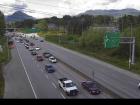 Ironworkers North approach - N Highway 1 at the northend of Ironworkers Memorial Bridge by Fern Street, looking northbound. | 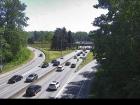 Ironworkers North approach - S Highway 1 at the northend of Ironworkers Memorial Bridge by Fern Street, looking southbound. | ||||||
 Ironworkers South westbound Highway 1 at the south end of Ironworkers Memorial Bridge, looking westbound towards the North Shore. |  Ironworkers South eastbound Highway 1 at the south end of Ironworkers Memorial Bridge, looking eastbound toward the Cassiar Tunnel. | ||||||
Highway 1 (Fraser Valley) | |||||||
Highway 0 (Chilliwack Lake Road) |  Chilliwack Lake Chilliwack Lake Road, at Paulsen Road. About 42 km east of Chilliwack, looking east. | ||||||
Highway 0 (Golden Ears Way) |  Golden Ears Way at Wharf Street North end of Golden Ears Bridge at Wharf Street, looking southbound. |  Golden Ears Way at 199A Avenue and 200 Street Golden Ears Way, at 199A Avenue off-ramp and 200 Street on-ramp, looking northbound. | |||||
Highway 7 (Lougheed Highway) |  Lougheed at Kennedy Road Highway 7 (Lougheed Highway) at Kennedy Road, looking northwest towards Pitt River Bridge. | ||||||
 Lougheed at Dewdney Trunk Road - N Highway 7 (Lougheed Highway) at Dewdney Trunk Road, looking north. | |||||||
 Lougheed at Dewdney Trunk Road - E Highway 7 (Lougheed Highway) at Dewdney Trunk Road, looking east. |  Lougheed at Maple Meadows Way - S Highway 7 (Lougheed Highway) at Maple Meadows Way/Dewdney Trunk Road, looking south. |  Lougheed at Haney Bypass - N Highway 7 (Lougheed Highway) at Haney Bypass/222 Street, looking north. | |||||
 Lougheed at Haney Bypass - S Highway 7 (Lougheed Highway) at Haney Bypass/222 Street, looking south. | |||||||
 Kanaka Way at Lougheed - westbound Westbound on Highway 7 (Lougheed Highway) at Kanaka Way/Haney Bypass. |  Kanaka Way at Lougheed - eastbound Eastbound on Highway 7 (Lougheed Highway) at Kanaka Way/Haney Bypass. | ||||||
 Silverdale - N Highway 7 (Lougheed Highway) at Hayward Street in Mission, looking north along Hayward Street. |  Silverdale - W Highway 7 (Lougheed Highway) at Hayward Street in Mission, looking westbound along Highway 7. |  Silverdale - E Highway 7 (Lougheed Highway) at Hayward Street in Mission, looking eastbound along Highway 7. | |||||
 Silverdale - S Highway 7 (Lougheed Highway) at Hayward Street in Mission, looking south to Hayward Street. | |||||||
 Highlands Boulevard - W Highway 7 (Lougheed Highway) about 3 km east of Harrison Mills at Highlands Boulevard, looking west | 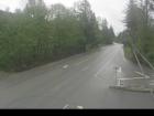 Highlands Boulevard - E Highway 7 (Lougheed Highway) about 3 km east of Harrison Mills at Highlands Boulevard, looking east. | ||||||
Highway 7B (Mary Hill Bypass) | |||||||
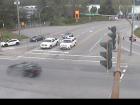 Mary Hill Bypass at Broadway - N Hwy 7B (Mary Hill Bypass), at Broadway St in Port Coquitlam, looking north. | 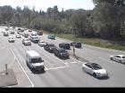 Mary Hill Bypass at Broadway - W Hwy 7B (Mary Hill Bypass), at Broadway St in Port Coquitlam, looking west. | ||||||
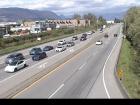 Mary Hill Bypass at Broadway - E Hwy 7B (Mary Hill Bypass), at Broadway St in Port Coquitlam, looking east. | |||||||
Highway 9 | |||||||
Highway 10 |  Hwy 10 at King George Boulevard - W Highway 10 at King George Boulevard, looking west on Highway 10. |  Hwy 10 at King George Boulevard - E Highway 10 at King George Boulevard, looking east on Highway 10. | |||||
Highway 11 (Abbotsford Mission Hwy) | |||||||
Highway 0 (Barnston) | |||||||
Highway 15 (South Surrey - Whiterock) | |||||||
Highway 17 | 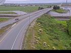 Deltaport Way - N Hwy 17 (South Fraser Perimeter Rd) at Deltaport Way in South Delta, looking north. | 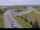 Deltaport Way - S Hwy 17 (South Fraser Perimeter Rd) at Deltaport Way in South Delta, looking south. | |||||
Hwy 17 at Hwy 91 Connector - N Hwy 17 (South Fraser Perimeter Rd), at Hwy 91 Connector, looking north. | Hwy 17 at Hwy 91 Connector - W Hwy 17 (South Fraser Perimeter Rd), at Hwy 91 Connector, looking west. | Hwy 17 at Hwy 91 Connector - E Hwy 17 (South Fraser Perimeter Rd), at Hwy 91 Connector, looking east. | |||||
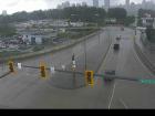 Tannery Road - N Highway 17 (South Fraser Perimeter Road) at Tannery Road Overpass in Surrey, looking north. | 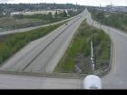 Tannery Road - W Highway 17 (South Fraser Perimeter Road) at Tannery Road Overpass in Surrey, looking west. |  Tannery Road - E Highway 17 (South Fraser Perimeter Road) at Tannery Road Overpass in Surrey, looking east. |  Tannery Road - S Highway 17 (South Fraser Perimeter Road) at Tannery Road Overpass in Surrey, looking south. | ||||
Highway 17A | |||||||
Highway 91A (New Westminster / Queensborough) |  Hwy 91A at Queensborough Bridge - E Highway 91A at the north end of Queensborough Bridge, looking east. |  Hwy 91A at Queensborough Bridge - S Highway 91A at the north end of Queensborough Bridge, looking south. | |||||
 Queensborough Connector Highway 91A at Highway 91 interchange to Queensborough Connector, looking north. | |||||||
Highway 0 (Knight Street) | |||||||
Highway 91 (Alex Fraser Bridge) |  Annacis Channel Bridge Approach Hwy 91 at Hwy 91A interchange, looking northeast to Annacis Channel Bridge approach. | ||||||
Highway 91 (East-West Connector) | 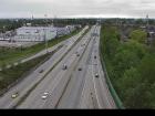 Hwy 91 East-West Connector - W Hwy 91 at Hwy 91A Interchange, looking west on the East-West Connector. | ||||||
Highway 91 (Delta) | |||||||
Highway 99 (Whistler to Lillooet) |  Lillooet-Fountain Valley Highway 99 about 15 km north of Lillooet near Fountain Slide, looking southwest. | ||||||
Highway 99 (Sea-to-Sky Highway) | |||||||
Highway 99 (Lions Gate Bridge/Marine Drive) | |||||||
Highway 99 (Oak Street Bridge - Richmond) |  Oak St at 70 Avenue - N Oak Street at 70 Avenue, north approach to Oak Street Bridge, looking north on Oak Street. |  Oak St at 70 Avenue - S Oak Street at 70 Avenue, north approach to Oak Street Bridge, looking south to the bridge. | |||||
Highway 99 (George Massey Tunnel) | 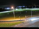 Hwy 99 at Hwy 17A - W Highway 99 at Highway 17A overpass, looking west on Highway 99 at northbound lanes. | ||||||
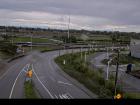 Hwy 99 at Hwy 17A - E Highway 99 at Highway 17A overpass, looking east at southbound lanes on Highway 99. | |||||||
Highway 99 (Delta to Surrey) | |||||||
 Hwy 99 at Mud Bay - W Highway 99, near Highway 91 around Mud Bay in Surrey, looking west on Highway 99 northbound. | 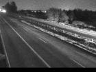 Hwy 99 at Mud Bay - E Highway 99, near Highway 91 around Mud Bay in Surrey, looking east on Highway 99 southbound. | ||||||
Highway 99 (Surrey to White Rock) | |||||||
Highway 99A (King George Blvd) | |||||||
Highway 101 (Sunshine Coast) | |||||||


