BC HighwayCams - Highway 113
Northern, Southern Interior and Vancouver Island images will update every 15 to 30 minutes; Lower Mainland images will update about every two to 15 minutes.
Please note all BC HwyCams use Pacific Time Zone (PT).
Attention motorists:
Spring weather can make highway conditions in B.C. unpredictable, particularly through high mountain passes. Please be prepared and be aware that winter tires and chains may still be needed.
We reserve the right to restrict travel at any time of the year depending on road conditions.
Click for more information
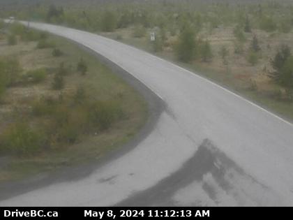 |
Gitwinksihlkw
Highway 113 at Anlaw Road near Gitwinksihlkw, within Nisga'a Memorial Lava Bed Provincial Park, looking east. (elevation: 40 metres) |
||
Weather Forecast (from Environment Canada)All weather stations (current weather) for this region (map) |
|||
|
|||
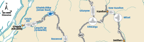
 Grizzly Hill Highway 113 (Nass Road) about 3 km southwest of Village of Laxgalts'ap (Greenville), looking west. |  Laxgalts'ap Highway 113 near the Village of Laxgalts'ap in the Nass Valley, looking eastbound. |  Gitwinksihlkw Highway 113 at Anlaw Road near Gitwinksihlkw, within Nisga'a Memorial Lava Bed Provincial Park, looking east. |  Rosswood Highway 113 near Rosswood about 44 km north of Terrace, looking north. |