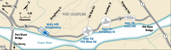
BC HighwayCams - Highway 7B (Mary Hill Bypass)
Northern, Southern Interior and Vancouver Island images will update every 15 to 30 minutes; Lower Mainland images will update about every two to 15 minutes.
Please note all BC HwyCams use Pacific Time Zone (PT).
 Attention motorists:
Winter tires or chains are required on most routes in British Columbia from October 1 to April 30. For select highways not located through mountain passes and/or high snowfall areas, tire and chain requirements end March 31. These routes are marked with regulatory signs posted on highways throughout the province. We reserve the right to restrict travel at any time of the year depending on road conditions.
Click for more information
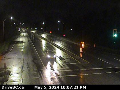 |
Mary Hill Bypass at Shaughnessy - E
Hwy 7B/Mary Hill Bypass at Shaughnessy St looking east. (elevation: 6 metres)
|
Weather Forecast (from Environment Canada)
|
|
 |
|
Mary Hill Bypass at Shaughnessy - W
Hwy 7B/Mary Hill Bypass at Shaughnessy St looking west. | Mary Hill Bypass at Shaughnessy - E
Hwy 7B/Mary Hill Bypass at Shaughnessy St looking east. | Pitt River Rd - N
Hwy 7B (Mary Hill Bypass), at Pitt River Rd, looking north. | Pitt River Rd - W
Hwy 7B (Mary Hill Bypass), at Pitt River Rd, looking west. |
Pitt River Rd - E
Hwy 7B (Mary Hill Bypass), at Pitt River Rd, looking east. | Pitt River Rd - S
Hwy 7B (Mary Hill Bypass), at Pitt River Rd, looking south. | Mary Hill Bypass at Broadway - N
Hwy 7B (Mary Hill Bypass), at Broadway St in Port Coquitlam, looking north. | Mary Hill Bypass at Broadway - W
Hwy 7B (Mary Hill Bypass), at Broadway St in Port Coquitlam, looking west. |
Mary Hill Bypass at Broadway - E
Hwy 7B (Mary Hill Bypass), at Broadway St in Port Coquitlam, looking east. | Mary Hill Bypass - W
Hwy 7B, on Mary Hill at Kingsway Ave, looking west. | Mary Hill Bypass - E
Hwy 7B, on Mary Hill, looking east. |