BC HighwayCams - Highway 3A
Northern, Southern Interior and Vancouver Island images will update every 15 to 30 minutes; Lower Mainland images will update about every two to 15 minutes.
Please note all BC HwyCams use Pacific Time Zone (PT).
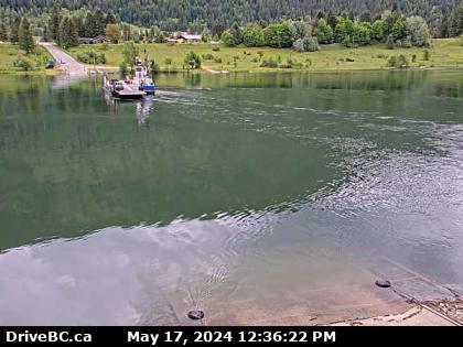 |
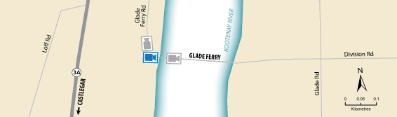
Glade Ferry Terminal - W
Highway 3A at Glade Ferry Road, looking at ferry landing on west side of river. (elevation: 453 metres)
|
Weather Forecast (from Environment Canada)
|
|
 |
|
Glade Ferry Terminal - N
Highway 3A at Glade Ferry Road, looking north at west side ferry line up. | Glade Ferry Terminal - W
Highway 3A at Glade Ferry Road, looking at ferry landing on west side of river. | Glade Ferry Terminal - E
Highway 3A at Glade Ferry Road, looking at ferry landing on east side of river. | Harrop Ferry Landing
Harrop Ferry Landing on the south side of Kootenay Lake, looking north. |
Harrop Ferry Landing North View
Harrop Ferry Landing on south side of Kootenay Lake, looking at the north side landing. | Harrop Ferry North Landing
Harrop Ferry Landing northbound line-up, looking south. | Balfour Ferry Approach - NE
Highway 3A and Highway 31 at Balfour ferry terminal entrance near Ferry Landing Road, looking northeast. | Balfour Ferry Busk Road Parking
Highway 3A and Highway 31 at Busk Road near the Balfour ferry terminal, looking at ferry parking lot. |
Balfour Ferry Approach - SW
Highway 3A and Highway 31 at Balfour ferry terminal entrance of Ferry Landing Road, looking southwest. | Balfour Ferry Terminal
Balfour ferry terminal, looking north towards Highway 3A. | Balfour Ferry Ramp
Balfour ferry terminal, looking south at ferry loading ramp. | Kootenay Bay Ferry Landing
Highway 3A at Kootenay Bay Ferry Landing, looking northeast. |
Kootenay Bay Ferry Ramp
Highway 3A at Kootenay Bay Ferry Landing, looking southwest. | Sanca Creek
Highway 3A about 1.6 km south of Sanca Creek Bridge, looking south. |