BC HighwayCams - Highway 3A
Northern, Southern Interior and Vancouver Island images will update every 15 to 30 minutes; Lower Mainland images will update about every two to 15 minutes.
Please note all BC HwyCams use Pacific Time Zone (PT).
Attention motorists:
Spring weather can make highway conditions in B.C. unpredictable, particularly through high mountain passes. Please be prepared and be aware that winter tires and chains may still be needed.
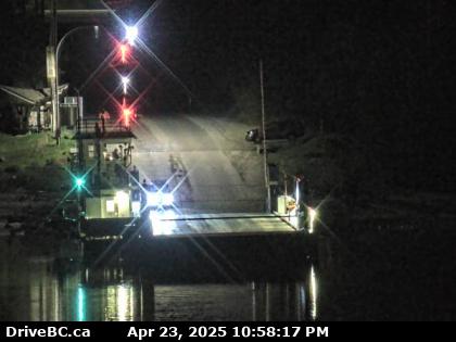 |
Harrop Ferry Landing North View
Harrop Ferry Landing, on south side of Kootenay Lake, looking at the north side landing. (elevation: 534 metres) |
||
|
|||
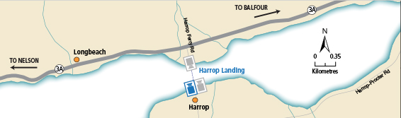
 Glade Ferry Terminal - N Hwy 3A at Glade Ferry Road, 20 km north of Castlegar, looking north at west side ferry line up. |  Glade Ferry Terminal - W Hwy 3A at Glade Ferry Road, looking at ferry landing on west side of river. |  Glade Ferry Terminal - E Hwy 3A at Glade Ferry Road, looking at ferry landing on east side of river. |  Harrop Ferry Landing Harrop Ferry Landing on the south side of Kootenay Lake, looking north. |
 Harrop Ferry Landing North View Harrop Ferry Landing, on south side of Kootenay Lake, looking at the north side landing. |  Harrop Ferry Landing South View Harrop Ferry Landing, looking south at northbound line-up. |  Balfour Ferry Approach - NE Hwy 3A & Hwy 31 at Balfour inland ferry terminal entrance near Ferry Landing Road, looking northeast. |  Balfour Ferry Busk Road Parking Hwy 3A & Hwy 31 at Busk Road near the Balfour inland ferry terminal entrance, looking at ferry parking lot. |
 Balfour Ferry Approach - SW Hwy 3A & Hwy 31 at Balfour inland ferry terminal entrance of Ferry Landing Road, looking southwest. |  Balfour Ferry Terminal Balfour inland ferry terminal, looking north towards Hwy 3A. |  Balfour Ferry Ramp Balfour inland ferry terminal, looking south to ferry loading ramp. |  Kootenay Bay Ferry Landing Kootenay Bay Ferry Landing, looking northeast on Hwy 3A. |
 Kootenay Bay Ferry Ramp Kootenay Bay Ferry Landing, looking southwest to ferry ramp. |  Sanca Creek Hwy 3A near Sanca Creek, 1.6 km south of Sanca Creek Bridge, looking south. |
||