BC HighwayCams - Highway 5 (Coquihalla)
Northern, Southern Interior and Vancouver Island images will update every 15 to 30 minutes; Lower Mainland images will update about every two to 15 minutes.
Please note all BC HwyCams use Pacific Time Zone (PT).
Attention motorists:
Spring weather can make highway conditions in B.C. unpredictable, particularly through high mountain passes. Please be prepared and be aware that winter tires and chains may still be needed.
 |
|
|||||||
|
||||||||
Weather Forecast (from Environment Canada)All weather stations (current weather) for this region (map) |
||||||||
 Walloper Hwy 5, about 30 km south of Kamloops, looking south. |  Hwy 5 at Hwy 97D northbound Hwy 5 at Exit 366 Logan Lake/Lac le Jeune Rd, looking northbound along Hwy 5. |  Hwy 97D at Hwy 5 - NE Hwy 97D (Logan Lake/Lac le Jeune Rd) at Hwy 5, looking northeast. |  Hwy 97D at Hwy 5 - SW Hwy 97D (Logan Lake/Lac le Jeune Rd) at Hwy 5, looking southwest. | |||||
 Hwy 5 at Hwy 97D southbound Hwy 5 at Exit 366 Logan Lake/Lac le Jeune Rd, looking southbound along Hwy 5. |  Helmer Lake Hwy 5, 24 km north of Merritt at Helmer Interchange, looking north. |  Comstock Hwy 5 at Comstock Rd, about 15 km south of Merritt, looking north. |  Larson Hill - N Hwy 5 at Larson Hill, 36 km south of Merritt, looking north. | |||||
 Larson Hill - S Hwy 5 at Larson Hill, 36 km south of Merritt, looking south. |  Mine Creek Hwy 5 southbound, at Mine Creek Rd, looking south. |  Britton Creek - N Hwy 5, by Britton Creek Rest Area northbound turnoff, looking north. |  Britton Creek - S Hwy 5, by Britton Creek Rest Area northbound turnoff, looking south. | |||||
 Coquihalla Lakes - N Hwy 5, 61km south of Merritt, looking north. |  Coquihalla Lakes - S Hwy 5, 61km south of Merritt, looking south. |  Coquihalla Summit - N Hwy 5, about 7 km north of Zopkios Brake Check, looking north. |  Coquihalla Summit - S Hwy 5, about 7 km north of Zopkios Brake Check, looking south. | |||||
 Zopkios Southbound - N Hwy 5, southbound at Zopkios Rest Area, near the Coquihalla Summit, looking north. |  Zopkios Southbound - S Hwy 5, southbound at Zopkios Rest Area, near the Coquihalla Summit, looking south. |  Zopkios Northbound - N Hwy 5, northbound at Zopkios Rest Area, near the Coquihalla Summit looking north. |  Zopkios Northbound - S Hwy 5, northbound at Zopkios Rest Area, near the Coquihalla Summit looking south. | |||||
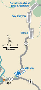
 Coquihalla Great Bear Snowshed - N Hwy 5, Great Bear Snowshed looking north. |  Coquihalla Great Bear Snowshed - S Hwy 5, Great Bear Snowshed looking south. |  Box Canyon - N Hwy 5, near Box Canyon Chain-up Area, looking north. |  Box Canyon - S Hwy 5, near Box Canyon Chain-up Area, looking south. | |||||
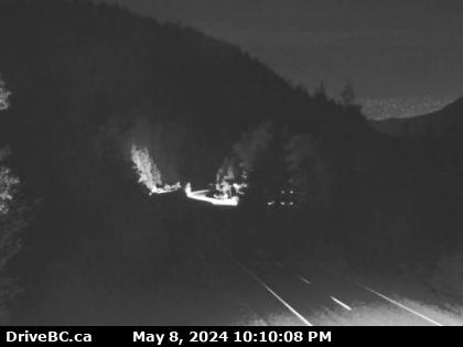
 Portia - N Hwy 5, by northbound Portia Chain Up, looking north. |  Portia - S Hwy 5, by northbound Portia Chain Up, looking south. |  Othello - N Hwy 5 at Othello, about 11 km east of Hope, looking north. |  Othello - S Hwy 5 at Othello, about 11 km east of Hope, looking south. | |||||